West Helena Topo Map Arkansas
To zoom in, hover over the map of West Helena
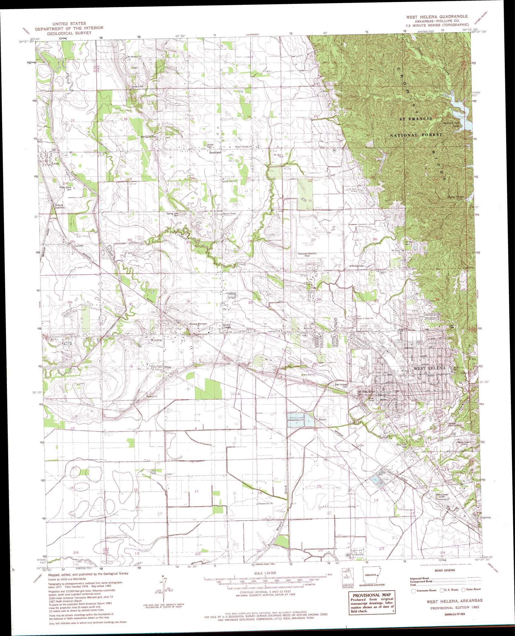
USGS Topo Quad 34090e6 - 1:24,000 scale
| Topo Map Name: | West Helena |
| USGS Topo Quad ID: | 34090e6 |
| Print Size: | ca. 21 1/4" wide x 27" high |
| Southeast Coordinates: | 34.5° N latitude / 90.625° W longitude |
| Map Center Coordinates: | 34.5625° N latitude / 90.6875° W longitude |
| U.S. State: | AR |
| Filename: | o34090e6.jpg |
| Download Map JPG Image: | West Helena topo map 1:24,000 scale |
| Map Type: | Topographic |
| Topo Series: | 7.5´ |
| Map Scale: | 1:24,000 |
| Source of Map Images: | United States Geological Survey (USGS) |
| Alternate Map Versions: |
West Helena AR 1982, updated 1982 Download PDF Buy paper map West Helena AR 2011 Download PDF Buy paper map West Helena AR 2014 Download PDF Buy paper map |
| FStopo: | US Forest Service topo West Helena is available: Download FStopo PDF Download FStopo TIF |
1:24,000 Topo Quads surrounding West Helena
Moro |
Marianna |
Soudan |
Brickeys |
Council |
Aubrey |
Rondo |
Lagrange |
Stubbs Island |
Tunica |
Marvell |
Lexa |
West Helena |
Helena |
Dundee |
Watkins Corner |
Lakeview |
Friars Point Nw |
Moon Lake |
Lula |
Lambrook |
Elaine |
Friars Point |
Coahoma |
Jonestown |
> Back to 34090e1 at 1:100,000 scale
> Back to 34090a1 at 1:250,000 scale
> Back to U.S. Topo Maps home
West Helena topo map: Gazetteer
West Helena: Airports
Helena Hospital Heliport elevation 73m 239′Thompson-Robbins Airport elevation 73m 239′
West Helena: Forests
Saint Francis National Forest elevation 103m 337′West Helena: Parks
East Park elevation 102m 334′West Park elevation 72m 236′
West Helena: Populated Places
Belser (historical) elevation 58m 190′Huma elevation 59m 193′
Latour elevation 61m 200′
Pillar elevation 65m 213′
Southland elevation 88m 288′
West Helena elevation 79m 259′
Wycamp elevation 64m 209′
West Helena: Post Offices
West Helena Post Office elevation 81m 265′West Helena: Streams
Caney Creek elevation 56m 183′Crooked Creek elevation 53m 173′
West Helena digital topo map on disk
Buy this West Helena topo map showing relief, roads, GPS coordinates and other geographical features, as a high-resolution digital map file on DVD: