Gravelly Topo Map Arkansas
To zoom in, hover over the map of Gravelly
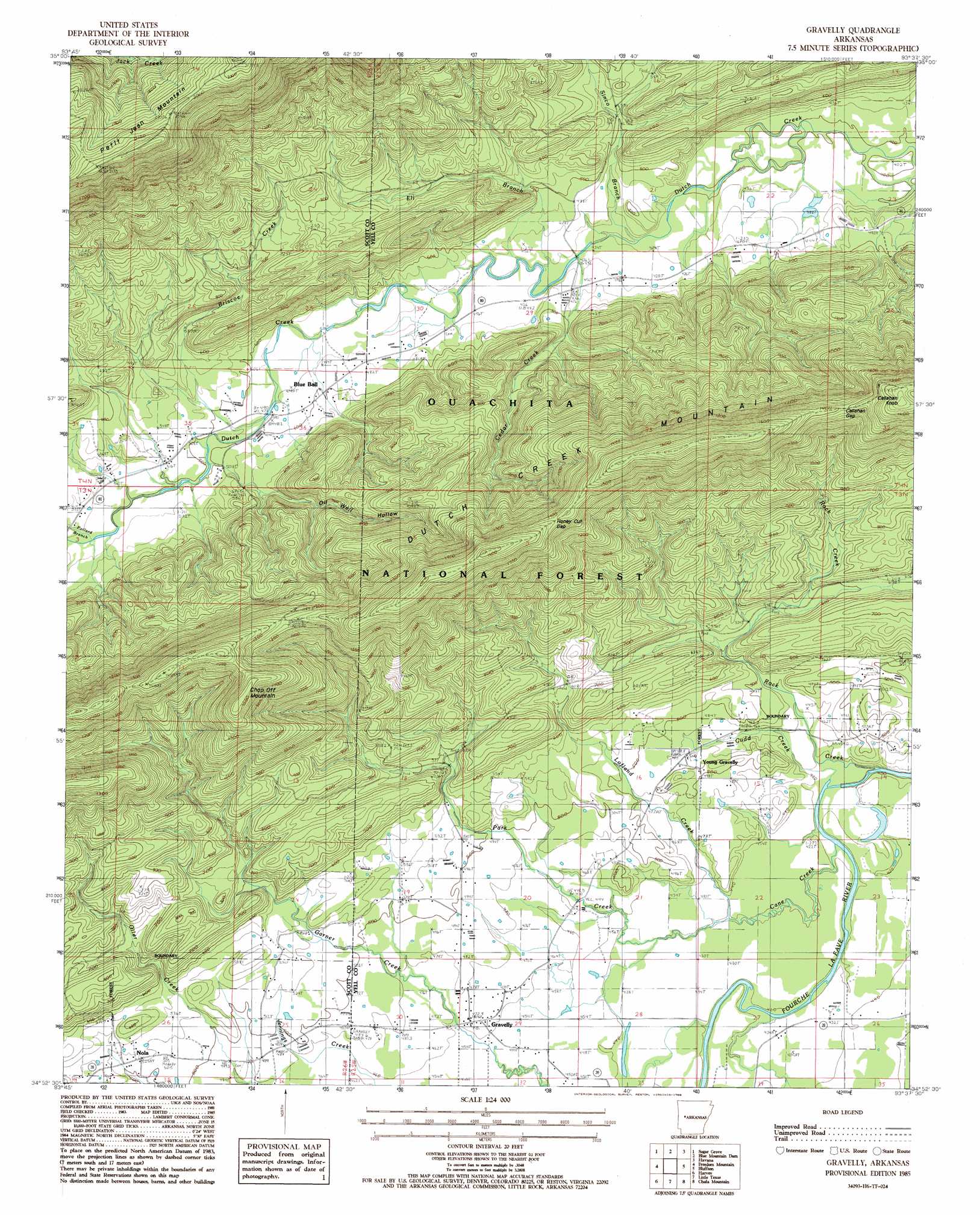
USGS Topo Quad 34093h6 - 1:24,000 scale
| Topo Map Name: | Gravelly |
| USGS Topo Quad ID: | 34093h6 |
| Print Size: | ca. 21 1/4" wide x 27" high |
| Southeast Coordinates: | 34.875° N latitude / 93.625° W longitude |
| Map Center Coordinates: | 34.9375° N latitude / 93.6875° W longitude |
| U.S. State: | AR |
| Filename: | o34093h6.jpg |
| Download Map JPG Image: | Gravelly topo map 1:24,000 scale |
| Map Type: | Topographic |
| Topo Series: | 7.5´ |
| Map Scale: | 1:24,000 |
| Source of Map Images: | United States Geological Survey (USGS) |
| Alternate Map Versions: |
Gravelly AR 1985, updated 1986 Download PDF Buy paper map Gravelly AR 2011 Download PDF Buy paper map Gravelly AR 2014 Download PDF Buy paper map |
| FStopo: | US Forest Service topo Gravelly is available: Download FStopo PDF Download FStopo TIF |
1:24,000 Topo Quads surrounding Gravelly
Booneville |
Magazine |
Blue Mountain |
Magazine Mountain Ne |
Chickalah Mountain West |
Golden City |
Sugar Grove |
Blue Mountain Dam |
Havana |
Danville |
Bee Mountain |
Freedom Mountain |
Gravelly |
Bluffton |
Rover |
Parks |
Harvey |
Little Texas |
Chula Mountain |
Onyx |
Buck Knob |
Bushy Creek Mountain |
Sims |
Story |
Fannie |
> Back to 34093e1 at 1:100,000 scale
> Back to 34092a1 at 1:250,000 scale
> Back to U.S. Topo Maps home
Gravelly topo map: Gazetteer
Gravelly: Gaps
Callahan Gap elevation 423m 1387′Honey Cut Gap elevation 440m 1443′
Gravelly: Populated Places
Blue Ball elevation 145m 475′Gravelly elevation 142m 465′
Nola elevation 153m 501′
Young Gravelly elevation 148m 485′
Gravelly: Post Offices
Gravelly Post Office elevation 143m 469′Gravelly: Ridges
Dutch Creek Mountain elevation 514m 1686′Gravelly: Streams
Briscoe Creek elevation 146m 479′Cane Creek elevation 130m 426′
Cedar Branch elevation 119m 390′
Cedar Creek elevation 133m 436′
Cudd Creek elevation 140m 459′
Eli Branch elevation 134m 439′
Lofland Creek elevation 128m 419′
Park Creek elevation 134m 439′
Pollard Branch elevation 156m 511′
Rock Creek elevation 128m 419′
Sinco Branch elevation 130m 426′
Gravelly: Summits
Callahan Knob elevation 516m 1692′Chop Off Mountain elevation 470m 1541′
Gravelly: Valleys
Oil Well Hollow elevation 149m 488′Gravelly digital topo map on disk
Buy this Gravelly topo map showing relief, roads, GPS coordinates and other geographical features, as a high-resolution digital map file on DVD: