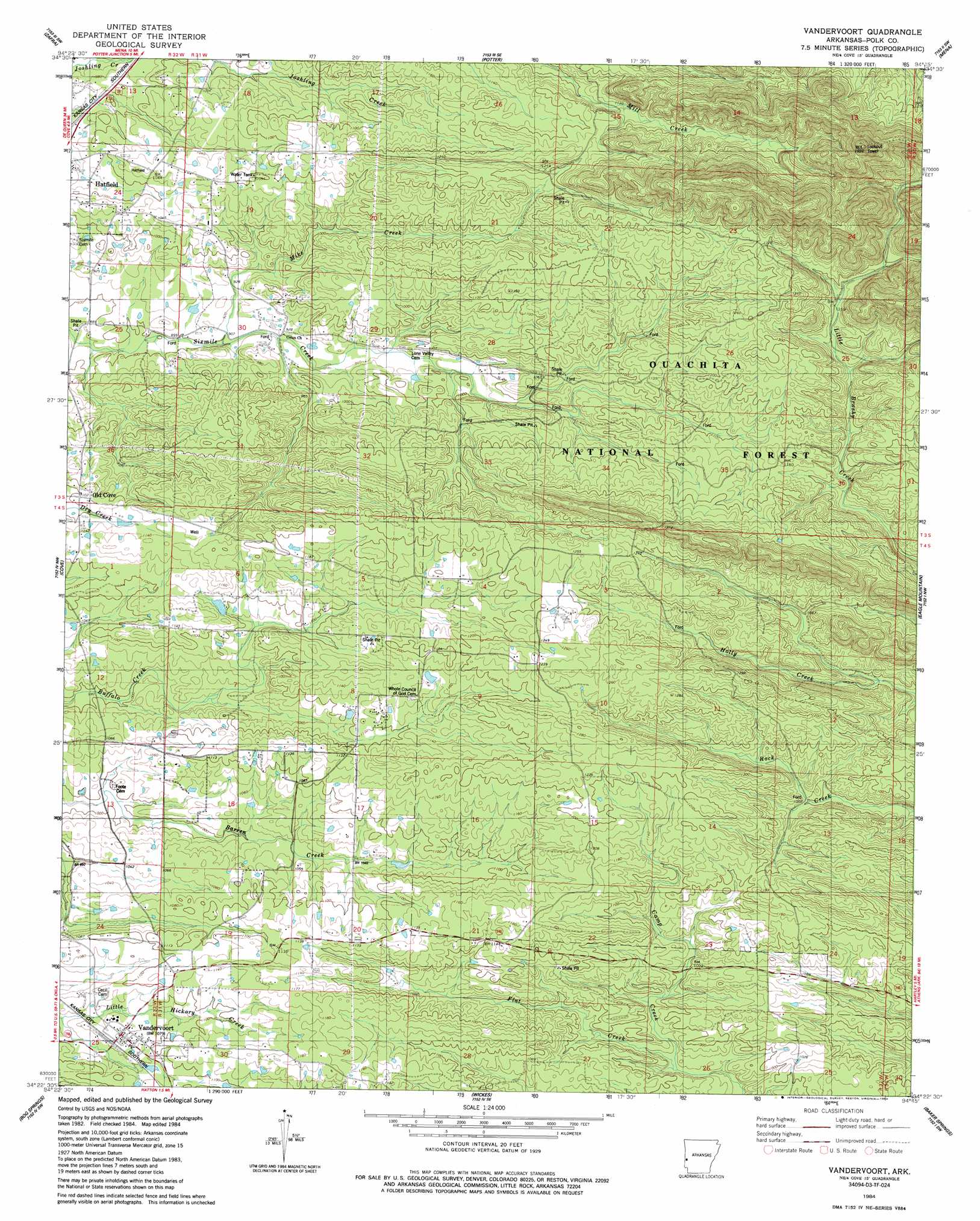
Vandervoort Topo Map Arkansas
To zoom in, hover over the map of Vandervoort
USGS Topo Quad 34094d3 - 1:24,000 scale
| Topo Map Name: | Vandervoort |
| USGS Topo Quad ID: | 34094d3 |
| Print Size: | ca. 21 1/4" wide x 27" high |
| Southeast Coordinates: | 34.375° N latitude / 94.25° W longitude |
| Map Center Coordinates: | 34.4375° N latitude / 94.3125° W longitude |
| U.S. State: | AR |
| Filename: | o34094d3.jpg |
| Download Map JPG Image: | Vandervoort topo map 1:24,000 scale |
| Map Type: | Topographic |
| Topo Series: | 7.5´ |
| Map Scale: | 1:24,000 |
| Source of Map Images: | United States Geological Survey (USGS) |
| Alternate Map Versions: |
Vandervoort AR 1984, updated 1984 Download PDF Buy paper map Vandervoort AR 2011 Download PDF Buy paper map Vandervoort AR 2014 Download PDF Buy paper map |
| FStopo: | US Forest Service topo Vandervoort is available: Download FStopo PDF Download FStopo TIF |
1:24,000 Topo Quads surrounding Vandervoort
Page |
Mountain Fork |
Rich Mountain |
Acorn |
Y City |
Lynn Mountain |
Zafra |
Potter |
Mena |
Board Camp |
Watson |
Cove |
Vandervoort |
Eagle Mountain |
Nichols Nountain |
Big Hudson Creek |
Bog Springs |
Wickes |
Baker Springs |
Umpire |
Toblerville |
De Queen Nw |
Gillham |
Gillham Dam |
Dierks Dam |
> Back to 34094a1 at 1:100,000 scale
> Back to 34094a1 at 1:250,000 scale
> Back to U.S. Topo Maps home
Vandervoort topo map: Gazetteer
Vandervoort: Populated Places
Bethel Chapel elevation 350m 1148′Lone Valley elevation 305m 1000′
McCauley elevation 376m 1233′
Old Cove elevation 335m 1099′
Vandervoort elevation 335m 1099′
Vandervoort: Streams
Camp Creek elevation 296m 971′Mike Creek elevation 277m 908′
Vandervoort digital topo map on disk
Buy this Vandervoort topo map showing relief, roads, GPS coordinates and other geographical features, as a high-resolution digital map file on DVD: