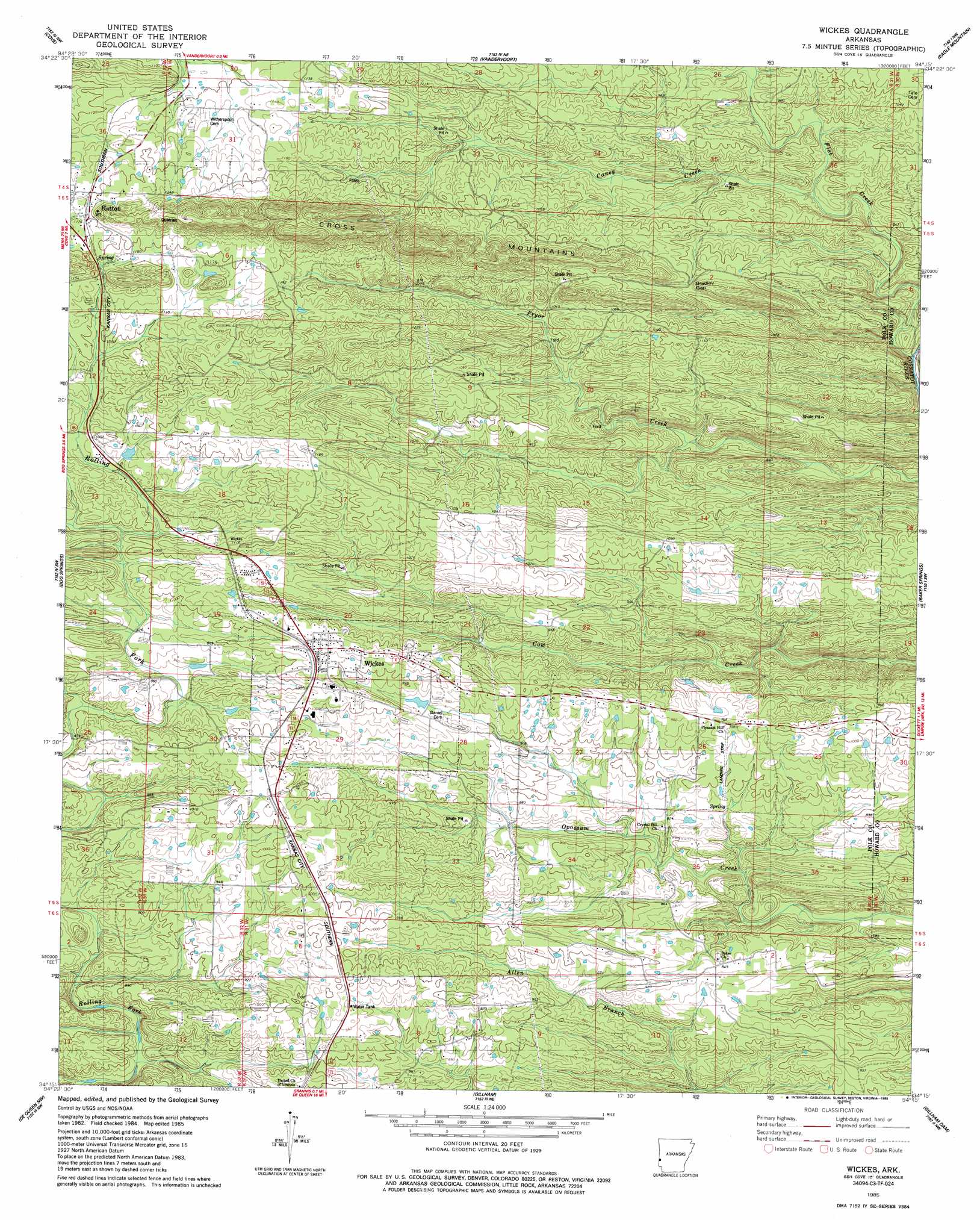
Wickes Topo Map Arkansas
To zoom in, hover over the map of Wickes
USGS Topo Quad 34094c3 - 1:24,000 scale
| Topo Map Name: | Wickes |
| USGS Topo Quad ID: | 34094c3 |
| Print Size: | ca. 21 1/4" wide x 27" high |
| Southeast Coordinates: | 34.25° N latitude / 94.25° W longitude |
| Map Center Coordinates: | 34.3125° N latitude / 94.3125° W longitude |
| U.S. State: | AR |
| Filename: | o34094c3.jpg |
| Download Map JPG Image: | Wickes topo map 1:24,000 scale |
| Map Type: | Topographic |
| Topo Series: | 7.5´ |
| Map Scale: | 1:24,000 |
| Source of Map Images: | United States Geological Survey (USGS) |
| Alternate Map Versions: |
Wickes AR 1985, updated 1985 Download PDF Buy paper map Wickes AR 2011 Download PDF Buy paper map Wickes AR 2014 Download PDF Buy paper map |
1:24,000 Topo Quads surrounding Wickes
Lynn Mountain |
Zafra |
Potter |
Mena |
Board Camp |
Watson |
Cove |
Vandervoort |
Eagle Mountain |
Nichols Nountain |
Big Hudson Creek |
Bog Springs |
Wickes |
Baker Springs |
Umpire |
Toblerville |
De Queen Nw |
Gillham |
Gillham Dam |
Dierks Dam |
Eagletown |
Chapel Hill |
De Queen |
Geneva |
Dierks |
> Back to 34094a1 at 1:100,000 scale
> Back to 34094a1 at 1:250,000 scale
> Back to U.S. Topo Maps home
Wickes topo map: Gazetteer
Wickes: Dams
Brewer Lake Dam elevation 289m 948′Jenkins Lake Dam elevation 314m 1030′
Wickes: Gaps
Bradley Gap elevation 313m 1026′Wickes: Populated Places
Hatton elevation 362m 1187′Wickes elevation 315m 1033′
Wickes: Reservoirs
Brewer Lake elevation 289m 948′Jenkins Lake elevation 314m 1030′
Wickes: Streams
Caney Creek elevation 258m 846′Flat Creek elevation 215m 705′
Wickes digital topo map on disk
Buy this Wickes topo map showing relief, roads, GPS coordinates and other geographical features, as a high-resolution digital map file on DVD: