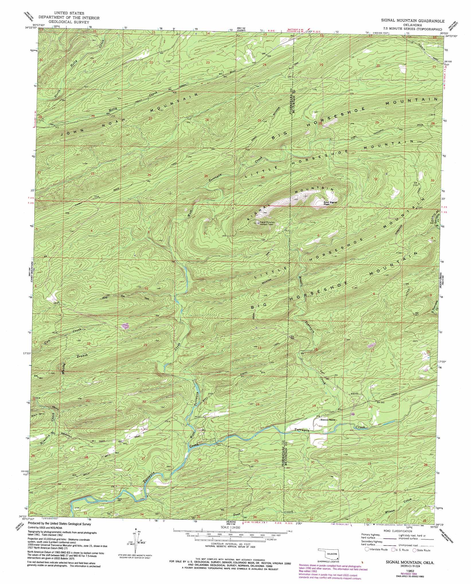
Signal Mountain Topo Map Oklahoma
To zoom in, hover over the map of Signal Mountain
USGS Topo Quad 34095c1 - 1:24,000 scale
| Topo Map Name: | Signal Mountain |
| USGS Topo Quad ID: | 34095c1 |
| Print Size: | ca. 21 1/4" wide x 27" high |
| Southeast Coordinates: | 34.25° N latitude / 95° W longitude |
| Map Center Coordinates: | 34.3125° N latitude / 95.0625° W longitude |
| U.S. State: | OK |
| Filename: | o34095c1.jpg |
| Download Map JPG Image: | Signal Mountain topo map 1:24,000 scale |
| Map Type: | Topographic |
| Topo Series: | 7.5´ |
| Map Scale: | 1:24,000 |
| Source of Map Images: | United States Geological Survey (USGS) |
| Alternate Map Versions: |
Signal Mountain OK 1962, updated 1964 Download PDF Buy paper map Signal Mountain OK 1962, updated 1983 Download PDF Buy paper map Signal Mountain OK 1962, updated 1993 Download PDF Buy paper map Signal Mountain OK 2010 Download PDF Buy paper map Signal Mountain OK 2012 Download PDF Buy paper map Signal Mountain OK 2016 Download PDF Buy paper map |
1:24,000 Topo Quads surrounding Signal Mountain
Clayton |
Albion Sw |
Albion Se |
Honobia |
Ludlow |
Wildhorse Mountain |
Nashoba |
Clebit |
Battiest |
White Rock Mountain |
Cloudy |
Caney Mountain |
Signal Mountain |
Rockey Creek |
Bethel |
Spencerville |
Sobol |
Alikchi |
Bear Mountain |
Old Glory Mountain |
Fort Towson |
Swink |
Wright City |
Golden |
Steel Junction |
> Back to 34095a1 at 1:100,000 scale
> Back to 34094a1 at 1:250,000 scale
> Back to U.S. Topo Maps home
Signal Mountain topo map: Gazetteer
Signal Mountain: Streams
Middle Terrapin Creek elevation 171m 561′West Terrapin Creek elevation 160m 524′
Whisky Branch elevation 212m 695′
Signal Mountain: Summits
East Signal Peak elevation 448m 1469′John Noah Mountain elevation 320m 1049′
Signal Mountain elevation 448m 1469′
Signal Mountain: Trails
Billy Bell Trail elevation 202m 662′Dead End Trail elevation 315m 1033′
East Signal Trail elevation 195m 639′
Harry Rowe Trail elevation 297m 974′
Little Horseshoe Trail elevation 339m 1112′
Round Mountain Trail elevation 298m 977′
Signal Mountain Trail elevation 309m 1013′
West Signal Trail elevation 253m 830′
Signal Mountain digital topo map on disk
Buy this Signal Mountain topo map showing relief, roads, GPS coordinates and other geographical features, as a high-resolution digital map file on DVD: