Ord Mountain Topo Map California
To zoom in, hover over the map of Ord Mountain
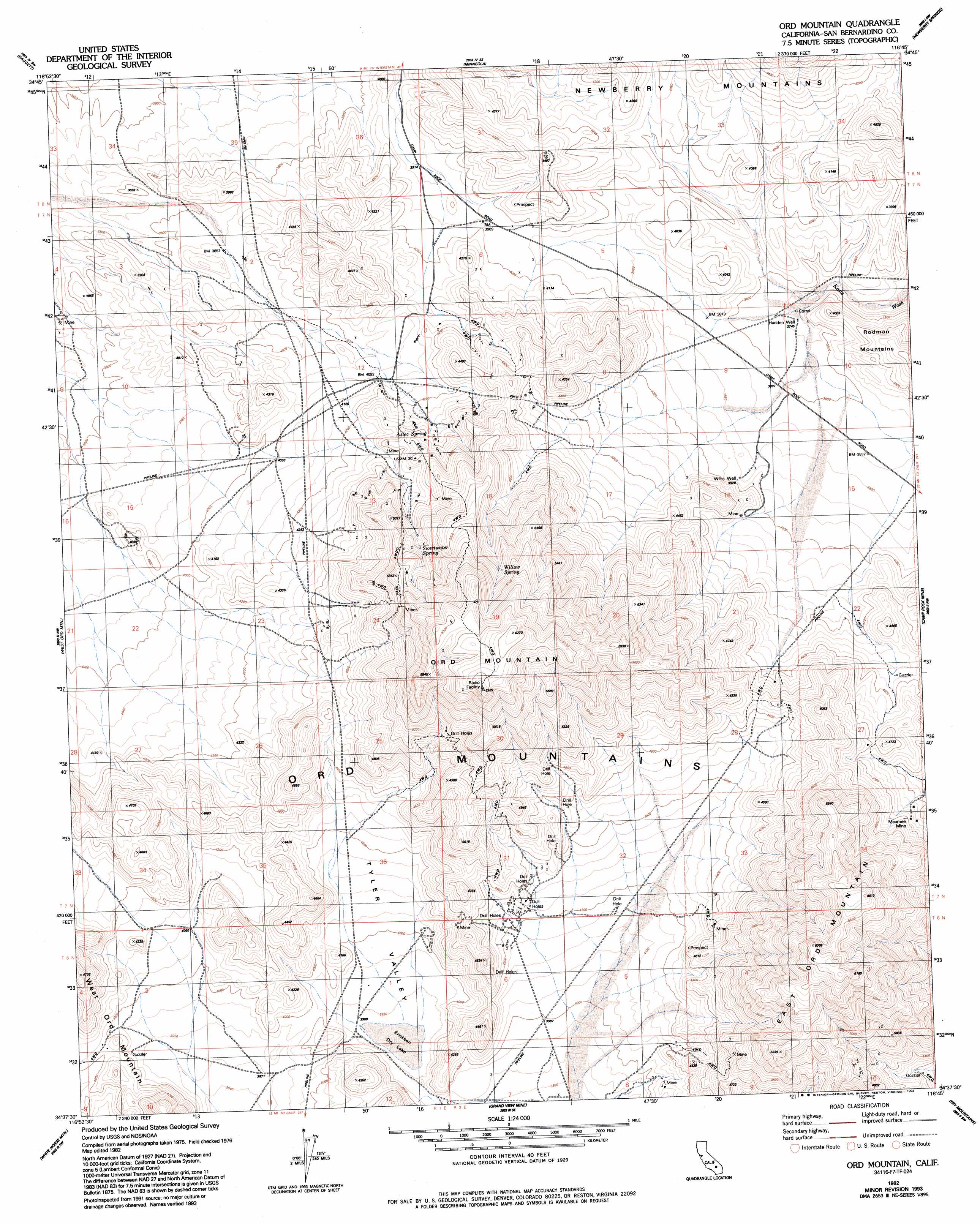
USGS Topo Quad 34116f7 - 1:24,000 scale
| Topo Map Name: | Ord Mountain |
| USGS Topo Quad ID: | 34116f7 |
| Print Size: | ca. 21 1/4" wide x 27" high |
| Southeast Coordinates: | 34.625° N latitude / 116.75° W longitude |
| Map Center Coordinates: | 34.6875° N latitude / 116.8125° W longitude |
| U.S. State: | CA |
| Filename: | o34116f7.jpg |
| Download Map JPG Image: | Ord Mountain topo map 1:24,000 scale |
| Map Type: | Topographic |
| Topo Series: | 7.5´ |
| Map Scale: | 1:24,000 |
| Source of Map Images: | United States Geological Survey (USGS) |
| Alternate Map Versions: |
Ord Mountain CA 1982, updated 1982 Download PDF Buy paper map Ord Mountain CA 1982, updated 1987 Download PDF Buy paper map Ord Mountain CA 1982, updated 1993 Download PDF Buy paper map Ord Mountain CA 2012 Download PDF Buy paper map Ord Mountain CA 2015 Download PDF Buy paper map |
1:24,000 Topo Quads surrounding Ord Mountain
Barstow |
Nebo |
Yermo |
Harvard Hill |
Manix |
Barstow Se |
Daggett |
Minneola |
Newberry Springs |
Troy Lake |
Stoddard Well |
West Ord Mountain |
Ord Mountain |
Camp Rock Mine |
Silver Bell Mine |
Fairview Valley |
White Horse Mountain |
Grand View Mine |
Fry Mountains |
Iron Ridge |
Fifteenmile Valley |
Lucerne Valley |
Cougar Buttes |
Old Woman Springs |
Melville Lake |
> Back to 34116e1 at 1:100,000 scale
> Back to 34116a1 at 1:250,000 scale
> Back to U.S. Topo Maps home
Ord Mountain topo map: Gazetteer
Ord Mountain: Flats
Ericksen Dry Lake elevation 1189m 3900′Ord Mountain: Mines
Maumee Mine elevation 1367m 4484′Ord Mountain: Ranges
Ord Mountains elevation 1367m 4484′Ord Mountain: Springs
Aztec Spring elevation 1354m 4442′Sweetwater Spring elevation 1474m 4835′
Willow Spring elevation 1608m 5275′
Ord Mountain: Summits
East Ord Mountain elevation 1831m 6007′Ord Mountain elevation 1863m 6112′
Ord Mountain: Valleys
Tyler Valley elevation 1221m 4005′Ord Mountain: Wells
Hadden Well elevation 1142m 3746′Willis Well elevation 1209m 3966′
Ord Mountain digital topo map on disk
Buy this Ord Mountain topo map showing relief, roads, GPS coordinates and other geographical features, as a high-resolution digital map file on DVD: