Lexington Topo Map Tennessee
To zoom in, hover over the map of Lexington
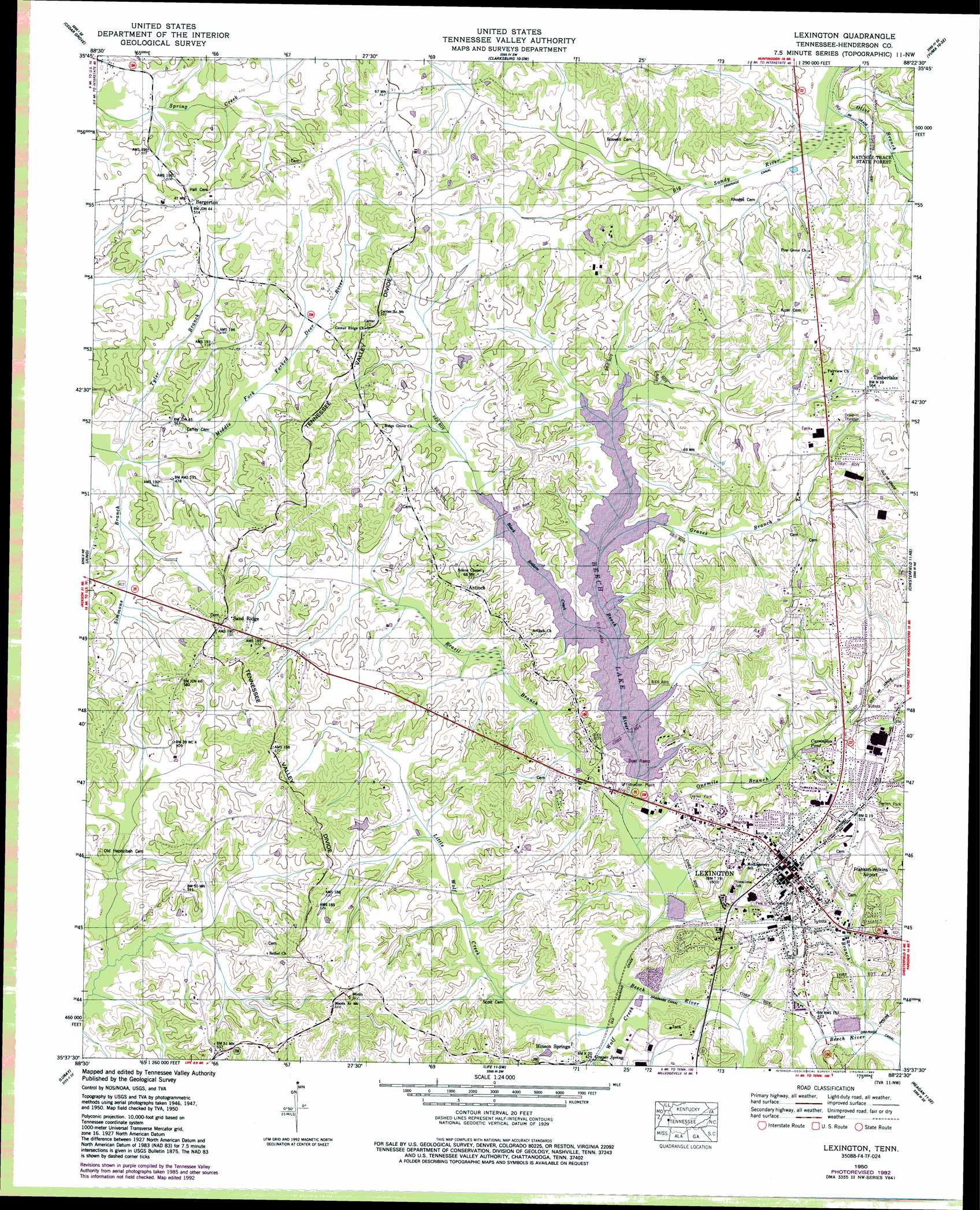
USGS Topo Quad 35088f4 - 1:24,000 scale
| Topo Map Name: | Lexington |
| USGS Topo Quad ID: | 35088f4 |
| Print Size: | ca. 21 1/4" wide x 27" high |
| Southeast Coordinates: | 35.625° N latitude / 88.375° W longitude |
| Map Center Coordinates: | 35.6875° N latitude / 88.4375° W longitude |
| U.S. State: | TN |
| Filename: | o35088f4.jpg |
| Download Map JPG Image: | Lexington topo map 1:24,000 scale |
| Map Type: | Topographic |
| Topo Series: | 7.5´ |
| Map Scale: | 1:24,000 |
| Source of Map Images: | United States Geological Survey (USGS) |
| Alternate Map Versions: |
Lexington TN 1936 Download PDF Buy paper map Lexington TN 1950, updated 1953 Download PDF Buy paper map Lexington TN 1950, updated 1967 Download PDF Buy paper map Lexington TN 1950, updated 1992 Download PDF Buy paper map Lexington TN 2010 Download PDF Buy paper map Lexington TN 2013 Download PDF Buy paper map Lexington TN 2016 Download PDF Buy paper map |
1:24,000 Topo Quads surrounding Lexington
Atwood |
Mclemoresville |
Palmer Shelter |
Buena Vista |
Seventeen Creek |
Spring Creek |
Cedar Grove |
Clarksburg |
Yuma |
Holladay |
Claybrook |
Juno |
Lexington |
Chesterfield |
Parsons |
Beech Bluff |
Luray |
Life |
Reagan |
Scotts Hill |
Henderson |
Jacks Creek |
Enville |
Sardis |
Thurman |
> Back to 35088e1 at 1:100,000 scale
> Back to 35088a1 at 1:250,000 scale
> Back to U.S. Topo Maps home
Lexington topo map: Gazetteer
Lexington: Airports
Franklin Wilkins Airport elevation 158m 518′Lexington: Dams
Beech Dam elevation 133m 436′Berry Lake Dam elevation 155m 508′
Lexington Sewage Lagoon Dam elevation 125m 410′
Milam Dam elevation 164m 538′
Lexington: Lakes
Carrington Pond elevation 145m 475′Lexington: Populated Places
Antioch elevation 165m 541′Bargerton elevation 154m 505′
Beech River elevation 166m 544′
Broadway elevation 152m 498′
Hinson Springs elevation 134m 439′
Lexington elevation 159m 521′
Sand Ridge elevation 172m 564′
Timberlake elevation 172m 564′
Lexington: Post Offices
Bargerton Post Office (historical) elevation 155m 508′Lexington Post Office elevation 159m 521′
Lexington: Reservoirs
Beech Lake elevation 133m 436′Berry Lake elevation 155m 508′
Lexington Sewage Lagoon Pond elevation 125m 410′
Milam Pond elevation 164m 538′
Lexington: Springs
Graper Spring elevation 136m 446′Lexington: Streams
Black Bottom Creek elevation 141m 462′Brazil Branch elevation 130m 426′
Graves Branch elevation 141m 462′
Little Wolf Creek elevation 128m 419′
Olive Branch elevation 143m 469′
Onemile Branch elevation 129m 423′
Simmons Branch elevation 139m 456′
Town Branch elevation 125m 410′
Tyler Branch elevation 139m 456′
Wolf Creek elevation 128m 419′
Lexington digital topo map on disk
Buy this Lexington topo map showing relief, roads, GPS coordinates and other geographical features, as a high-resolution digital map file on DVD: