Solgohachia Topo Map Arkansas
To zoom in, hover over the map of Solgohachia
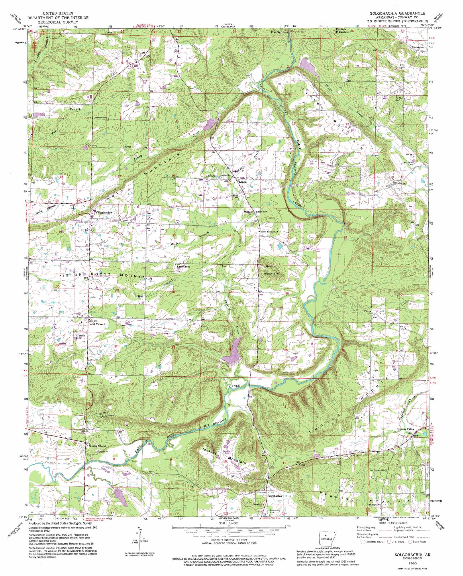
USGS Topo Quad 35092c6 - 1:24,000 scale
| Topo Map Name: | Solgohachia |
| USGS Topo Quad ID: | 35092c6 |
| Print Size: | ca. 21 1/4" wide x 27" high |
| Southeast Coordinates: | 35.25° N latitude / 92.625° W longitude |
| Map Center Coordinates: | 35.3125° N latitude / 92.6875° W longitude |
| U.S. State: | AR |
| Filename: | o35092c6.jpg |
| Download Map JPG Image: | Solgohachia topo map 1:24,000 scale |
| Map Type: | Topographic |
| Topo Series: | 7.5´ |
| Map Scale: | 1:24,000 |
| Source of Map Images: | United States Geological Survey (USGS) |
| Alternate Map Versions: |
Solgohachia AR 1962, updated 1963 Download PDF Buy paper map Solgohachia AR 1962, updated 1990 Download PDF Buy paper map Solgohachia AR 1990, updated 1995 Download PDF Buy paper map Solgohachia AR 2011 Download PDF Buy paper map Solgohachia AR 2014 Download PDF Buy paper map |
1:24,000 Topo Quads surrounding Solgohachia
Solo |
Lost Corner |
Rex |
Scotland |
Clinton |
Hector |
Jerusalem |
Cleveland |
Formosa |
Bee Branch |
Moreland |
Hattieville |
Solgohachia |
Springfield |
Damascus |
Atkins |
Morrilton West |
Morrilton East |
Menifee |
Greenbrier |
Adona |
Perryville |
Houston |
Gleason |
Conway |
> Back to 35092a1 at 1:100,000 scale
> Back to 35092a1 at 1:250,000 scale
> Back to U.S. Topo Maps home
Solgohachia topo map: Gazetteer
Solgohachia: Dams
East Fork Point Remove Site Eight Dam elevation 140m 459′East Fork Point Remove Site Nine Dam elevation 106m 347′
East Fork Point Remove Site Seven Dam elevation 133m 436′
East Fork Point Remove Site Ten Dam elevation 90m 295′
Fowler Lake Dam elevation 129m 423′
Solgohachia: Populated Places
Arthur elevation 166m 544′Cypress Valley elevation 121m 396′
Lanty elevation 137m 449′
Lick Mountain elevation 210m 688′
Lone Grove elevation 152m 498′
McClaren elevation 140m 459′
Middleton elevation 182m 597′
Saint Vincent elevation 184m 603′
Solgohachia elevation 128m 419′
Sunnyside elevation 160m 524′
Wesley Chapel elevation 112m 367′
Wonderview elevation 208m 682′
Solgohachia: Post Offices
Solgohachia Post Office elevation 139m 456′Solgohachia: Reservoirs
East Fork Point Remove Site Eight Reservoir elevation 140m 459′East Fork Point Remove Site Nine Reservoir elevation 106m 347′
East Fork Point Remove Site Seven Reservoir elevation 133m 436′
East Fork Point Remove Site Ten Reservoir elevation 90m 295′
Fowler Lake elevation 129m 423′
Solgohachia: Streams
Green Creek elevation 123m 403′Hall Branch elevation 111m 364′
Miller Branch elevation 124m 406′
Prairie Creek elevation 96m 314′
Tenny Creek elevation 130m 426′
Solgohachia: Summits
Bull Mountain elevation 216m 708′Dutton Mountain elevation 212m 695′
Jenkins Mountain elevation 220m 721′
Ragsdale Mountain elevation 207m 679′
Round Mountain elevation 203m 666′
Solgohachia digital topo map on disk
Buy this Solgohachia topo map showing relief, roads, GPS coordinates and other geographical features, as a high-resolution digital map file on DVD: