Antelope Hills Topo Map Oklahoma
To zoom in, hover over the map of Antelope Hills
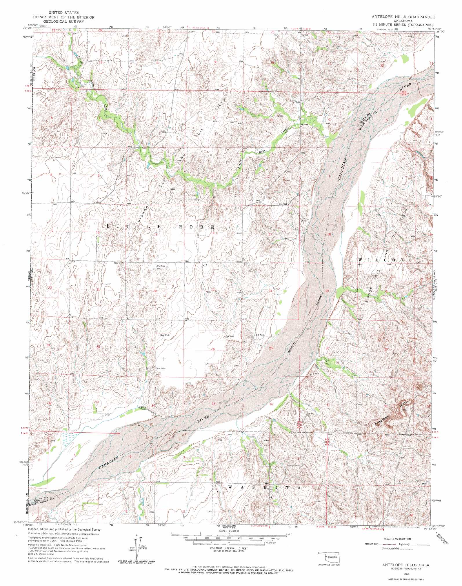
USGS Topo Quad 35099h8 - 1:24,000 scale
| Topo Map Name: | Antelope Hills |
| USGS Topo Quad ID: | 35099h8 |
| Print Size: | ca. 21 1/4" wide x 27" high |
| Southeast Coordinates: | 35.875° N latitude / 99.875° W longitude |
| Map Center Coordinates: | 35.9375° N latitude / 99.9375° W longitude |
| U.S. State: | OK |
| Filename: | o35099h8.jpg |
| Download Map JPG Image: | Antelope Hills topo map 1:24,000 scale |
| Map Type: | Topographic |
| Topo Series: | 7.5´ |
| Map Scale: | 1:24,000 |
| Source of Map Images: | United States Geological Survey (USGS) |
| Alternate Map Versions: |
Antelope Hills OK 1966, updated 1967 Download PDF Buy paper map Antelope Hills OK 2010 Download PDF Buy paper map Antelope Hills OK 2012 Download PDF Buy paper map Antelope Hills OK 2016 Download PDF Buy paper map |
1:24,000 Topo Quads surrounding Antelope Hills
Willow Creek |
Higgins North |
Goodwin |
Arnett |
Harmon Nw |
Coburn |
Higgins South |
Arnett Sw |
Arnett Se |
Harmon Sw |
Lake Marvin |
Dreyfoos |
Antelope Hills |
Antelope Hills Ne |
Roll Nw |
Blue Ridge School |
Gem |
Durham |
Crawford |
Roll |
Lake June |
Hackberry Creek |
Reydon |
Mackie |
Cheyenne Nw |
> Back to 35099e1 at 1:100,000 scale
> Back to 35098a1 at 1:250,000 scale
> Back to U.S. Topo Maps home
Antelope Hills topo map: Gazetteer
Antelope Hills: Dams
Bill Sherrill Dam elevation 682m 2237′Antelope Hills: Oilfields
Bishop Gas and Oil Field elevation 688m 2257′Antelope Hills: Reservoirs
Bill Sherrill Reservoir elevation 682m 2237′Antelope Hills: Streams
Little Robe Creek elevation 643m 2109′Antelope Hills: Summits
Antelope Hills elevation 792m 2598′Antelope Hills digital topo map on disk
Buy this Antelope Hills topo map showing relief, roads, GPS coordinates and other geographical features, as a high-resolution digital map file on DVD: