Lake June Topo Map Texas
To zoom in, hover over the map of Lake June
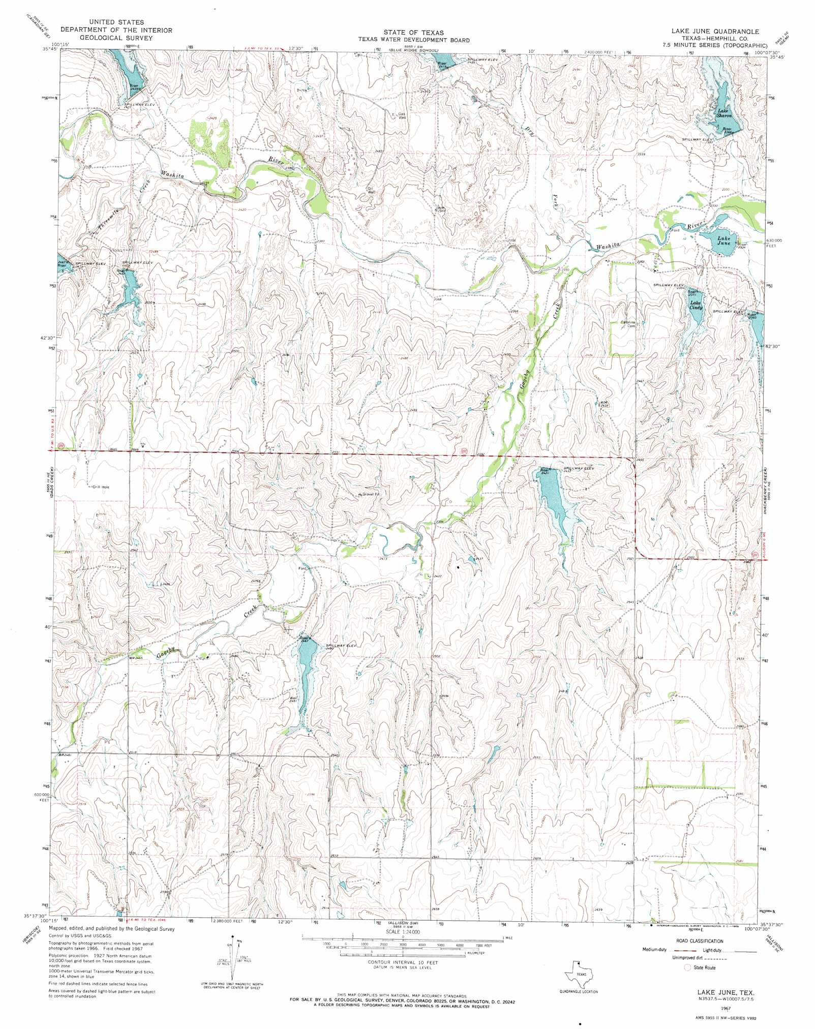
USGS Topo Quad 35100f2 - 1:24,000 scale
| Topo Map Name: | Lake June |
| USGS Topo Quad ID: | 35100f2 |
| Print Size: | ca. 21 1/4" wide x 27" high |
| Southeast Coordinates: | 35.625° N latitude / 100.125° W longitude |
| Map Center Coordinates: | 35.6875° N latitude / 100.1875° W longitude |
| U.S. State: | TX |
| Filename: | o35100f2.jpg |
| Download Map JPG Image: | Lake June topo map 1:24,000 scale |
| Map Type: | Topographic |
| Topo Series: | 7.5´ |
| Map Scale: | 1:24,000 |
| Source of Map Images: | United States Geological Survey (USGS) |
| Alternate Map Versions: |
Lake June TX 1967, updated 1969 Download PDF Buy paper map Lake June TX 2010 Download PDF Buy paper map Lake June TX 2012 Download PDF Buy paper map Lake June TX 2016 Download PDF Buy paper map |
1:24,000 Topo Quads surrounding Lake June
Canadian West |
Canadian East |
Lake Marvin |
Dreyfoos |
Antelope Hills |
Mendota |
Canadian Se |
Blue Ridge School |
Gem |
Durham |
Young Ranch |
Dads Creek |
Lake June |
Hackberry Creek |
Reydon |
Mobeetie |
Briscoe |
Allison Sw |
Allison |
Reydon Sw |
Spring Creek |
Wheeler |
Kelton Nw |
Kelton |
Sweetwater |
> Back to 35100e1 at 1:100,000 scale
> Back to 35100a1 at 1:250,000 scale
> Back to U.S. Topo Maps home
Lake June topo map: Gazetteer
Lake June: Dams
Lake June Dam elevation 712m 2335′Soil Conservation Service Site 13dam Dam elevation 748m 2454′
Soil Conservation Service Site 14a Dam elevation 753m 2470′
Soil Conservation Service Site 14dam Dam elevation 752m 2467′
Soil Conservation Service Site 15 Dam elevation 736m 2414′
Soil Conservation Service Site 24 Dam elevation 752m 2467′
Soil Conservation Service Site 25 Dam elevation 738m 2421′
Soil Conservation Service Site 26 Dam elevation 721m 2365′
Soil Conservation Service Site 27 Dam elevation 719m 2358′
Soil Conservation Service Site 28 Dam elevation 721m 2365′
Lake June: Reservoirs
Lake Cindy elevation 723m 2372′Lake June elevation 712m 2335′
Lake Sharon elevation 723m 2372′
Soil Conservation Service Site 13 Reservoir elevation 748m 2454′
Soil Conservation Service Site 14 Reservoir elevation 752m 2467′
Soil Conservation Service Site 14a Reservoir elevation 753m 2470′
Soil Conservation Service Site 15 Reservoir elevation 736m 2414′
Soil Conservation Service Site 24 Reservoir elevation 752m 2467′
Soil Conservation Service Site 25 Reservoir elevation 738m 2421′
Soil Conservation Service Site 26 Reservoir elevation 721m 2365′
Soil Conservation Service Site 27 Reservoir elevation 719m 2358′
Soil Conservation Service Site 28 Reservoir elevation 721m 2365′
Lake June: Streams
Dry Fork Washita River elevation 714m 2342′Gageby Creek elevation 714m 2342′
Threemile Creek elevation 732m 2401′
Lake June digital topo map on disk
Buy this Lake June topo map showing relief, roads, GPS coordinates and other geographical features, as a high-resolution digital map file on DVD: