Mccartys Topo Map New Mexico
To zoom in, hover over the map of Mccartys
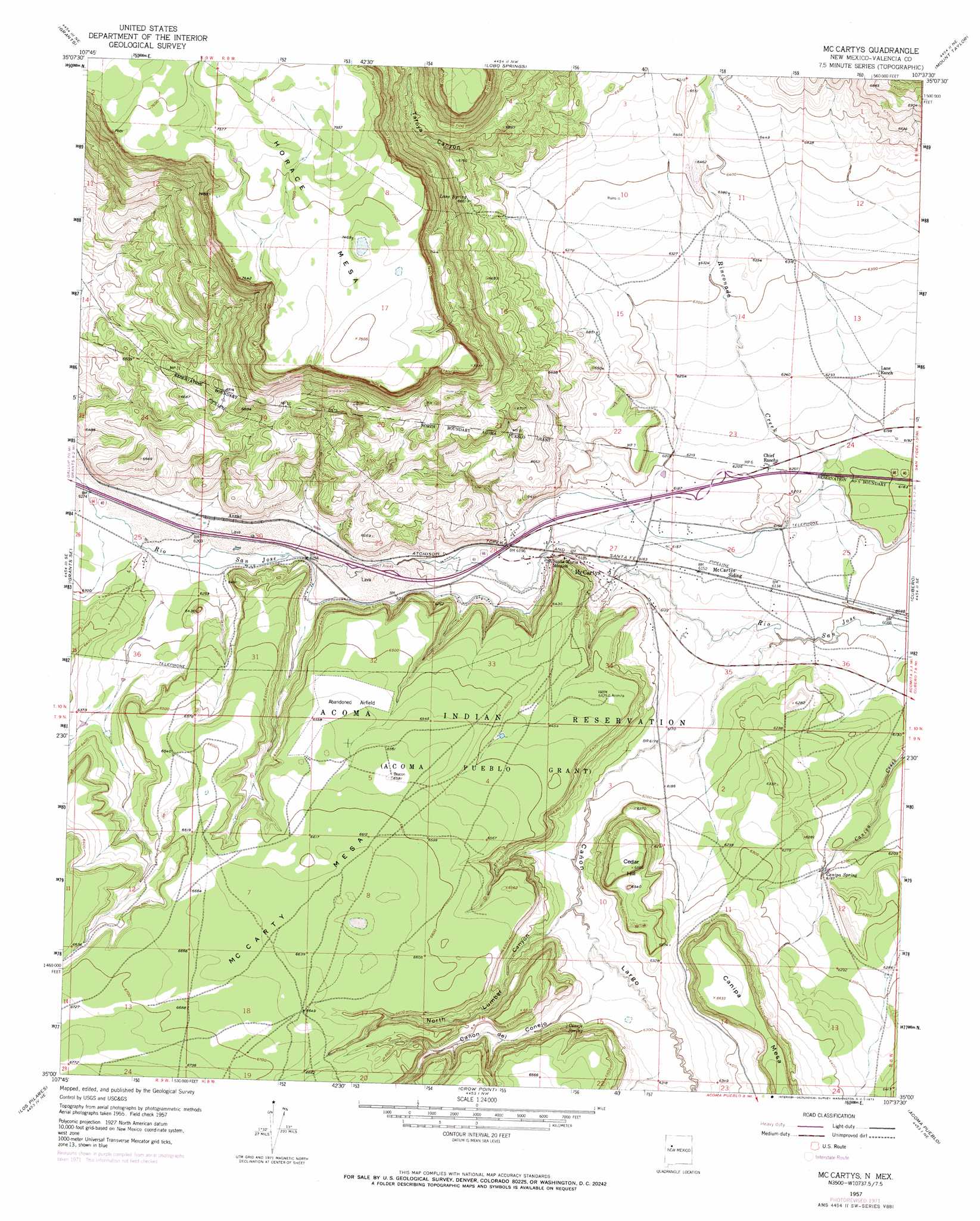
USGS Topo Quad 35107a6 - 1:24,000 scale
| Topo Map Name: | Mccartys |
| USGS Topo Quad ID: | 35107a6 |
| Print Size: | ca. 21 1/4" wide x 27" high |
| Southeast Coordinates: | 35° N latitude / 107.625° W longitude |
| Map Center Coordinates: | 35.0625° N latitude / 107.6875° W longitude |
| U.S. State: | NM |
| Filename: | o35107a6.jpg |
| Download Map JPG Image: | Mccartys topo map 1:24,000 scale |
| Map Type: | Topographic |
| Topo Series: | 7.5´ |
| Map Scale: | 1:24,000 |
| Source of Map Images: | United States Geological Survey (USGS) |
| Alternate Map Versions: |
Mc Cartys NM 1957, updated 1959 Download PDF Buy paper map Mc Cartys NM 1957, updated 1973 Download PDF Buy paper map McCartys NM 2010 Download PDF Buy paper map McCartys NM 2013 Download PDF Buy paper map McCartys NM 2017 Download PDF Buy paper map |
1:24,000 Topo Quads surrounding Mccartys
Bluewater |
Dos Lomas |
San Mateo |
Cerro Pelon |
Laguna Canoneros |
Milan |
Grants |
Lobo Springs |
Mount Taylor |
Seboyeta |
San Rafael |
Grants Se |
Mccartys |
Cubero |
Laguna |
Arrosa Ranch |
Los Pilares |
Crow Point |
Acoma Pueblo |
South Butte |
North Pasture |
Laguna Honda |
Blue Mesa |
East Mesa |
Marmon Ranch |
> Back to 35107a1 at 1:100,000 scale
> Back to 35106a1 at 1:250,000 scale
> Back to U.S. Topo Maps home
Mccartys topo map: Gazetteer
Mccartys: Mines
Basalt Quarry elevation 1948m 6391′Mccartys: Populated Places
Anzac elevation 1909m 6263′McCartys elevation 1880m 6167′
Mccartys: Springs
Canipa Spring elevation 1890m 6200′Conejo Spring elevation 1955m 6414′
Lane Spring elevation 2023m 6637′
Mccartys: Summits
Canipa Mesa elevation 2022m 6633′Cedar Hill elevation 2002m 6568′
CM Carty Mesa elevation 2021m 6630′
McCarty Mesa elevation 2023m 6637′
Mccartys: Valleys
Cañon de Conejo elevation 1916m 6286′Cañon Largo elevation 1867m 6125′
North Lumber Canyon elevation 1896m 6220′
Tafoya Canyon elevation 1970m 6463′
Mccartys: Wells
10027 Water Well elevation 1875m 6151′10032 Water Well elevation 1915m 6282′
Acoma 2 Water Well elevation 2028m 6653′
Airport WL Water Well elevation 1988m 6522′
Anzac 86-1 Water Well elevation 1916m 6286′
Test Well 3 Water Well elevation 1886m 6187′
Mccartys digital topo map on disk
Buy this Mccartys topo map showing relief, roads, GPS coordinates and other geographical features, as a high-resolution digital map file on DVD: