Kingman Se Topo Map Arizona
To zoom in, hover over the map of Kingman Se
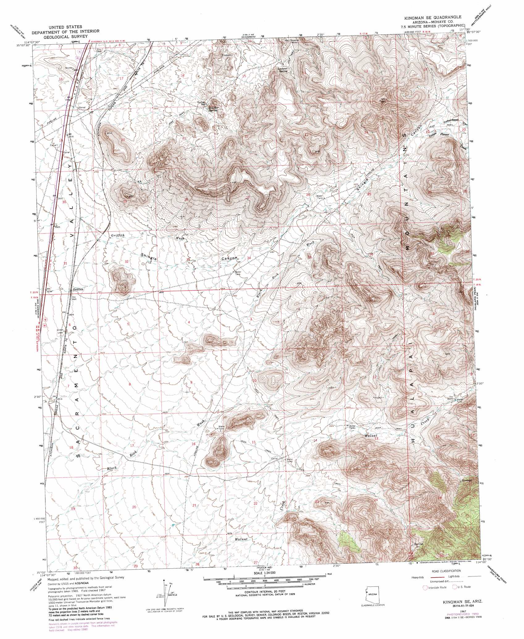
USGS Topo Quad 35114a1 - 1:24,000 scale
| Topo Map Name: | Kingman Se |
| USGS Topo Quad ID: | 35114a1 |
| Print Size: | ca. 21 1/4" wide x 27" high |
| Southeast Coordinates: | 35° N latitude / 114° W longitude |
| Map Center Coordinates: | 35.0625° N latitude / 114.0625° W longitude |
| U.S. State: | AZ |
| Filename: | o35114a1.jpg |
| Download Map JPG Image: | Kingman Se topo map 1:24,000 scale |
| Map Type: | Topographic |
| Topo Series: | 7.5´ |
| Map Scale: | 1:24,000 |
| Source of Map Images: | United States Geological Survey (USGS) |
| Alternate Map Versions: |
Kingman SE AZ 1967, updated 1969 Download PDF Buy paper map Kingman SE AZ 1967, updated 1980 Download PDF Buy paper map Kingman SE AZ 1967, updated 1985 Download PDF Buy paper map Kingman SE AZ 2011 Download PDF Buy paper map Kingman SE AZ 2014 Download PDF Buy paper map |
1:24,000 Topo Quads surrounding Kingman Se
Grasshopper Junction Se |
Cerbat |
Stockton Hill |
Kingman Airport |
Peacock Peak |
Secret Pass |
Kingman Nw |
Kingman |
Rattlesnake Hill |
Hualapai Spring |
Mount Nutt |
Kingman Sw |
Kingman Se |
Hualapai Peak |
Dean Peak |
Warm Springs |
Yucca Nw |
Yucca Ne |
Wabayuma Peak |
Hibernia Peak |
Warm Springs Se |
Yucca |
Yucca Se |
Creamery Canyon |
Diamond Joe Peak |
> Back to 35114a1 at 1:100,000 scale
> Back to 35114a1 at 1:250,000 scale
> Back to U.S. Topo Maps home
Kingman Se topo map: Gazetteer
Kingman Se: Mines
Boulder Creek Lode Mine elevation 835m 2739′Holy Moses Mine elevation 1061m 3480′
Kingman Se: Populated Places
Drake elevation 765m 2509′Griffith elevation 799m 2621′
Kingman Se: Reservoirs
Griffith Tank elevation 826m 2709′Number Five Trough elevation 911m 2988′
Kingman Se: Springs
Boulder Spring elevation 954m 3129′Lookout Spring elevation 1018m 3339′
Kingman Se: Streams
Yellow Flower Creek elevation 1078m 3536′Kingman Se: Valleys
Cottonwood Canyon elevation 1099m 3605′Kingman Se: Wells
Boulder Well elevation 946m 3103′Kingman Se digital topo map on disk
Buy this Kingman Se topo map showing relief, roads, GPS coordinates and other geographical features, as a high-resolution digital map file on DVD:
Southern Sierra Nevada, California & Southern Nevada
Buy digital topo maps: Southern Sierra Nevada, California & Southern Nevada