Agnos Topo Map Arkansas
To zoom in, hover over the map of Agnos
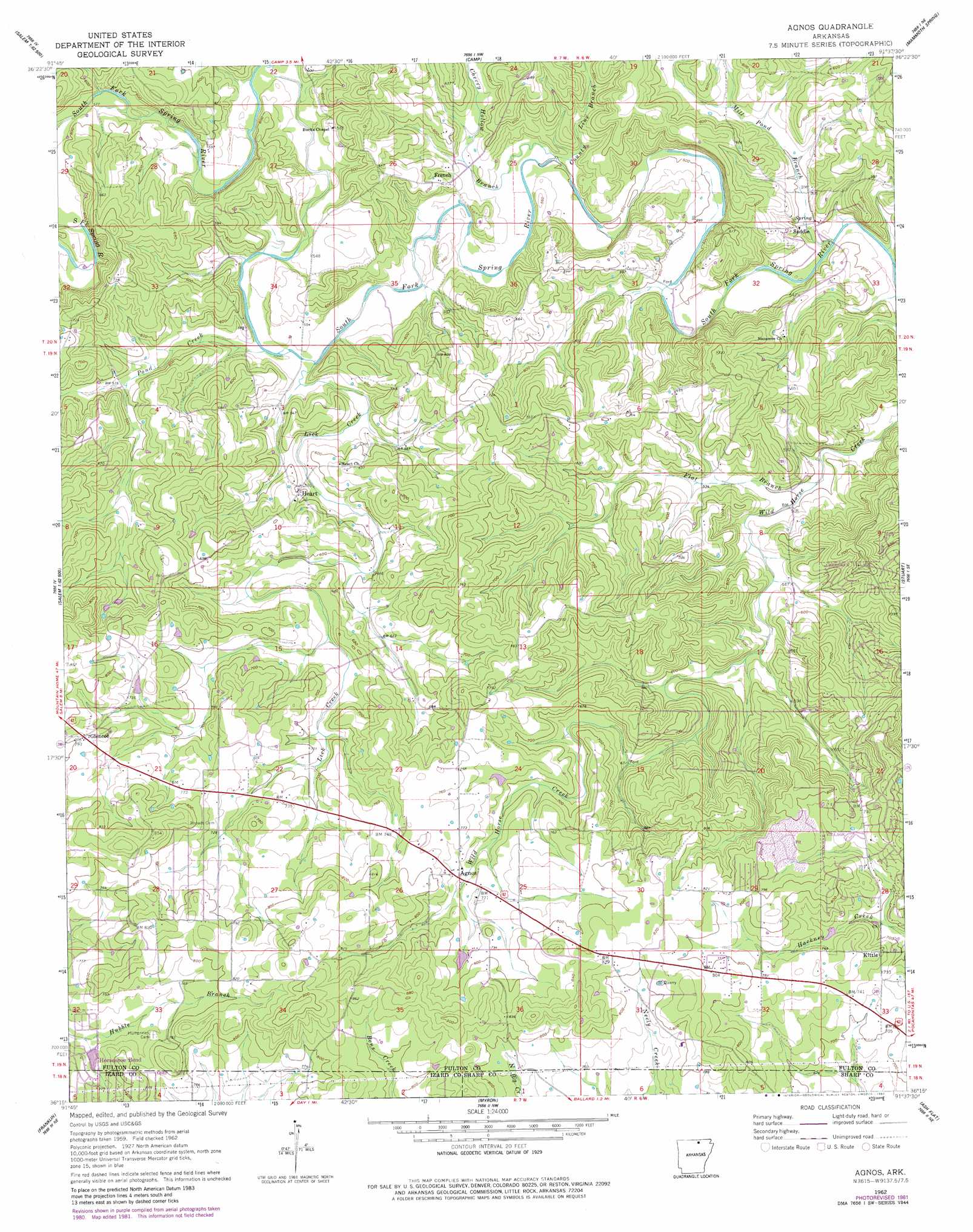
USGS Topo Quad 36091c6 - 1:24,000 scale
| Topo Map Name: | Agnos |
| USGS Topo Quad ID: | 36091c6 |
| Print Size: | ca. 21 1/4" wide x 27" high |
| Southeast Coordinates: | 36.25° N latitude / 91.625° W longitude |
| Map Center Coordinates: | 36.3125° N latitude / 91.6875° W longitude |
| U.S. State: | AR |
| Filename: | o36091c6.jpg |
| Download Map JPG Image: | Agnos topo map 1:24,000 scale |
| Map Type: | Topographic |
| Topo Series: | 7.5´ |
| Map Scale: | 1:24,000 |
| Source of Map Images: | United States Geological Survey (USGS) |
| Alternate Map Versions: |
Agnos AR 1962, updated 1963 Download PDF Buy paper map Agnos AR 1962, updated 1982 Download PDF Buy paper map Agnos AR 2011 Download PDF Buy paper map Agnos AR 2014 Download PDF Buy paper map |
1:24,000 Topo Quads surrounding Agnos
Moody |
Lanton |
Koshkonong |
Thayer |
Conch |
Viola |
Salem Knob |
Camp |
Mammoth Spring |
Wirth |
Byron |
Salem |
Agnos |
Stuart |
Hardy |
Oxford |
Franklin |
Myron |
Ash Flat |
Sitka |
Melbourne |
Zion |
Sidney |
Evening Shade |
Poughkeepsie |
> Back to 36091a1 at 1:100,000 scale
> Back to 36090a1 at 1:250,000 scale
> Back to U.S. Topo Maps home
Agnos topo map: Gazetteer
Agnos: Dams
Lake Brown Dam elevation 222m 728′North Lake Dam elevation 225m 738′
Timber Lake Dam elevation 233m 764′
Agnos: Populated Places
Agnos elevation 227m 744′French elevation 178m 583′
Glencoe elevation 241m 790′
Heart elevation 182m 597′
Kittle elevation 229m 751′
Saddle elevation 149m 488′
Agnos: Reservoirs
Lake Brown elevation 222m 728′North Lake elevation 225m 738′
Timber Lake elevation 233m 764′
Agnos: Streams
Cherry Hollow Branch elevation 153m 501′County Line Branch elevation 153m 501′
Flat Branch elevation 147m 482′
Lick Creek elevation 157m 515′
Mill Pond Branch elevation 142m 465′
Pond Creek elevation 161m 528′
Agnos digital topo map on disk
Buy this Agnos topo map showing relief, roads, GPS coordinates and other geographical features, as a high-resolution digital map file on DVD: