Franklin Topo Map Arkansas
To zoom in, hover over the map of Franklin
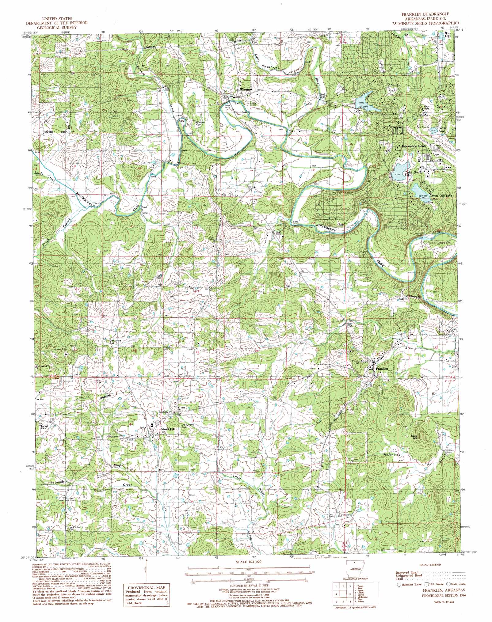
USGS Topo Quad 36091b7 - 1:24,000 scale
| Topo Map Name: | Franklin |
| USGS Topo Quad ID: | 36091b7 |
| Print Size: | ca. 21 1/4" wide x 27" high |
| Southeast Coordinates: | 36.125° N latitude / 91.75° W longitude |
| Map Center Coordinates: | 36.1875° N latitude / 91.8125° W longitude |
| U.S. State: | AR |
| Filename: | o36091b7.jpg |
| Download Map JPG Image: | Franklin topo map 1:24,000 scale |
| Map Type: | Topographic |
| Topo Series: | 7.5´ |
| Map Scale: | 1:24,000 |
| Source of Map Images: | United States Geological Survey (USGS) |
| Alternate Map Versions: |
Melbourne NE AR 1976, updated 1977 Download PDF Buy paper map Franklin AR 1984, updated 1984 Download PDF Buy paper map Franklin AR 2011 Download PDF Buy paper map Franklin AR 2014 Download PDF Buy paper map |
1:24,000 Topo Quads surrounding Franklin
Gepp |
Viola |
Salem Knob |
Camp |
Mammoth Spring |
Elizabeth |
Byron |
Salem |
Agnos |
Stuart |
Pineville |
Oxford |
Franklin |
Myron |
Ash Flat |
Boswell |
Melbourne |
Zion |
Sidney |
Evening Shade |
Sylamore |
Guion |
Mount Pleasant |
Sandtown |
Cave City |
> Back to 36091a1 at 1:100,000 scale
> Back to 36090a1 at 1:250,000 scale
> Back to U.S. Topo Maps home
Franklin topo map: Gazetteer
Franklin: Airports
Horseshoe Bend Airport elevation 222m 728′Franklin: Dams
Cedar Glade Lake Dam elevation 243m 797′Lake Pioneer Dam elevation 233m 764′
White Oak Lake Dam elevation 222m 728′
Franklin: Populated Places
Franklin elevation 186m 610′Horseshoe Bend elevation 266m 872′
New Liberty elevation 240m 787′
Violet Hill elevation 227m 744′
Wiseman elevation 183m 600′
Franklin: Post Offices
Violet Hill Post Office elevation 234m 767′Wiseman Post Office elevation 182m 597′
Franklin: Reservoirs
Bass Lake elevation 218m 715′Cedar Glade Lake elevation 243m 797′
Lake Pioneer elevation 233m 764′
Lodge Lake elevation 227m 744′
White Oak Lake elevation 222m 728′
Franklin: Streams
Bullpen Creek elevation 184m 603′Little Strawberry River elevation 178m 583′
Sandy Creek elevation 192m 629′
Franklin: Summits
Burns Hill elevation 247m 810′Franklin digital topo map on disk
Buy this Franklin topo map showing relief, roads, GPS coordinates and other geographical features, as a high-resolution digital map file on DVD: