Protem Sw Topo Map Missouri
To zoom in, hover over the map of Protem Sw
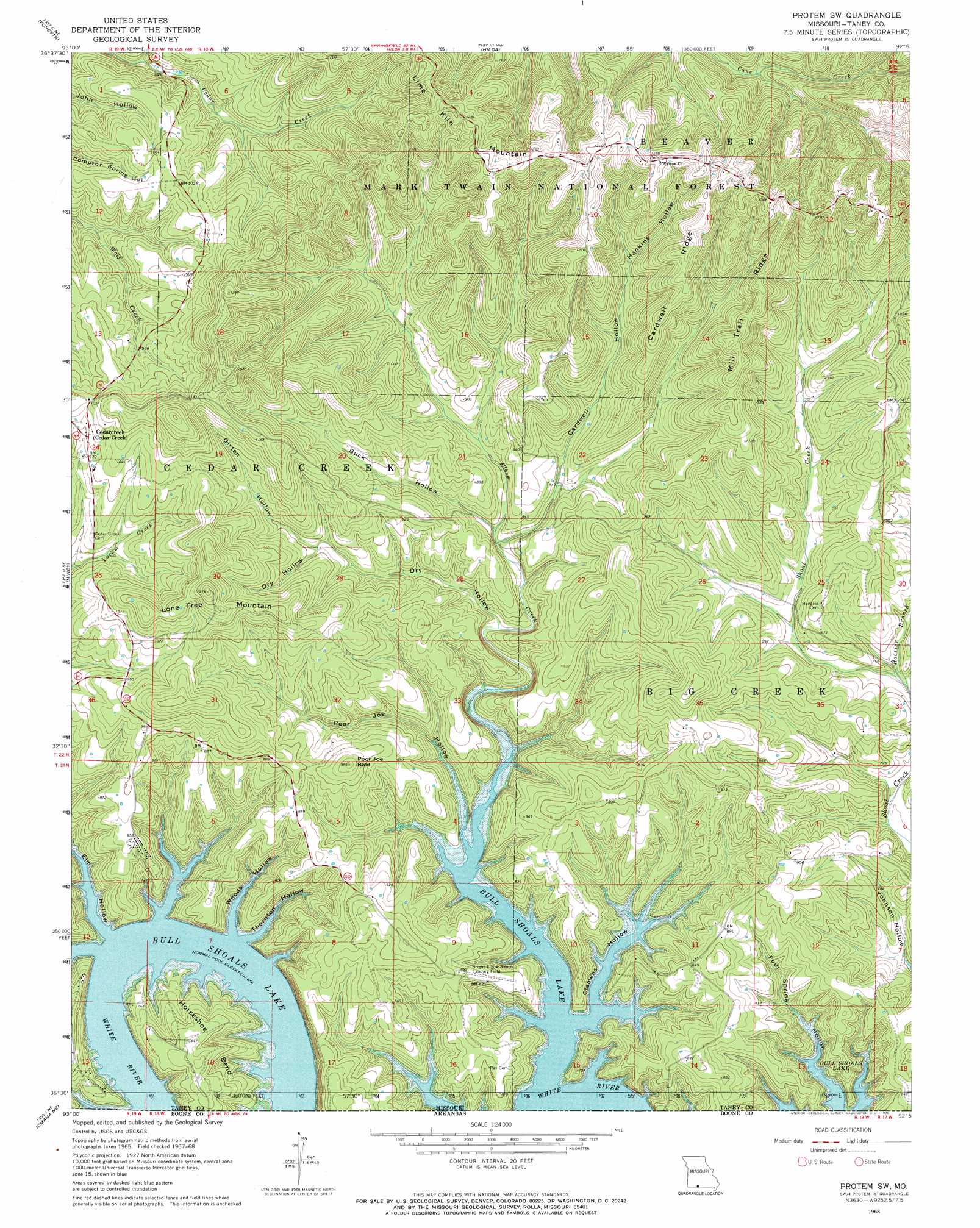
USGS Topo Quad 36092e8 - 1:24,000 scale
| Topo Map Name: | Protem Sw |
| USGS Topo Quad ID: | 36092e8 |
| Print Size: | ca. 21 1/4" wide x 27" high |
| Southeast Coordinates: | 36.5° N latitude / 92.875° W longitude |
| Map Center Coordinates: | 36.5625° N latitude / 92.9375° W longitude |
| U.S. State: | MO |
| Filename: | o36092e8.jpg |
| Download Map JPG Image: | Protem Sw topo map 1:24,000 scale |
| Map Type: | Topographic |
| Topo Series: | 7.5´ |
| Map Scale: | 1:24,000 |
| Source of Map Images: | United States Geological Survey (USGS) |
| Alternate Map Versions: |
Protem SW MO 1968, updated 1970 Download PDF Buy paper map Protem SW MO 1968, updated 1970 Download PDF Buy paper map Protem SW MO 2004, updated 2006 Download PDF Buy paper map Protem SW MO 2012 Download PDF Buy paper map Protem SW MO 2015 Download PDF Buy paper map |
| FStopo: | US Forest Service topo Protem SW is available: Download FStopo PDF Download FStopo TIF |
1:24,000 Topo Quads surrounding Protem Sw
Day |
Garrison |
Bradleyville |
Brownbranch |
Smallett |
Branson |
Forsyth |
Hilda |
Protem Ne |
Thornfield |
Hollister |
Mincy |
Protem Sw |
Protem |
Theodosia |
Omaha |
Omaha Ne |
Diamond City |
Peel |
Cotter Nw |
Batavia |
Bergman |
Zinc |
Pyatt |
Cotter Sw |
> Back to 36092e1 at 1:100,000 scale
> Back to 36092a1 at 1:250,000 scale
> Back to U.S. Topo Maps home
Protem Sw topo map: Gazetteer
Protem Sw: Airports
Bright Elbow Ranch Landing Field elevation 251m 823′Protem Sw: Bends
Horsehoe Bend elevation 258m 846′Protem Sw: Populated Places
Cedarcreek elevation 307m 1007′Protem Sw: Ridges
Cardwell Ridge elevation 392m 1286′Mill Trail Ridge elevation 387m 1269′
Protem Sw: Streams
Dabbs Creek elevation 233m 764′Elbow Creek elevation 199m 652′
Hoosier Branch elevation 228m 748′
Protem Sw: Summits
Lone Tree Mountain elevation 385m 1263′Poor Joe Bald elevation 300m 984′
Protem Sw: Valleys
Buck Hollow elevation 237m 777′Cardwell Hollow elevation 238m 780′
Clemens Hollow elevation 199m 652′
Dry Hollow elevation 225m 738′
Elm Hollow elevation 199m 652′
Girten Hollow elevation 264m 866′
Hankins Hollow elevation 299m 980′
Poor Joe Hollow elevation 199m 652′
Thornton Hollow elevation 199m 652′
White Oak Hollow elevation 199m 652′
Woods Hollow elevation 199m 652′
Protem Sw digital topo map on disk
Buy this Protem Sw topo map showing relief, roads, GPS coordinates and other geographical features, as a high-resolution digital map file on DVD: