Cross L Ranch Sw Topo Map New Mexico
To zoom in, hover over the map of Cross L Ranch Sw
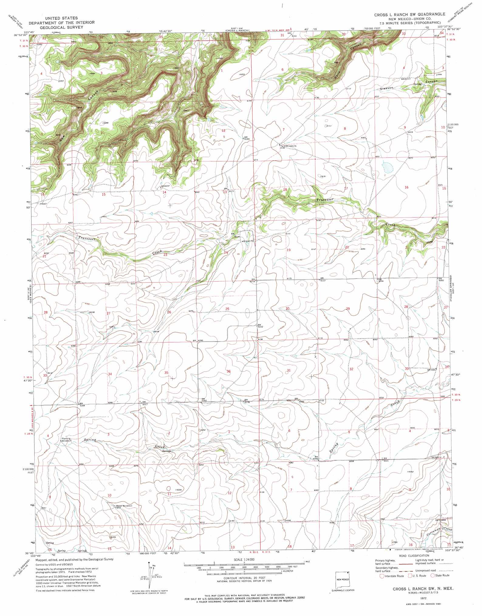
USGS Topo Quad 36103g6 - 1:24,000 scale
| Topo Map Name: | Cross L Ranch Sw |
| USGS Topo Quad ID: | 36103g6 |
| Print Size: | ca. 21 1/4" wide x 27" high |
| Southeast Coordinates: | 36.75° N latitude / 103.625° W longitude |
| Map Center Coordinates: | 36.8125° N latitude / 103.6875° W longitude |
| U.S. State: | NM |
| Filename: | o36103g6.jpg |
| Download Map JPG Image: | Cross L Ranch Sw topo map 1:24,000 scale |
| Map Type: | Topographic |
| Topo Series: | 7.5´ |
| Map Scale: | 1:24,000 |
| Source of Map Images: | United States Geological Survey (USGS) |
| Alternate Map Versions: |
Cross L Ranch SW NM 1972, updated 1975 Download PDF Buy paper map Cross L Ranch SW NM 2010 Download PDF Buy paper map Cross L Ranch SW NM 2013 Download PDF Buy paper map Cross L Ranch SW NM 2017 Download PDF Buy paper map |
1:24,000 Topo Quads surrounding Cross L Ranch Sw
Branson |
Branson Se |
Pine Canyon |
Cobert Mesa North |
Jesus Canyon |
Alps Mesa |
Emery Peak |
Cross L Ranch |
Cobert Mesa South |
Travesser Park |
Folsom |
Des Moines |
Cross L Ranch Sw |
Fiddler Springs |
Guy |
Capulin |
Little Grande |
Wetherly Lake |
Blind Gap |
Boiler Gap |
Malpie Mountain |
Cow Mountain |
Grenville Sw |
Grenville |
Mount Dora |
> Back to 36103e1 at 1:100,000 scale
> Back to 36102a1 at 1:250,000 scale
> Back to U.S. Topo Maps home
No gazetteer data is available for the Cross L Ranch Sw topo map sheet.
Cross L Ranch Sw digital topo map on disk
Buy this Cross L Ranch Sw topo map showing relief, roads, GPS coordinates and other geographical features, as a high-resolution digital map file on DVD: