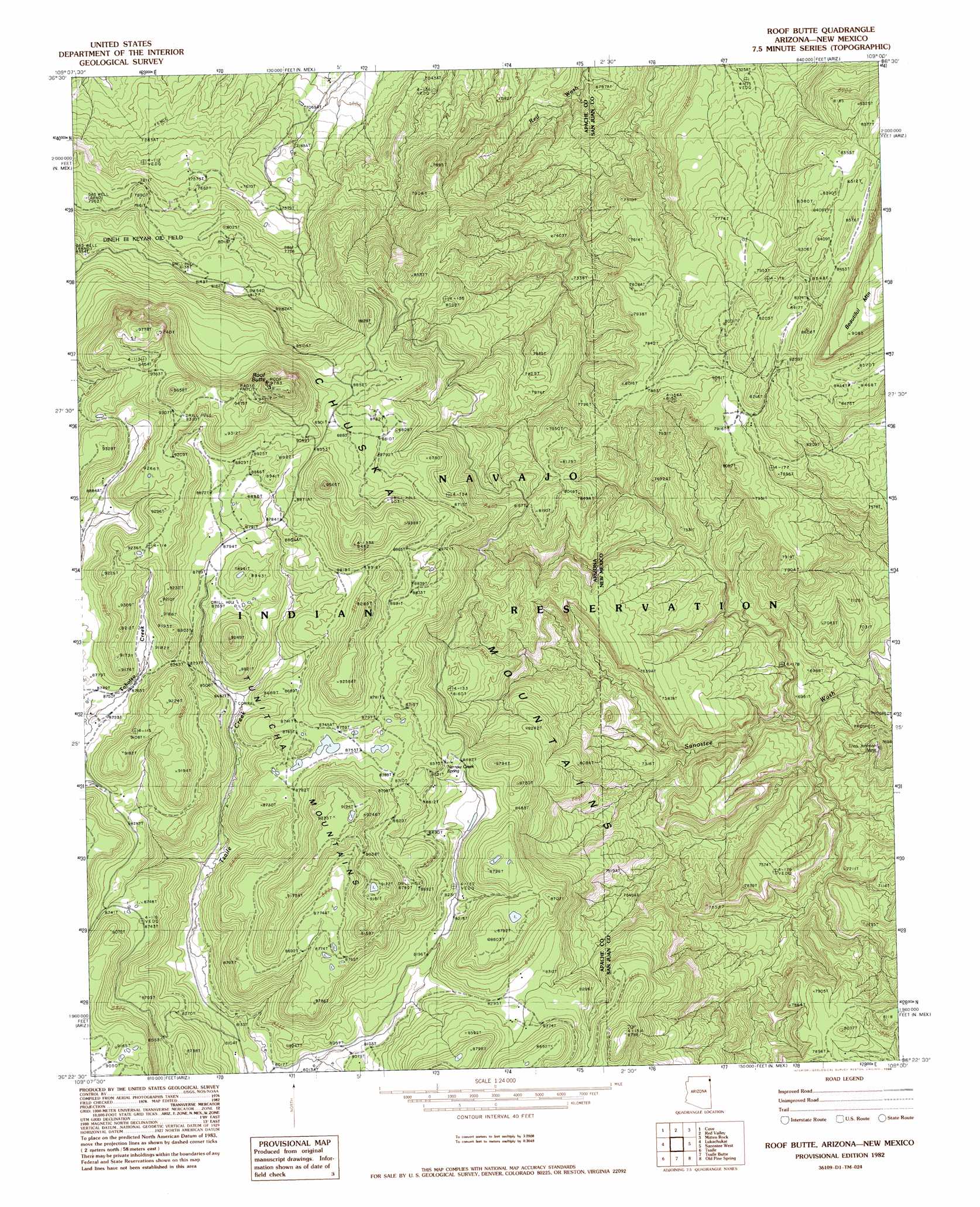
Roof Butte Topo Map Arizona
To zoom in, hover over the map of Roof Butte
USGS Topo Quad 36109d1 - 1:24,000 scale
| Topo Map Name: | Roof Butte |
| USGS Topo Quad ID: | 36109d1 |
| Print Size: | ca. 21 1/4" wide x 27" high |
| Southeast Coordinates: | 36.375° N latitude / 109° W longitude |
| Map Center Coordinates: | 36.4375° N latitude / 109.0625° W longitude |
| U.S. States: | AZ, NM |
| Filename: | o36109d1.jpg |
| Download Map JPG Image: | Roof Butte topo map 1:24,000 scale |
| Map Type: | Topographic |
| Topo Series: | 7.5´ |
| Map Scale: | 1:24,000 |
| Source of Map Images: | United States Geological Survey (USGS) |
| Alternate Map Versions: |
Sonsala Butte 1 NE AZ 1955, updated 1958 Download PDF Buy paper map Roof Butte AZ 1982, updated 1982 Download PDF Buy paper map Roof Butte AZ 1982, updated 1986 Download PDF Buy paper map Roof Butte AZ 2010 Download PDF Buy paper map Roof Butte AZ 2011 Download PDF Buy paper map Roof Butte AZ 2014 Download PDF Buy paper map |
1:24,000 Topo Quads surrounding Roof Butte
Kinusta Mesa |
Boiling Over Well |
Horse Mesa |
Sand Spring |
Ship Rock |
Mexican Cry Mesa |
Cove |
Red Valley |
Mitten Rock |
Yellow Hill |
Bad Bug Butte |
Lukachukai |
Roof Butte |
Sanostee West |
Sanostee East |
Red Cornfield Mesa |
Tsaile |
Tsaile Butte |
Old Pine Spring |
Tsin-Nas-Kid |
Mummy Cave Ruins |
Lower Wheatfields |
Upper Wheatfields |
Toadlena |
Two Grey Hills |
> Back to 36109a1 at 1:100,000 scale
> Back to 36108a1 at 1:250,000 scale
> Back to U.S. Topo Maps home
Roof Butte topo map: Gazetteer
Roof Butte: Arches
Snake Bridge elevation 2092m 6863′Roof Butte: Mines
Enos Johnson Mine elevation 2102m 6896′Roof Butte: Springs
12R-66 Spring elevation 2472m 8110′Narrow Creek Spring elevation 2613m 8572′
Roof Butte: Summits
Roof Butte elevation 2952m 9685′Roof Butte digital topo map on disk
Buy this Roof Butte topo map showing relief, roads, GPS coordinates and other geographical features, as a high-resolution digital map file on DVD: