Red Point Topo Map Arizona
To zoom in, hover over the map of Red Point
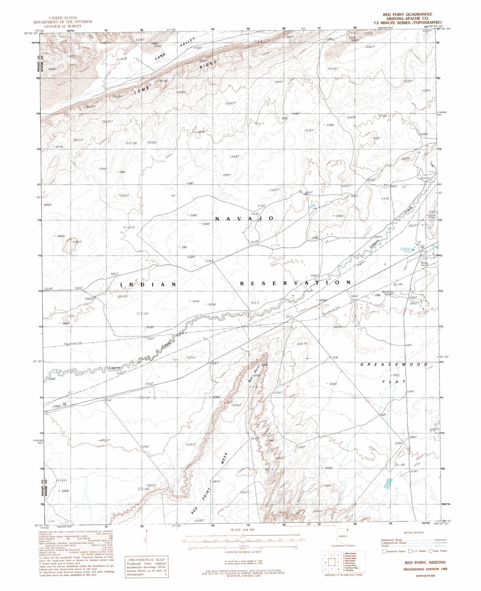
USGS Topo Quad 36109g8 - 1:24,000 scale
| Topo Map Name: | Red Point |
| USGS Topo Quad ID: | 36109g8 |
| Print Size: | ca. 21 1/4" wide x 27" high |
| Southeast Coordinates: | 36.75° N latitude / 109.875° W longitude |
| Map Center Coordinates: | 36.8125° N latitude / 109.9375° W longitude |
| U.S. State: | AZ |
| Filename: | o36109g8.jpg |
| Download Map JPG Image: | Red Point topo map 1:24,000 scale |
| Map Type: | Topographic |
| Topo Series: | 7.5´ |
| Map Scale: | 1:24,000 |
| Source of Map Images: | United States Geological Survey (USGS) |
| Alternate Map Versions: |
Setsiltso Springs 2 SW AZ 1952, updated 1954 Download PDF Buy paper map Red Point AZ 1988, updated 1988 Download PDF Buy paper map Red Point AZ 2011 Download PDF Buy paper map Red Point AZ 2014 Download PDF Buy paper map |
1:24,000 Topo Quads surrounding Red Point
Goulding |
Monument Pass |
Mexican Hat Sw |
Mexican Hat Se |
Moses Rock |
Mystery Valley |
Mitten Buttes |
Rooster Rock |
Garnet Ridge |
Mexican Water |
Agathla Peak |
Baby Rocks |
Red Point |
Dennehotso |
Mexican Water Sw |
Kayenta East |
Church Rock |
Red Point Mesa |
Tall Mesa |
Rock Point |
Owl Spring |
Chilchinbito |
Sweetwater Mesa |
White Point |
Rock Point Sw |
> Back to 36109e1 at 1:100,000 scale
> Back to 36108a1 at 1:250,000 scale
> Back to U.S. Topo Maps home
Red Point topo map: Gazetteer
Red Point: Flats
Greasewood Flat elevation 1578m 5177′Red Point: Populated Places
Diamond Fields elevation 1549m 5082′Red Point: Summits
Red Point elevation 1676m 5498′Red Point digital topo map on disk
Buy this Red Point topo map showing relief, roads, GPS coordinates and other geographical features, as a high-resolution digital map file on DVD: