Tall Mountain Nw Topo Map Arizona
To zoom in, hover over the map of Tall Mountain Nw
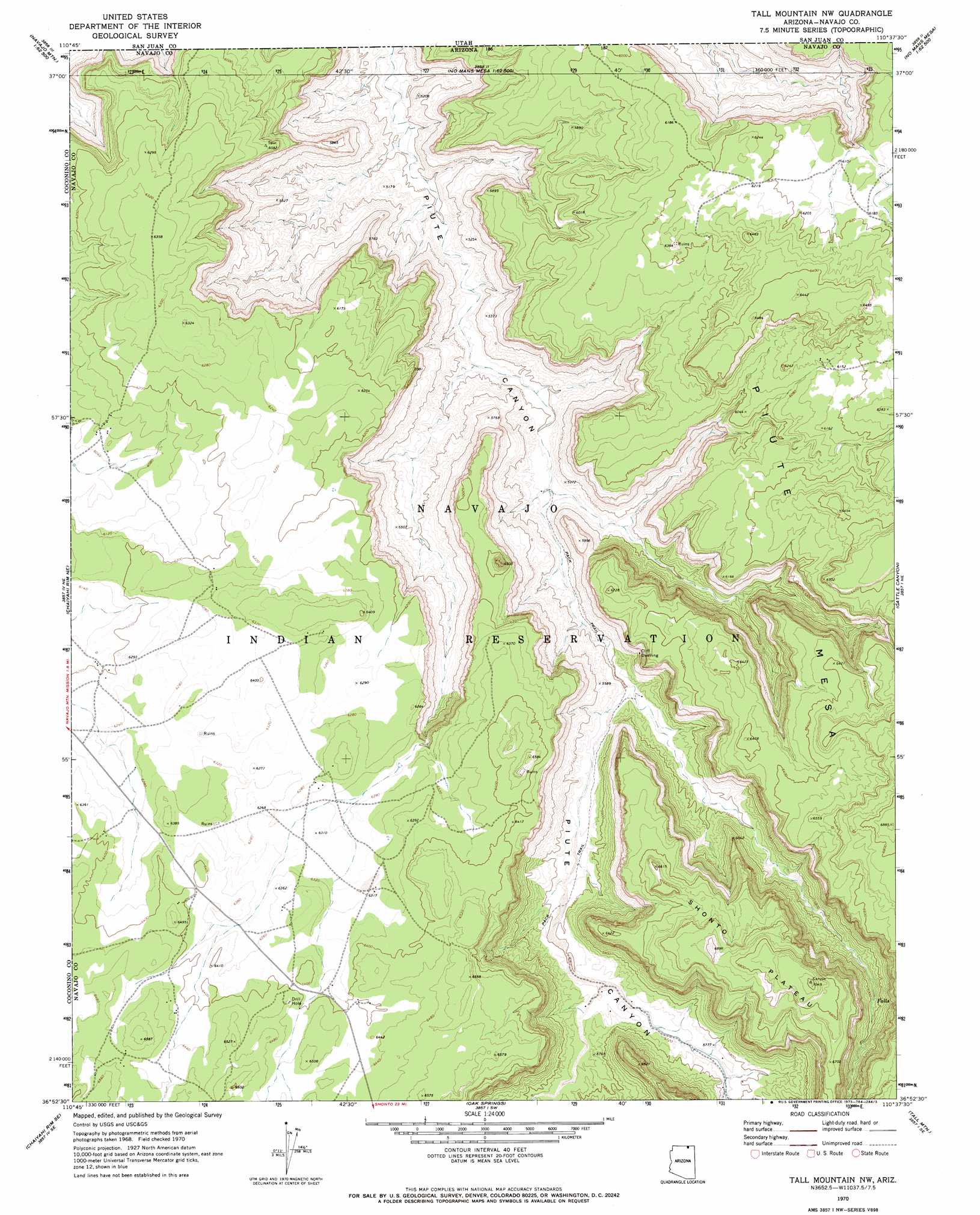
USGS Topo Quad 36110h6 - 1:24,000 scale
| Topo Map Name: | Tall Mountain Nw |
| USGS Topo Quad ID: | 36110h6 |
| Print Size: | ca. 21 1/4" wide x 27" high |
| Southeast Coordinates: | 36.875° N latitude / 110.625° W longitude |
| Map Center Coordinates: | 36.9375° N latitude / 110.6875° W longitude |
| U.S. State: | AZ |
| Filename: | o36110h6.jpg |
| Download Map JPG Image: | Tall Mountain Nw topo map 1:24,000 scale |
| Map Type: | Topographic |
| Topo Series: | 7.5´ |
| Map Scale: | 1:24,000 |
| Source of Map Images: | United States Geological Survey (USGS) |
| Alternate Map Versions: |
Tall Mountain NW AZ 1970, updated 1973 Download PDF Buy paper map Tall Mountain NW AZ 2011 Download PDF Buy paper map Tall Mountain NW AZ 2011 Download PDF Buy paper map Tall Mountain NW AZ 2014 Download PDF Buy paper map |
1:24,000 Topo Quads surrounding Tall Mountain Nw
Nasja Mesa |
Wilson Creek |
Deep Canyon North |
No Mans Mesa North |
Monitor Butte |
Rainbow Bridge |
Navajo Begay |
Deep Canyon South |
No Mans Mesa South |
Jacobs Monument |
Chaiyahi Flat |
Chaiyahi Rim Ne |
Tall Mountain Nw |
Cattle Canyon |
Big Point |
Chaiyahi Rim Sw |
Chaiyahi Rim Se |
Oak Springs |
Tall Mountain |
Keet Seel Ruin |
Two Red Mesas |
Inscription House Ruin |
Shonto Nw |
Betatakin Ruin |
Marsh Pass |
> Back to 36110e1 at 1:100,000 scale
> Back to 36110a1 at 1:250,000 scale
> Back to U.S. Topo Maps home
Tall Mountain Nw digital topo map on disk
Buy this Tall Mountain Nw topo map showing relief, roads, GPS coordinates and other geographical features, as a high-resolution digital map file on DVD: