Monitor Butte Topo Map Utah
To zoom in, hover over the map of Monitor Butte
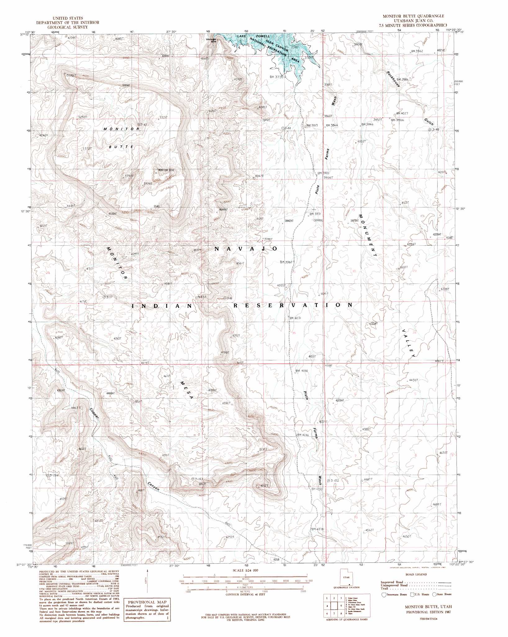
USGS Topo Quad 37110b4 - 1:24,000 scale
| Topo Map Name: | Monitor Butte |
| USGS Topo Quad ID: | 37110b4 |
| Print Size: | ca. 21 1/4" wide x 27" high |
| Southeast Coordinates: | 37.125° N latitude / 110.375° W longitude |
| Map Center Coordinates: | 37.1875° N latitude / 110.4375° W longitude |
| U.S. State: | UT |
| Filename: | o37110b4.jpg |
| Download Map JPG Image: | Monitor Butte topo map 1:24,000 scale |
| Map Type: | Topographic |
| Topo Series: | 7.5´ |
| Map Scale: | 1:24,000 |
| Source of Map Images: | United States Geological Survey (USGS) |
| Alternate Map Versions: |
Clay Hills 3 NW UT 1952, updated 1954 Download PDF Buy paper map Monitor Butte UT 1987, updated 1987 Download PDF Buy paper map Monitor Butte UT 2011 Download PDF Buy paper map Monitor Butte UT 2014 Download PDF Buy paper map |
1:24,000 Topo Quads surrounding Monitor Butte
Halls Crossing |
Halls Crossing Ne |
Burnt Spring |
Clay Hills |
Red House Spring |
Alcove Canyon |
Nokai Dome |
Mikes Mesa |
Whirlwind Draw |
Slickhorn Canyon West |
Deep Canyon North |
No Mans Mesa North |
Monitor Butte |
Oljeto Ne |
Goulding Nw |
Deep Canyon South |
No Mans Mesa South |
Jacobs Monument |
Oljeto |
Goulding |
Tall Mountain Nw |
Cattle Canyon |
Big Point |
Boot Mesa |
Mystery Valley |
> Back to 37110a1 at 1:100,000 scale
> Back to 37110a1 at 1:250,000 scale
> Back to U.S. Topo Maps home
Monitor Butte topo map: Gazetteer
Monitor Butte: Mines
Whirlwind Mine elevation 1185m 3887′Whirlwind Mine elevation 1228m 4028′
Monitor Butte: Summits
Monitor Butte elevation 1682m 5518′Monitor Mesa elevation 1306m 4284′
Monitor Butte digital topo map on disk
Buy this Monitor Butte topo map showing relief, roads, GPS coordinates and other geographical features, as a high-resolution digital map file on DVD: