Formaster Well Topo Map Arizona
To zoom in, hover over the map of Formaster Well
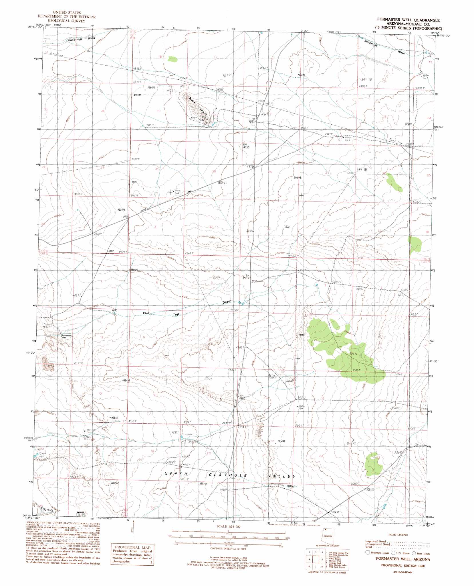
USGS Topo Quad 36113g1 - 1:24,000 scale
| Topo Map Name: | Formaster Well |
| USGS Topo Quad ID: | 36113g1 |
| Print Size: | ca. 21 1/4" wide x 27" high |
| Southeast Coordinates: | 36.75° N latitude / 113° W longitude |
| Map Center Coordinates: | 36.8125° N latitude / 113.0625° W longitude |
| U.S. State: | AZ |
| Filename: | o36113g1.jpg |
| Download Map JPG Image: | Formaster Well topo map 1:24,000 scale |
| Map Type: | Topographic |
| Topo Series: | 7.5´ |
| Map Scale: | 1:24,000 |
| Source of Map Images: | United States Geological Survey (USGS) |
| Alternate Map Versions: |
Lost Spring SE AZ 1954, updated 1956 Download PDF Buy paper map Formaster Well AZ 1988, updated 1988 Download PDF Buy paper map Formaster Well AZ 2011 Download PDF Buy paper map Formaster Well AZ 2014 Download PDF Buy paper map |
1:24,000 Topo Quads surrounding Formaster Well
The Divide |
Little Creek Mountain |
Smithsonian Butte |
Hildale |
Elephant Butte |
Rock Canyon |
Lost Spring Mountain West |
Lost Spring Mountain East |
Colorado City |
Moccasin |
Gyp Pocket |
White Pockets |
Formaster Well |
Maroney Well |
Pipe Valley |
The Grandstand |
Antelope Knoll |
Little Clayhole Valley |
Wild Band Pockets |
Sunshine Ridge |
Russell Spring |
Moriah Knoll |
Hat Knoll |
Heaton Knolls |
Robinson Canyon |
> Back to 36113e1 at 1:100,000 scale
> Back to 36112a1 at 1:250,000 scale
> Back to U.S. Topo Maps home
Formaster Well topo map: Gazetteer
Formaster Well: Reservoirs
Flattop Reservoir elevation 1501m 4924′Formaster Well: Summits
Black Knolls elevation 1513m 4963′Formaster Well: Wells
Formaster Well elevation 1466m 4809′Formaster Well digital topo map on disk
Buy this Formaster Well topo map showing relief, roads, GPS coordinates and other geographical features, as a high-resolution digital map file on DVD: