Savedge Topo Map Virginia
To zoom in, hover over the map of Savedge
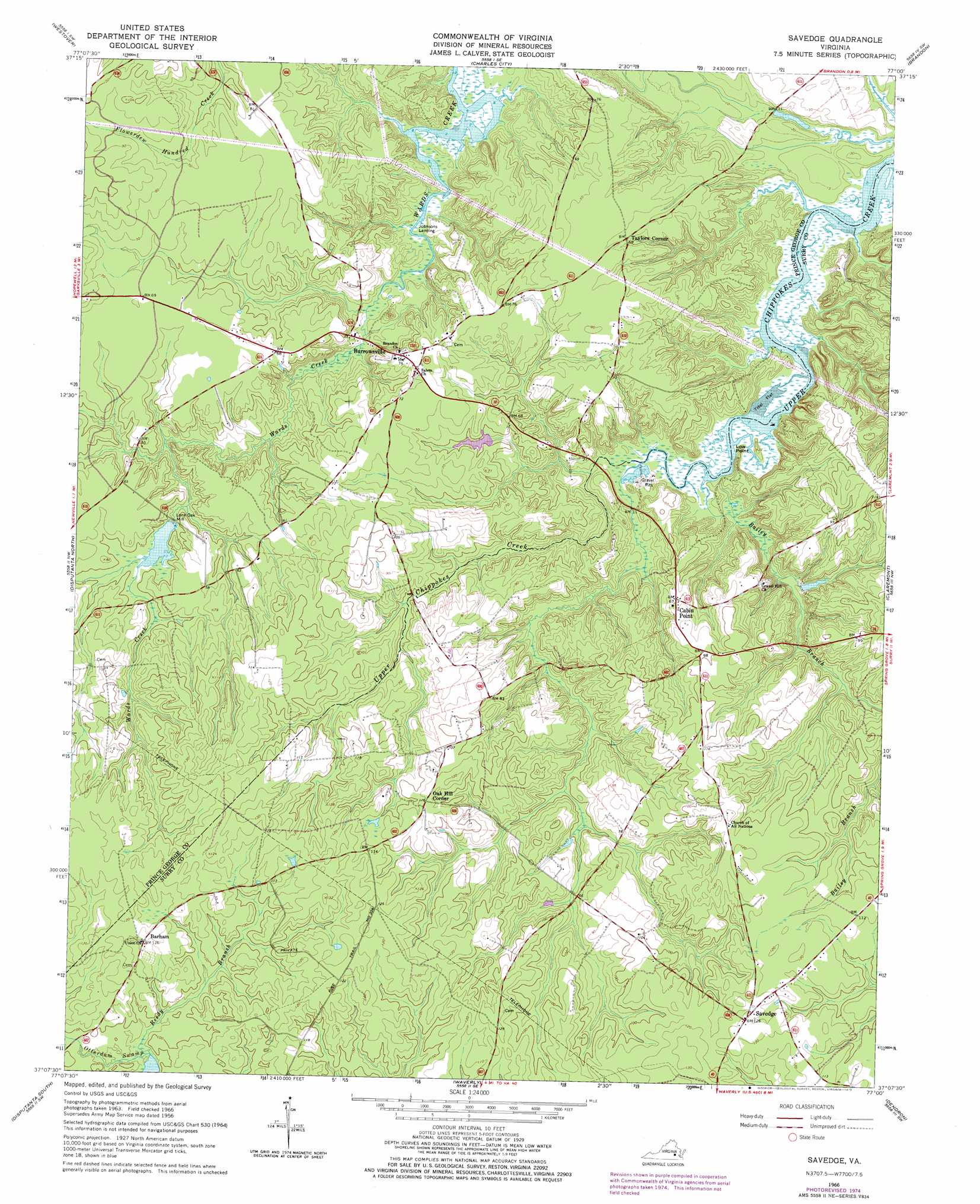
USGS Topo Quad 37077b1 - 1:24,000 scale
| Topo Map Name: | Savedge |
| USGS Topo Quad ID: | 37077b1 |
| Print Size: | ca. 21 1/4" wide x 27" high |
| Southeast Coordinates: | 37.125° N latitude / 77° W longitude |
| Map Center Coordinates: | 37.1875° N latitude / 77.0625° W longitude |
| U.S. State: | VA |
| Filename: | o37077b1.jpg |
| Download Map JPG Image: | Savedge topo map 1:24,000 scale |
| Map Type: | Topographic |
| Topo Series: | 7.5´ |
| Map Scale: | 1:24,000 |
| Source of Map Images: | United States Geological Survey (USGS) |
| Alternate Map Versions: |
Savedge VA 1956, updated 1958 Download PDF Buy paper map Savedge VA 1966, updated 1967 Download PDF Buy paper map Savedge VA 1966, updated 1975 Download PDF Buy paper map Savedge VA 2011 Download PDF Buy paper map Savedge VA 2013 Download PDF Buy paper map Savedge VA 2016 Download PDF Buy paper map |
1:24,000 Topo Quads surrounding Savedge
Dutch Gap |
Roxbury |
Providence Forge |
Walkers |
Toano |
Hopewell |
Westover |
Charles City |
Brandon |
Norge |
Prince George |
Disputanta North |
Savedge |
Claremont |
Surry |
Templeton |
Disputanta South |
Waverly |
Dendron |
Runnymede |
Sussex |
Littleton |
Manry |
Ivor |
Raynor |
> Back to 37077a1 at 1:100,000 scale
> Back to 37076a1 at 1:250,000 scale
> Back to U.S. Topo Maps home
Savedge topo map: Gazetteer
Savedge: Capes
Low Point elevation 1m 3′Savedge: Dams
Gray Dam elevation 14m 45′Low Point Dam elevation 1m 3′
Manns Dam elevation 11m 36′
Whelans Dam elevation 21m 68′
Savedge: Populated Places
Barham elevation 37m 121′Burrowsville elevation 19m 62′
Lone Oak Mill elevation 13m 42′
Oak Hill Corner elevation 38m 124′
Savedge elevation 38m 124′
Taylors Corner elevation 27m 88′
Savedge: Reservoirs
Gray Pond elevation 14m 45′Low Point Millpond elevation 1m 3′
Manns Pond elevation 11m 36′
Whelans Pond elevation 21m 68′
Savedge: Streams
Bailey Branch elevation 1m 3′Reedy Branch elevation 25m 82′
Savedge digital topo map on disk
Buy this Savedge topo map showing relief, roads, GPS coordinates and other geographical features, as a high-resolution digital map file on DVD:
Atlantic Coast (NY, NJ, PA, DE, MD, VA, NC)
Buy digital topo maps: Atlantic Coast (NY, NJ, PA, DE, MD, VA, NC)
 map DVD")