Flat Topo Map Missouri
To zoom in, hover over the map of Flat
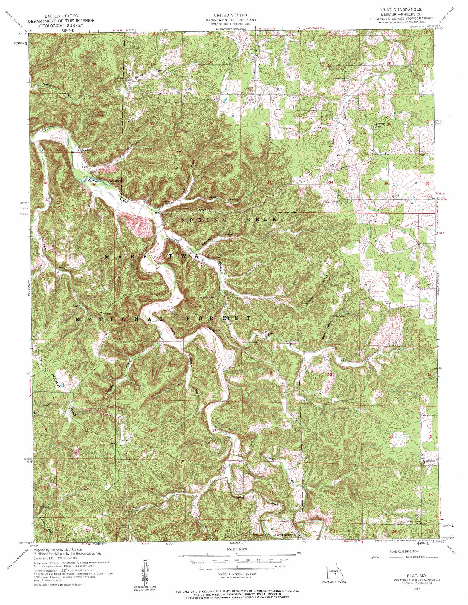
USGS Topo Quad 37091f8 - 1:24,000 scale
| Topo Map Name: | Flat |
| USGS Topo Quad ID: | 37091f8 |
| Print Size: | ca. 21 1/4" wide x 27" high |
| Southeast Coordinates: | 37.625° N latitude / 91.875° W longitude |
| Map Center Coordinates: | 37.6875° N latitude / 91.9375° W longitude |
| U.S. State: | MO |
| Filename: | o37091f8.jpg |
| Download Map JPG Image: | Flat topo map 1:24,000 scale |
| Map Type: | Topographic |
| Topo Series: | 7.5´ |
| Map Scale: | 1:24,000 |
| Source of Map Images: | United States Geological Survey (USGS) |
| Alternate Map Versions: |
Flat MO 1954, updated 1959 Download PDF Buy paper map Flat MO 2012 Download PDF Buy paper map Flat MO 2015 Download PDF Buy paper map |
| FStopo: | US Forest Service topo Flat is available: Download FStopo PDF Download FStopo TIF |
1:24,000 Topo Quads surrounding Flat
Hancock |
Dixon |
Newburg |
Rolla |
Dillon |
Waynesville |
Devils Elbow |
Kaintuck Hollow |
Yancy Mills |
Lecoma |
Bloodland |
Big Piney |
Flat |
Edgar Springs |
Anutt |
Roby |
Slabtown Spring |
Beulah |
Maples |
Rhyse |
Roubidoux |
Success |
Prescott |
Licking |
Montauk |
> Back to 37091e1 at 1:100,000 scale
> Back to 37090a1 at 1:250,000 scale
> Back to U.S. Topo Maps home
Flat topo map: Gazetteer
Flat: Populated Places
Flat elevation 351m 1151′Flat: Ridges
Tie Ridge elevation 342m 1122′Flat: Springs
Cave Spring elevation 301m 987′Relfe Spring elevation 252m 826′
Flat: Streams
Bradford Branch elevation 257m 843′Elm Creek elevation 287m 941′
Sherrill Creek elevation 285m 935′
Flat: Valleys
Ash Spring Hollow elevation 260m 853′Chambers Hollow elevation 268m 879′
Hamilton Hollow elevation 274m 898′
Lawrence Hollow elevation 270m 885′
Ledbetter Hollow elevation 265m 869′
Mathis Hollow elevation 304m 997′
Teasley Hollow elevation 244m 800′
Whitson Hollow elevation 286m 938′
Flat digital topo map on disk
Buy this Flat topo map showing relief, roads, GPS coordinates and other geographical features, as a high-resolution digital map file on DVD: