Rollin Topo Map Kansas
To zoom in, hover over the map of Rollin
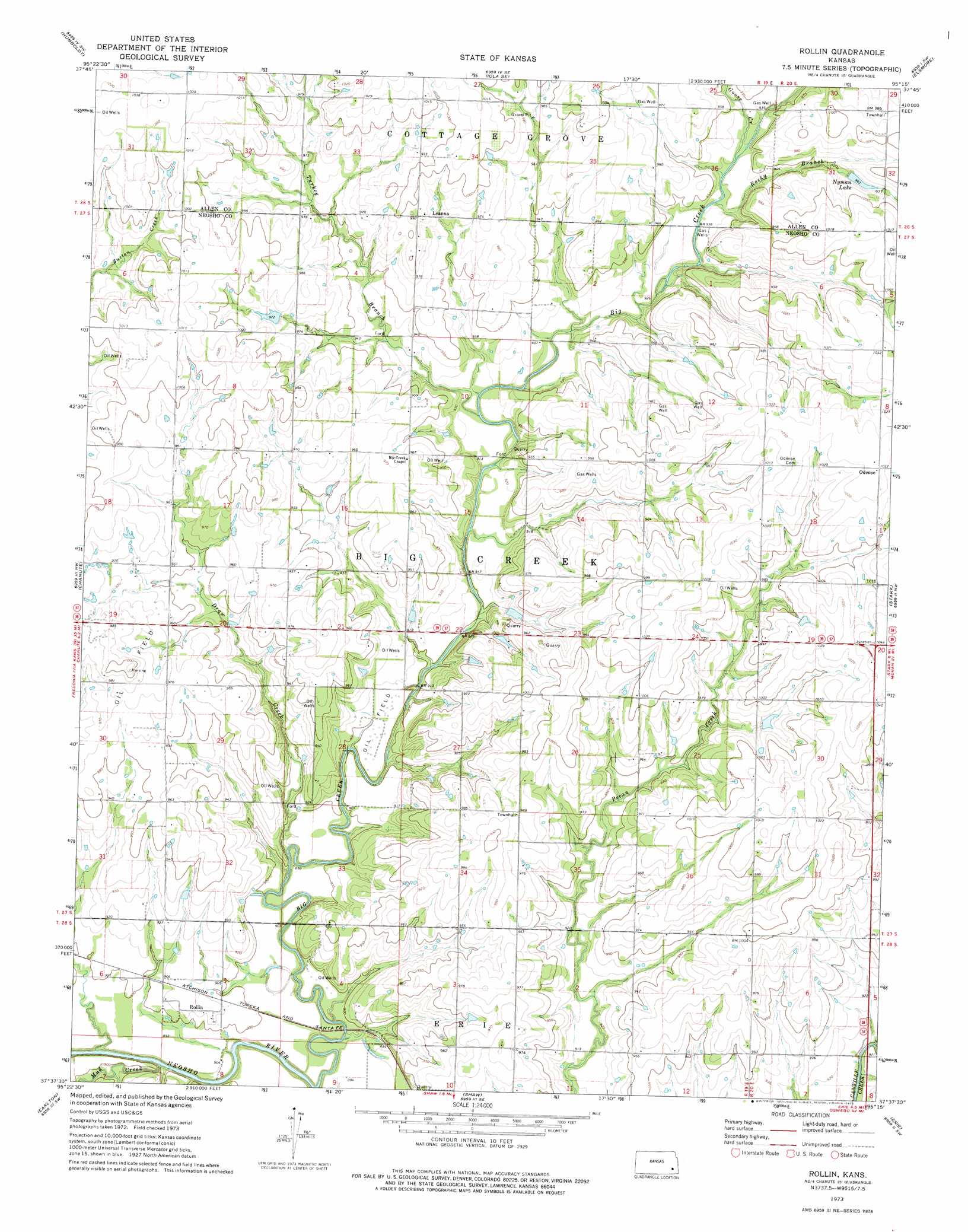
USGS Topo Quad 37095f3 - 1:24,000 scale
| Topo Map Name: | Rollin |
| USGS Topo Quad ID: | 37095f3 |
| Print Size: | ca. 21 1/4" wide x 27" high |
| Southeast Coordinates: | 37.625° N latitude / 95.25° W longitude |
| Map Center Coordinates: | 37.6875° N latitude / 95.3125° W longitude |
| U.S. State: | KS |
| Filename: | o37095f3.jpg |
| Download Map JPG Image: | Rollin topo map 1:24,000 scale |
| Map Type: | Topographic |
| Topo Series: | 7.5´ |
| Map Scale: | 1:24,000 |
| Source of Map Images: | United States Geological Survey (USGS) |
| Alternate Map Versions: |
Rollin KS 1973, updated 1975 Download PDF Buy paper map Rollin KS 2009 Download PDF Buy paper map Rollin KS 2012 Download PDF Buy paper map Rollin KS 2015 Download PDF Buy paper map |
1:24,000 Topo Quads surrounding Rollin
Piqua |
Iola |
La Harpe |
Moran |
Bronson |
Yates Center Se |
Humboldt |
Iola Se |
Elsmore |
Moran Se |
Vilas |
Chanute |
Rollin |
Stark |
Porterville |
Five Mounds |
Earlton |
Shaw |
Erie |
Walnut |
Morehead |
Thayer |
Galesburg |
South Mound |
Mccune Ne |
> Back to 37095e1 at 1:100,000 scale
> Back to 37094a1 at 1:250,000 scale
> Back to U.S. Topo Maps home
Rollin topo map: Gazetteer
Rollin: Dams
Nyman Lake Dam elevation 296m 971′Rollin: Populated Places
Leanna elevation 300m 984′Odense elevation 314m 1030′
Rollin elevation 278m 912′
Rollin: Reservoirs
Nyman Lake elevation 296m 971′Rollin: Streams
Big Creek elevation 269m 882′Draw Creek elevation 268m 879′
Goose Creek elevation 283m 928′
Mud Creek elevation 269m 882′
Rocky Branch elevation 282m 925′
Turkey Branch elevation 277m 908′
Rollin digital topo map on disk
Buy this Rollin topo map showing relief, roads, GPS coordinates and other geographical features, as a high-resolution digital map file on DVD: