Hooper East Topo Map Colorado
To zoom in, hover over the map of Hooper East
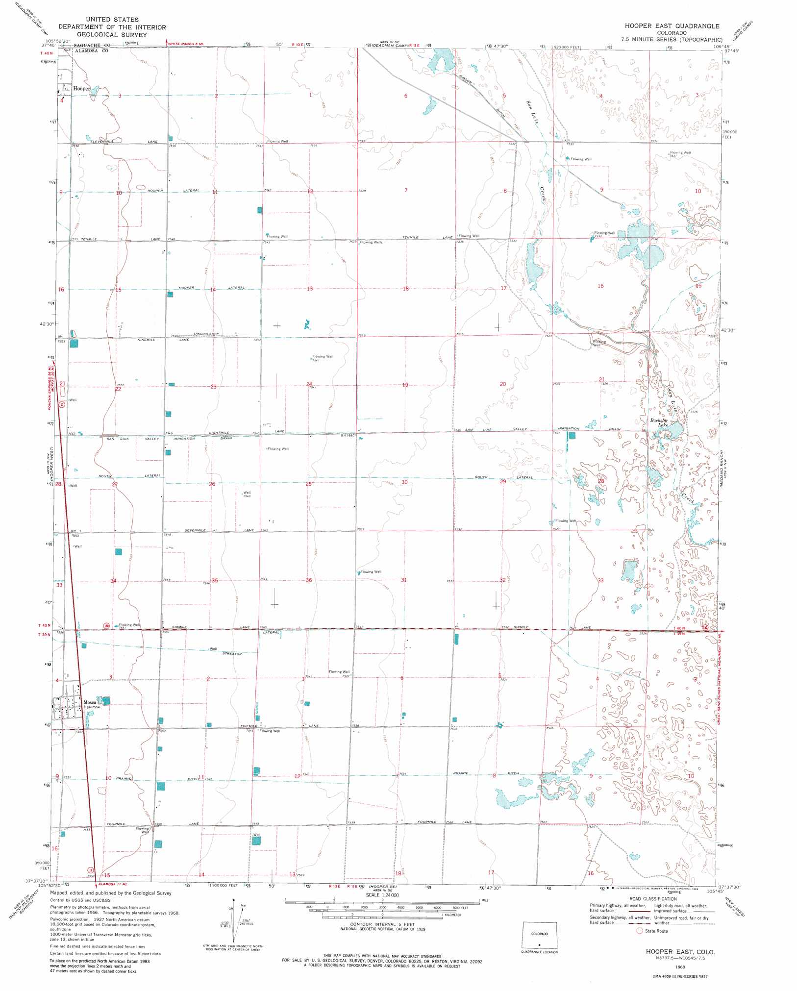
USGS Topo Quad 37105f7 - 1:24,000 scale
| Topo Map Name: | Hooper East |
| USGS Topo Quad ID: | 37105f7 |
| Print Size: | ca. 21 1/4" wide x 27" high |
| Southeast Coordinates: | 37.625° N latitude / 105.75° W longitude |
| Map Center Coordinates: | 37.6875° N latitude / 105.8125° W longitude |
| U.S. State: | CO |
| Filename: | o37105f7.jpg |
| Download Map JPG Image: | Hooper East topo map 1:24,000 scale |
| Map Type: | Topographic |
| Topo Series: | 7.5´ |
| Map Scale: | 1:24,000 |
| Source of Map Images: | United States Geological Survey (USGS) |
| Alternate Map Versions: |
Hooper East CO 1968, updated 1970 Download PDF Buy paper map Hooper East CO 1968, updated 1982 Download PDF Buy paper map Hooper East CO 2010 Download PDF Buy paper map Hooper East CO 2013 Download PDF Buy paper map Hooper East CO 2016 Download PDF Buy paper map |
1:24,000 Topo Quads surrounding Hooper East
Harrence Lake |
Moffat South |
Sheds Camp |
Crestone |
Crestone Peak |
Center North |
Deadman Camp Sw |
Deadman Camp |
Sand Camp |
Liberty |
Center South |
Hooper West |
Hooper East |
Medano Ranch |
Zapata Ranch |
Homelake |
Mount Pleasant School |
Hooper Se |
Dry Lakes |
Twin Peaks |
Waverly |
Alamosa West |
Alamosa East |
Baldy |
Blanca |
> Back to 37105e1 at 1:100,000 scale
> Back to 37104a1 at 1:250,000 scale
> Back to U.S. Topo Maps home
Hooper East topo map: Gazetteer
Hooper East: Populated Places
Mosca elevation 2304m 7559′Hooper East: Reservoirs
Bachelor Lake elevation 2295m 7529′Hooper East: Valleys
San Luis Valley elevation 2301m 7549′Hooper East digital topo map on disk
Buy this Hooper East topo map showing relief, roads, GPS coordinates and other geographical features, as a high-resolution digital map file on DVD: