Scarecrow Peak Topo Map Nevada
To zoom in, hover over the map of Scarecrow Peak
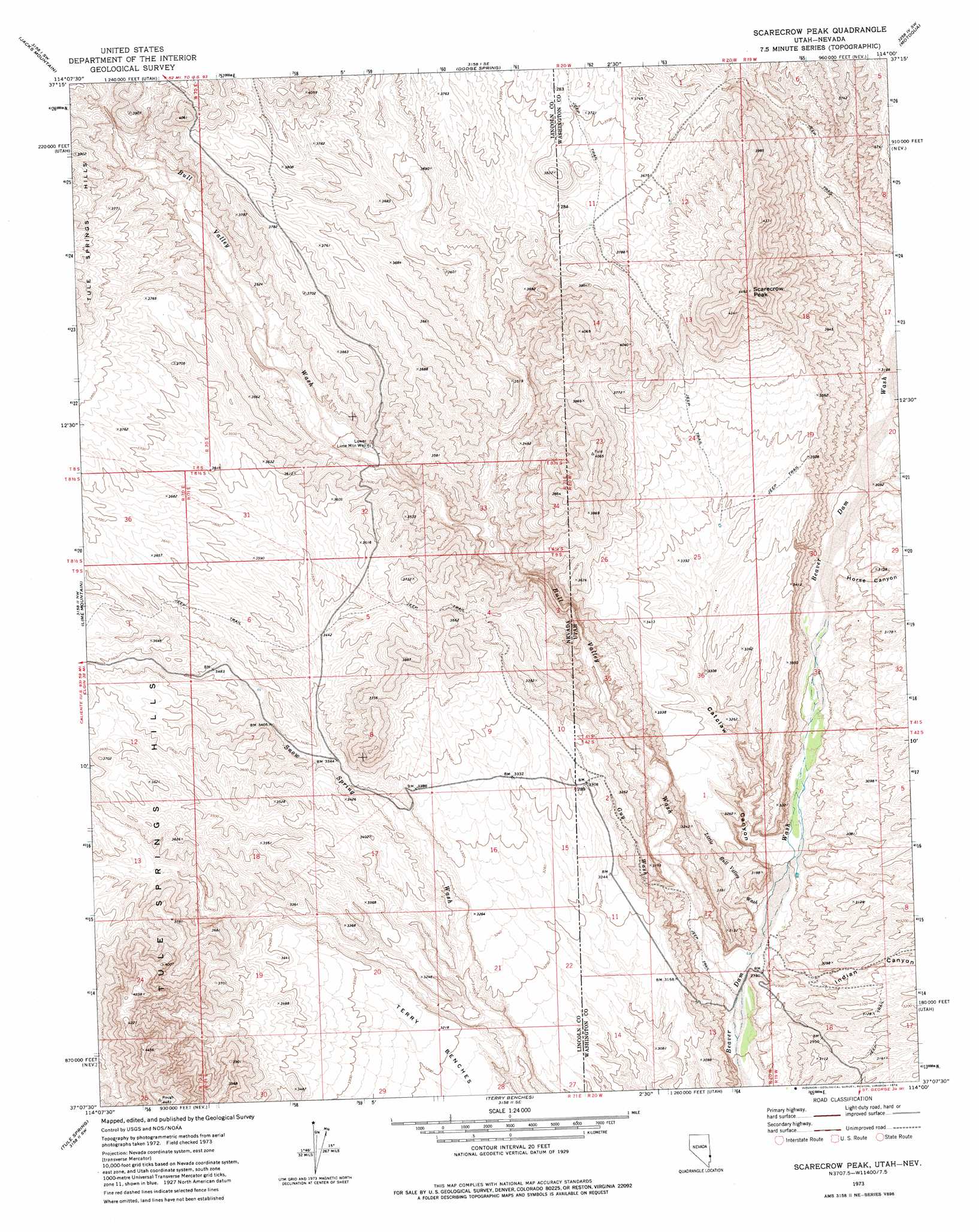
USGS Topo Quad 37114b1 - 1:24,000 scale
| Topo Map Name: | Scarecrow Peak |
| USGS Topo Quad ID: | 37114b1 |
| Print Size: | ca. 21 1/4" wide x 27" high |
| Southeast Coordinates: | 37.125° N latitude / 114° W longitude |
| Map Center Coordinates: | 37.1875° N latitude / 114.0625° W longitude |
| U.S. States: | NV, UT |
| Filename: | o37114b1.jpg |
| Download Map JPG Image: | Scarecrow Peak topo map 1:24,000 scale |
| Map Type: | Topographic |
| Topo Series: | 7.5´ |
| Map Scale: | 1:24,000 |
| Source of Map Images: | United States Geological Survey (USGS) |
| Alternate Map Versions: |
Scarecrow Peak UT 1973, updated 1976 Download PDF Buy paper map Scarecrow Peak UT 2011 Download PDF Buy paper map Scarecrow Peak UT 2014 Download PDF Buy paper map |
1:24,000 Topo Quads surrounding Scarecrow Peak
Fife Mountain |
Bunker Peak |
Docs Pass |
Goldstrike |
Maple Ridge |
Garden Spring |
Jacks Mountain |
Dodge Spring |
Motoqua |
Gunlock |
Blue Nose Peak |
Lime Mountain |
Scarecrow Peak |
West Mountain Peak |
Shivwits |
Toquop Gap |
Tule Spring |
Terry Benches |
Castle Cliff |
Jarvis Peak |
Davidson Peak |
Mesquite Nw |
Mesquite Ne |
Littlefield |
Mountain Sheep Spring |
> Back to 37114a1 at 1:100,000 scale
> Back to 37114a1 at 1:250,000 scale
> Back to U.S. Topo Maps home
Scarecrow Peak topo map: Gazetteer
Scarecrow Peak: Streams
Bull Valley Wash elevation 833m 2732′Scarecrow Peak: Summits
Scarecrow Peak elevation 1370m 4494′Scarecrow Peak: Valleys
Bull Valley Wash elevation 835m 2739′Catclaw Canyon elevation 872m 2860′
Guy Wash elevation 861m 2824′
Horse Canyon elevation 908m 2979′
Indian Canyon elevation 861m 2824′
Little Bull Valley Wash elevation 847m 2778′
Scarecrow Peak: Wells
Lower Lime Mountain Well elevation 1002m 3287′Scarecrow Peak digital topo map on disk
Buy this Scarecrow Peak topo map showing relief, roads, GPS coordinates and other geographical features, as a high-resolution digital map file on DVD: