Lida Wash Topo Map Nevada
To zoom in, hover over the map of Lida Wash
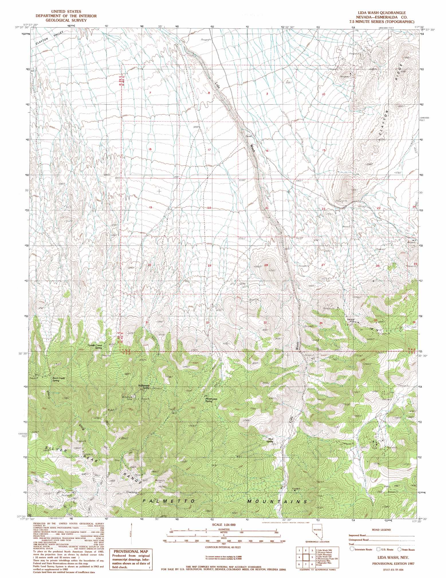
USGS Topo Quad 37117e5 - 1:24,000 scale
| Topo Map Name: | Lida Wash |
| USGS Topo Quad ID: | 37117e5 |
| Print Size: | ca. 21 1/4" wide x 27" high |
| Southeast Coordinates: | 37.5° N latitude / 117.5° W longitude |
| Map Center Coordinates: | 37.5625° N latitude / 117.5625° W longitude |
| U.S. State: | NV |
| Filename: | o37117e5.jpg |
| Download Map JPG Image: | Lida Wash topo map 1:24,000 scale |
| Map Type: | Topographic |
| Topo Series: | 7.5´ |
| Map Scale: | 1:24,000 |
| Source of Map Images: | United States Geological Survey (USGS) |
| Alternate Map Versions: |
Lida Wash NV 1987, updated 1987 Download PDF Buy paper map Lida Wash NV 2011 Download PDF Buy paper map Lida Wash NV 2014 Download PDF Buy paper map |
1:24,000 Topo Quads surrounding Lida Wash
Rhyolite Ridge |
Silver Peak |
Goat Island |
Paymaster Ridge |
Alkali |
Mohawk Mine |
Lida Wash Nw |
Alcatraz Island |
Split Mountain |
Montezuma Peak |
Oasis Divide |
Lida Wash Sw |
Lida Wash |
Montezuma Peak Sw |
Montezuma Peak Se |
Sylvania Canyon |
Sylvania Mountains |
Magruder Mountain |
Lida |
Mount Jackson |
Horse Thief Canyon |
Last Chance Mountain |
Tule Canyon |
Gold Point Sw |
Gold Point |
> Back to 37117e1 at 1:100,000 scale
> Back to 37116a1 at 1:250,000 scale
> Back to U.S. Topo Maps home
Lida Wash topo map: Gazetteer
Lida Wash: Areas
Indian Garden elevation 2049m 6722′Lida Wash: Mines
Big Three Mine elevation 1941m 6368′Imperial Mine elevation 1964m 6443′
McNamara Mine elevation 2240m 7349′
Lida Wash: Springs
Barrel Spring elevation 1950m 6397′Birch Creek Spring elevation 2191m 7188′
Horath Corral Spring elevation 1970m 6463′
McNamara Spring elevation 2114m 6935′
Mud Spring elevation 1998m 6555′
Pocahontas Spring elevation 2085m 6840′
Lida Wash: Summits
Harvey Peak elevation 2831m 9288′Lida Wash digital topo map on disk
Buy this Lida Wash topo map showing relief, roads, GPS coordinates and other geographical features, as a high-resolution digital map file on DVD: