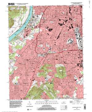
Louisville West Topo Map Kentucky
To zoom in, hover over the map of Louisville West
USGS Topo Quad 38085b7 - 1:24,000 scale
| Topo Map Name: | Louisville West |
| USGS Topo Quad ID: | 38085b7 |
| Print Size: | ca. 21 1/4" wide x 27" high |
| Southeast Coordinates: | 38.125° N latitude / 85.75° W longitude |
| Map Center Coordinates: | 38.1875° N latitude / 85.8125° W longitude |
| U.S. States: | KY, IN |
| Filename: | o38085b7.jpg |
| Download Map JPG Image: | Louisville West topo map 1:24,000 scale |
| Map Type: | Topographic |
| Topo Series: | 7.5´ |
| Map Scale: | 1:24,000 |
| Source of Map Images: | United States Geological Survey (USGS) |
| Alternate Map Versions: |
Louisville West KY 1955, updated 1957 Download PDF Buy paper map Louisville West KY 1960, updated 1961 Download PDF Buy paper map Louisville West KY 1965, updated 1966 Download PDF Buy paper map Louisville West KY 1983, updated 1984 Download PDF Buy paper map Louisville West KY 1983, updated 1987 Download PDF Buy paper map Louisville West KY 1983, updated 1994 Download PDF Buy paper map Louisville West KY 1998, updated 2000 Download PDF Buy paper map Louisville West KY 2010 Download PDF Buy paper map Louisville West KY 2013 Download PDF Buy paper map Louisville West KY 2016 Download PDF Buy paper map |
1:24,000 Topo Quads surrounding Louisville West
> Back to 38085a1 at 1:100,000 scale
> Back to 38084a1 at 1:250,000 scale
> Back to U.S. Topo Maps home
Louisville West topo map: Gazetteer
Louisville West: Airports
Churchill Downs Heliport elevation 139m 456′Southwest Government Center Heliport elevation 141m 462′
Louisville West: Crossings
Interchange 133A elevation 149m 488′Interchange 133B elevation 148m 485′
Interchange 134A elevation 146m 479′
Interchange 134B elevation 140m 459′
Interchange 135 elevation 143m 469′
Interchange 136A elevation 146m 479′
Interchange 136B elevation 140m 459′
Interchange 136C elevation 142m 465′
Louisville West: Parks
Algonquin Park elevation 140m 459′California Park elevation 139m 456′
Central Park elevation 141m 462′
Churchill Park elevation 145m 475′
Harris Park elevation 141m 462′
Iroquois Park elevation 231m 757′
McDonalds Field elevation 140m 459′
Miles Park elevation 136m 446′
Parkhill Center elevation 140m 459′
Parkway Field elevation 140m 459′
Pleasure Ridge Park elevation 138m 452′
Poppa Johns Cardinal Stadium elevation 141m 462′
Shively Park elevation 138m 452′
South Central Park elevation 139m 456′
Trager Stadium elevation 141m 462′
Tringle Park elevation 139m 456′
Ulmer Stadium elevation 141m 462′
Victory Park elevation 138m 452′
Waverly Hills Park elevation 169m 554′
Wyandotte Park elevation 139m 456′
Louisville West: Populated Places
Auburndale elevation 144m 472′Beechmont elevation 144m 472′
Hazelwood elevation 145m 475′
Heatherfield elevation 138m 452′
Highland Park elevation 148m 485′
Hunters Trace elevation 140m 459′
Jacobs Addition elevation 139m 456′
Kenwood elevation 145m 475′
Oakdale elevation 139m 456′
Parkland elevation 136m 446′
Parkwood elevation 150m 492′
Pleasure Ridge Park elevation 139m 456′
Riverside Gardens elevation 136m 446′
Saint Denis elevation 137m 449′
Saint Dennis elevation 134m 439′
Shively elevation 139m 456′
South Parkland elevation 139m 456′
Southern Heights elevation 146m 479′
Sylvania elevation 134m 439′
Wilder Park elevation 140m 459′
Louisville West: Post Offices
Beechmont Post Office elevation 142m 465′Doctor Martin Luther King Junior Post Office elevation 137m 449′
Iroquois Post Office elevation 144m 472′
Louisville Downtown Post Office elevation 139m 456′
Pleasure Ridge Park Post Office elevation 138m 452′
Shively Post Office elevation 137m 449′
Louisville West: Reservoirs
Cardinal Hill Reservoir elevation 203m 666′Dreamland Lake elevation 129m 423′
Louisville West: Streams
Big Run elevation 131m 429′Cane Run elevation 131m 429′
French Creek elevation 123m 403′
Mill Creek elevation 131m 429′
Paddy Run elevation 117m 383′
Pine Run elevation 129m 423′
Wilson Creek elevation 137m 449′
Louisville West: Summits
Finley Hill elevation 212m 695′Kenwood Hill elevation 230m 754′
Red Stone Hill elevation 201m 659′
Louisville West: Valleys
Gap Hollow elevation 126m 413′Louisville West digital topo map on disk
Buy this Louisville West topo map showing relief, roads, GPS coordinates and other geographical features, as a high-resolution digital map file on DVD:


