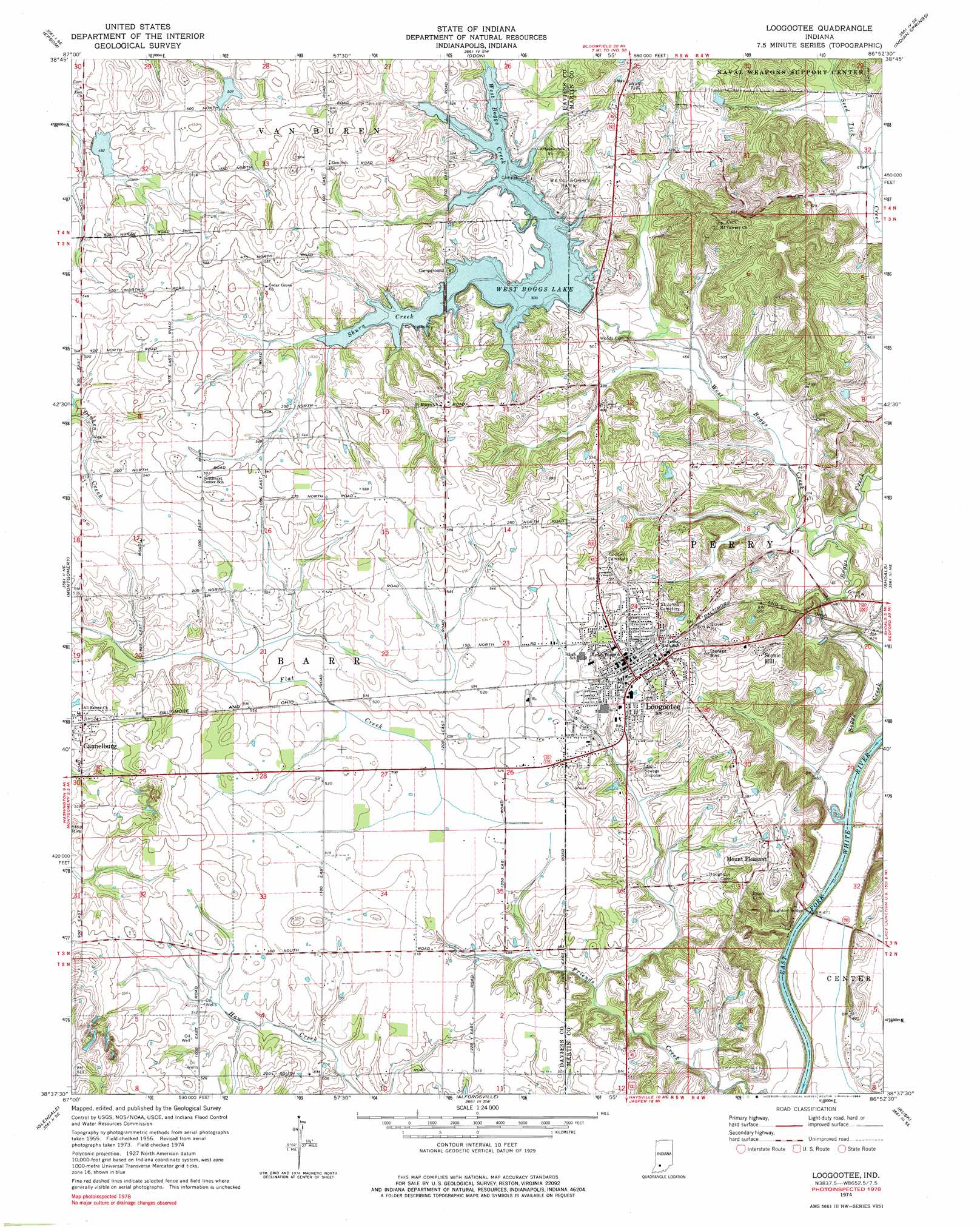
Loogootee Topo Map Indiana
To zoom in, hover over the map of Loogootee
USGS Topo Quad 38086f8 - 1:24,000 scale
| Topo Map Name: | Loogootee |
| USGS Topo Quad ID: | 38086f8 |
| Print Size: | ca. 21 1/4" wide x 27" high |
| Southeast Coordinates: | 38.625° N latitude / 86.875° W longitude |
| Map Center Coordinates: | 38.6875° N latitude / 86.9375° W longitude |
| U.S. State: | IN |
| Filename: | o38086f8.jpg |
| Download Map JPG Image: | Loogootee topo map 1:24,000 scale |
| Map Type: | Topographic |
| Topo Series: | 7.5´ |
| Map Scale: | 1:24,000 |
| Source of Map Images: | United States Geological Survey (USGS) |
| Alternate Map Versions: |
Loogootee IN 1956, updated 1957 Download PDF Buy paper map Loogootee IN 1956, updated 1957 Download PDF Buy paper map Loogootee IN 1974, updated 1976 Download PDF Buy paper map Loogootee IN 1974, updated 1984 Download PDF Buy paper map Loogootee IN 2010 Download PDF Buy paper map Loogootee IN 2013 Download PDF Buy paper map Loogootee IN 2016 Download PDF Buy paper map |
1:24,000 Topo Quads surrounding Loogootee
Sandborn |
Lyons |
Scotland |
Koleen |
Owensburg |
Plainville |
Epsom |
Odon |
Indian Springs |
Williams |
Washington |
Montgomery |
Loogootee |
Shoals |
Huron |
Sandy Hook |
Glendale |
Alfordsville |
Rusk |
Hillham |
Winslow |
Otwell |
Jasper |
Dubois |
Cuzco |
> Back to 38086e1 at 1:100,000 scale
> Back to 38086a1 at 1:250,000 scale
> Back to U.S. Topo Maps home
Loogootee topo map: Gazetteer
Loogootee: Bridges
Houghton Bridge elevation 135m 442′Loogootee: Dams
Prairie Creek Structure Number A-2-1 elevation 152m 498′Prairie Creek Structure Number A-2-2 elevation 157m 515′
West Boggs Creek Dam elevation 144m 472′
Loogootee: Parks
West Boggs Park elevation 163m 534′Loogootee: Populated Places
Cannelburg elevation 161m 528′Loogootee elevation 164m 538′
Mount Pleasant elevation 181m 593′
Scenic Hill elevation 187m 613′
Loogootee: Reservoirs
West Boggs Lake elevation 154m 505′Loogootee: Streams
Boggs Creek elevation 135m 442′Shurn Creek elevation 154m 505′
West Boggs Creek elevation 139m 456′
Loogootee digital topo map on disk
Buy this Loogootee topo map showing relief, roads, GPS coordinates and other geographical features, as a high-resolution digital map file on DVD: