Koleen Topo Map Indiana
To zoom in, hover over the map of Koleen
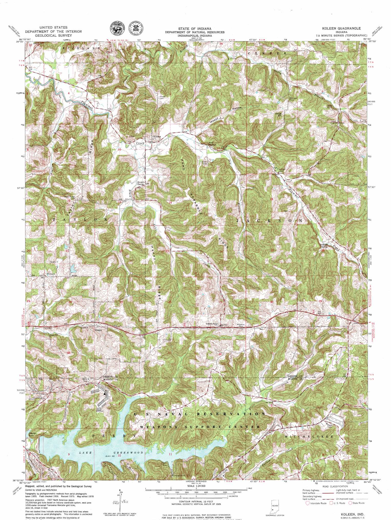
USGS Topo Quad 38086h7 - 1:24,000 scale
| Topo Map Name: | Koleen |
| USGS Topo Quad ID: | 38086h7 |
| Print Size: | ca. 21 1/4" wide x 27" high |
| Southeast Coordinates: | 38.875° N latitude / 86.75° W longitude |
| Map Center Coordinates: | 38.9375° N latitude / 86.8125° W longitude |
| U.S. State: | IN |
| Filename: | o38086h7.jpg |
| Download Map JPG Image: | Koleen topo map 1:24,000 scale |
| Map Type: | Topographic |
| Topo Series: | 7.5´ |
| Map Scale: | 1:24,000 |
| Source of Map Images: | United States Geological Survey (USGS) |
| Alternate Map Versions: |
Koleen IN 1956, updated 1959 Download PDF Buy paper map Koleen IN 1978, updated 1979 Download PDF Buy paper map Koleen IN 1978, updated 1979 Download PDF Buy paper map Koleen IN 2010 Download PDF Buy paper map Koleen IN 2013 Download PDF Buy paper map Koleen IN 2016 Download PDF Buy paper map |
1:24,000 Topo Quads surrounding Koleen
Coal City |
Arney |
Freedom |
Whitehall |
Bloomington |
Switz City |
Bloomfield |
Solsberry |
Stanford |
Clear Creek |
Lyons |
Scotland |
Koleen |
Owensburg |
Oolitic |
Epsom |
Odon |
Indian Springs |
Williams |
Bedford West |
Montgomery |
Loogootee |
Shoals |
Huron |
Georgia |
> Back to 38086e1 at 1:100,000 scale
> Back to 38086a1 at 1:250,000 scale
> Back to U.S. Topo Maps home
Koleen topo map: Gazetteer
Koleen: Dams
Gingerich Lake Dam elevation 206m 675′Greenwood Lake Dam elevation 179m 587′
Koleen: Populated Places
Doans elevation 187m 613′Koleen elevation 161m 528′
Koleen: Post Offices
Pleasant Ridge Post Office (historical) elevation 244m 800′Koleen: Reservoirs
Greenwood Lake elevation 179m 587′Oberlin Lake elevation 170m 557′
Koleen: Ridges
Haney Ridge elevation 241m 790′Hard Scrabble Ridge elevation 248m 813′
Taylor Ridge elevation 229m 751′
Koleen: Springs
Osborne Spring elevation 181m 593′Rankin Spring elevation 159m 521′
Rock Springs elevation 175m 574′
Koleen: Streams
Black Ankle Creek elevation 158m 518′Clifty Branch elevation 156m 511′
Dry Branch elevation 162m 531′
Flyblow Branch elevation 155m 508′
Little Clifty Branch elevation 176m 577′
Stalcup Branch elevation 163m 534′
Koleen: Valleys
Happy Hollow elevation 161m 528′Koleen digital topo map on disk
Buy this Koleen topo map showing relief, roads, GPS coordinates and other geographical features, as a high-resolution digital map file on DVD: