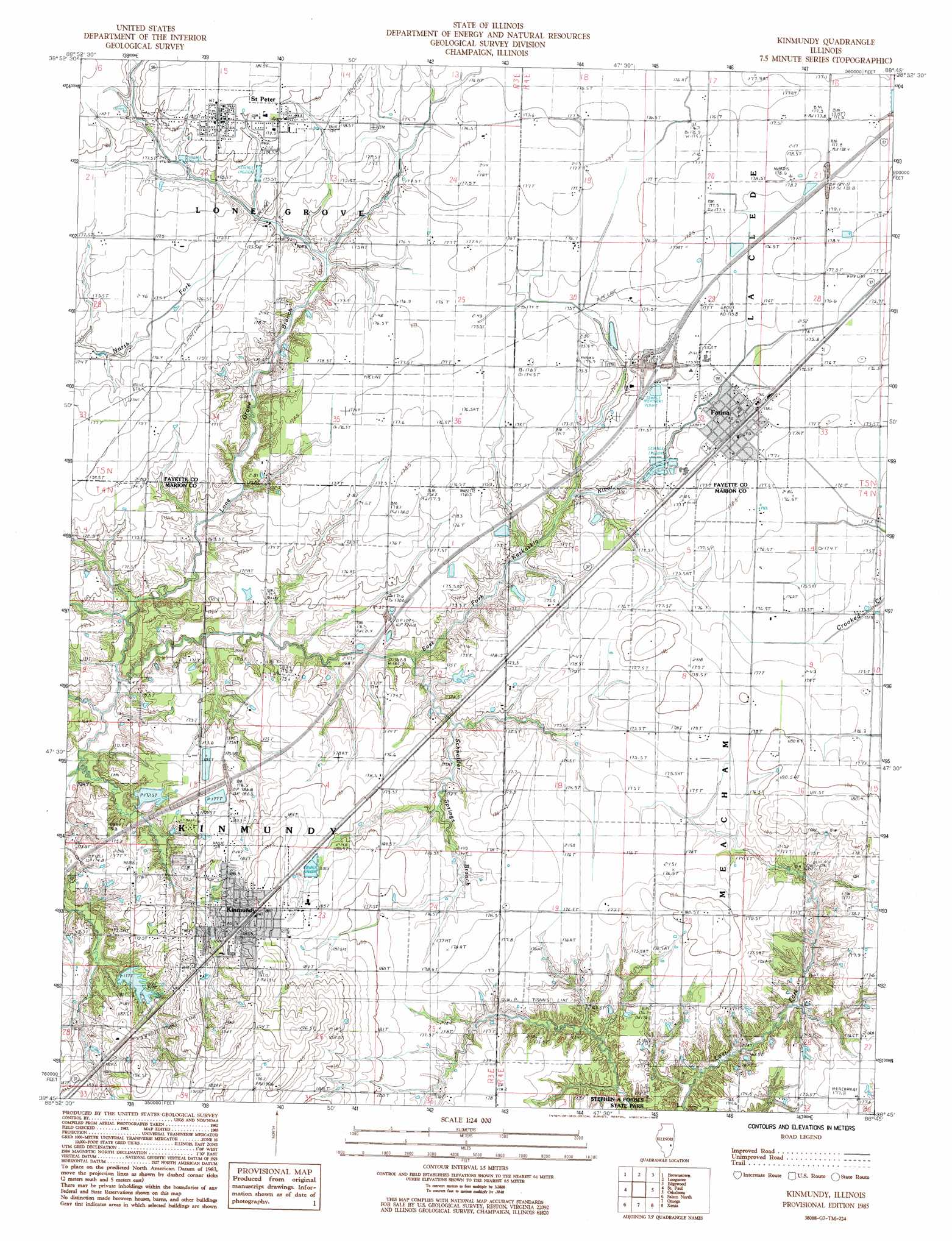
Kinmundy Topo Map Illinois
To zoom in, hover over the map of Kinmundy
USGS Topo Quad 38088g7 - 1:24,000 scale
| Topo Map Name: | Kinmundy |
| USGS Topo Quad ID: | 38088g7 |
| Print Size: | ca. 21 1/4" wide x 27" high |
| Southeast Coordinates: | 38.75° N latitude / 88.75° W longitude |
| Map Center Coordinates: | 38.8125° N latitude / 88.8125° W longitude |
| U.S. State: | IL |
| Filename: | o38088g7.jpg |
| Download Map JPG Image: | Kinmundy topo map 1:24,000 scale |
| Map Type: | Topographic |
| Topo Series: | 7.5´ |
| Map Scale: | 1:24,000 |
| Source of Map Images: | United States Geological Survey (USGS) |
| Alternate Map Versions: |
Kinmundy IL 1985, updated 1985 Download PDF Buy paper map Kinmundy IL 2012 Download PDF Buy paper map Kinmundy IL 2015 Download PDF Buy paper map |
1:24,000 Topo Quads surrounding Kinmundy
Vera |
Avena |
Altamont West |
Altamont East |
Effingham South |
Vandalia |
Brownstown |
Loogootee |
Edgewood |
Hord |
Patoka |
Saint Paul |
Kinmundy |
Oskaloosa |
Louisville West |
Fairman |
Salem North |
Omega |
Xenia |
Xenia Ne |
Centralia East |
Salem South |
Iuka |
Orchardville |
Johnsonville |
> Back to 38088e1 at 1:100,000 scale
> Back to 38088a1 at 1:250,000 scale
> Back to U.S. Topo Maps home
Kinmundy topo map: Gazetteer
Kinmundy: Crossings
Interchange 135 elevation 182m 597′Kinmundy: Dams
Kinmundy Lake Dam elevation 177m 580′Kinmundy: Populated Places
Farina elevation 177m 580′Kinmundy elevation 184m 603′
Saint Peter elevation 182m 597′
Kinmundy: Post Offices
Farina Post Office elevation 176m 577′Kinmundy Post Office elevation 181m 593′
Saint Peter Post Office elevation 182m 597′
Kinmundy: Reservoirs
Kinmundy Lake elevation 177m 580′Kinmundy: Streams
Lone Grove Branch elevation 165m 541′Schneider Springs Branch elevation 166m 544′
Kinmundy digital topo map on disk
Buy this Kinmundy topo map showing relief, roads, GPS coordinates and other geographical features, as a high-resolution digital map file on DVD: