Avena Topo Map Illinois
To zoom in, hover over the map of Avena
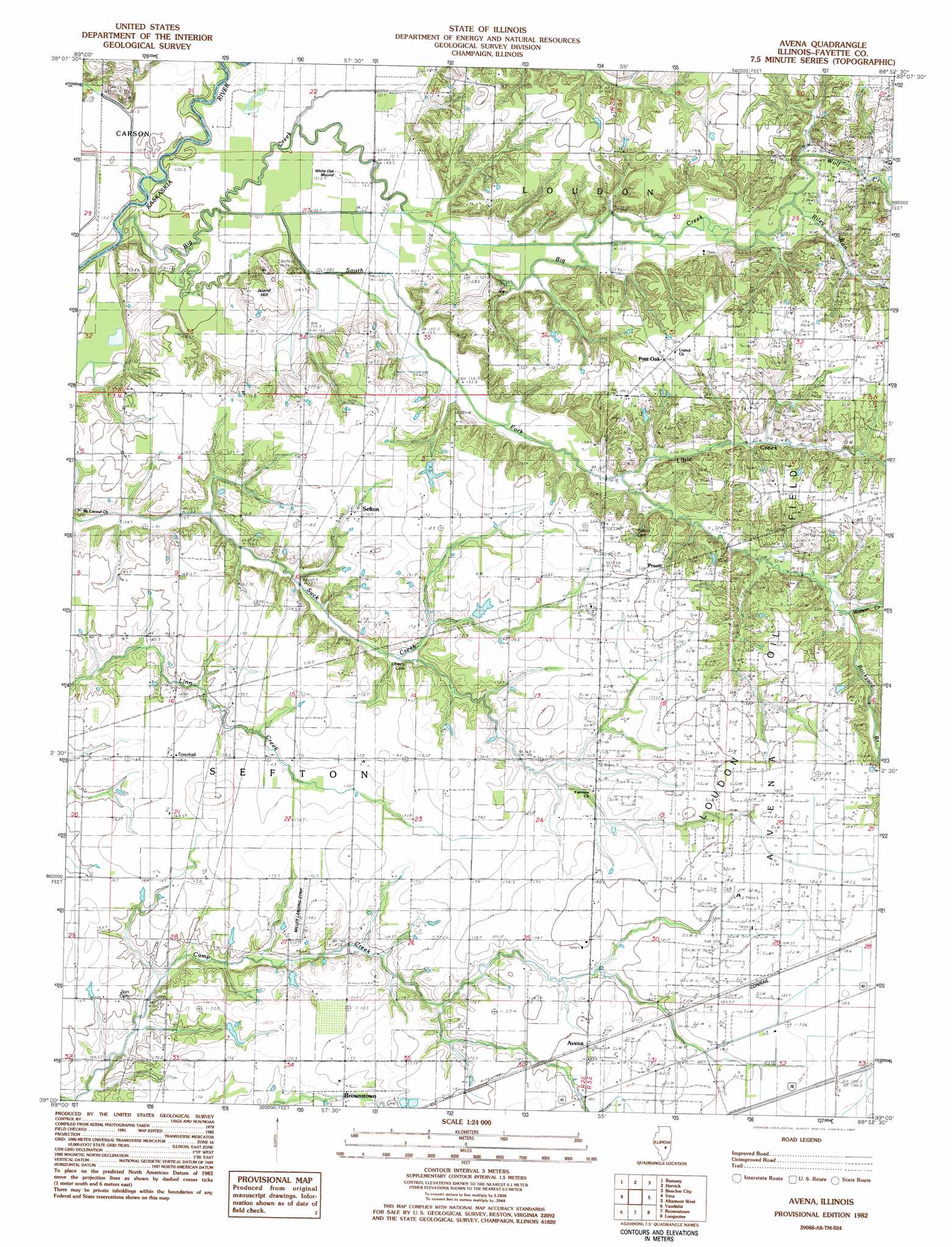
USGS Topo Quad 39088a8 - 1:24,000 scale
| Topo Map Name: | Avena |
| USGS Topo Quad ID: | 39088a8 |
| Print Size: | ca. 21 1/4" wide x 27" high |
| Southeast Coordinates: | 39° N latitude / 88.875° W longitude |
| Map Center Coordinates: | 39.0625° N latitude / 88.9375° W longitude |
| U.S. State: | IL |
| Filename: | o39088a8.jpg |
| Download Map JPG Image: | Avena topo map 1:24,000 scale |
| Map Type: | Topographic |
| Topo Series: | 7.5´ |
| Map Scale: | 1:24,000 |
| Source of Map Images: | United States Geological Survey (USGS) |
| Alternate Map Versions: |
Avena IL 1982, updated 1983 Download PDF Buy paper map Avena IL 1998, updated 2003 Download PDF Buy paper map Avena IL 2012 Download PDF Buy paper map Avena IL 2015 Download PDF Buy paper map |
1:24,000 Topo Quads surrounding Avena
Ohlman |
Oconee |
Lakewood |
Fancher |
Stewardson West |
Ramsey Lake |
Ramsey |
Herrick |
Beecher City |
Shumway |
Bingham |
Vera |
Avena |
Altamont West |
Altamont East |
Hagarstown |
Vandalia |
Brownstown |
Loogootee |
Edgewood |
Wildcat Lake |
Patoka |
Saint Paul |
Kinmundy |
Oskaloosa |
> Back to 39088a1 at 1:100,000 scale
> Back to 39088a1 at 1:250,000 scale
> Back to U.S. Topo Maps home
Avena topo map: Gazetteer
Avena: Airports
Miller Landing Strip elevation 174m 570′Avena: Populated Places
Avena elevation 178m 583′Post Oak elevation 183m 600′
Pruett elevation 182m 597′
Sefton elevation 172m 564′
Avena: Streams
Big Creek elevation 150m 492′Brickyard Branch elevation 163m 534′
Little Creek elevation 158m 518′
Riley Run elevation 158m 518′
South Fork Kaskaskia River elevation 150m 492′
Watson Creek elevation 163m 534′
Wolf Creek elevation 155m 508′
Avena: Summits
Island Hill elevation 171m 561′White Oak Mound elevation 156m 511′
Avena digital topo map on disk
Buy this Avena topo map showing relief, roads, GPS coordinates and other geographical features, as a high-resolution digital map file on DVD:
Northern Illinois, Northern Indiana & Southwestern Michigan
Buy digital topo maps: Northern Illinois, Northern Indiana & Southwestern Michigan