Saint Paul Topo Map Illinois
To zoom in, hover over the map of Saint Paul
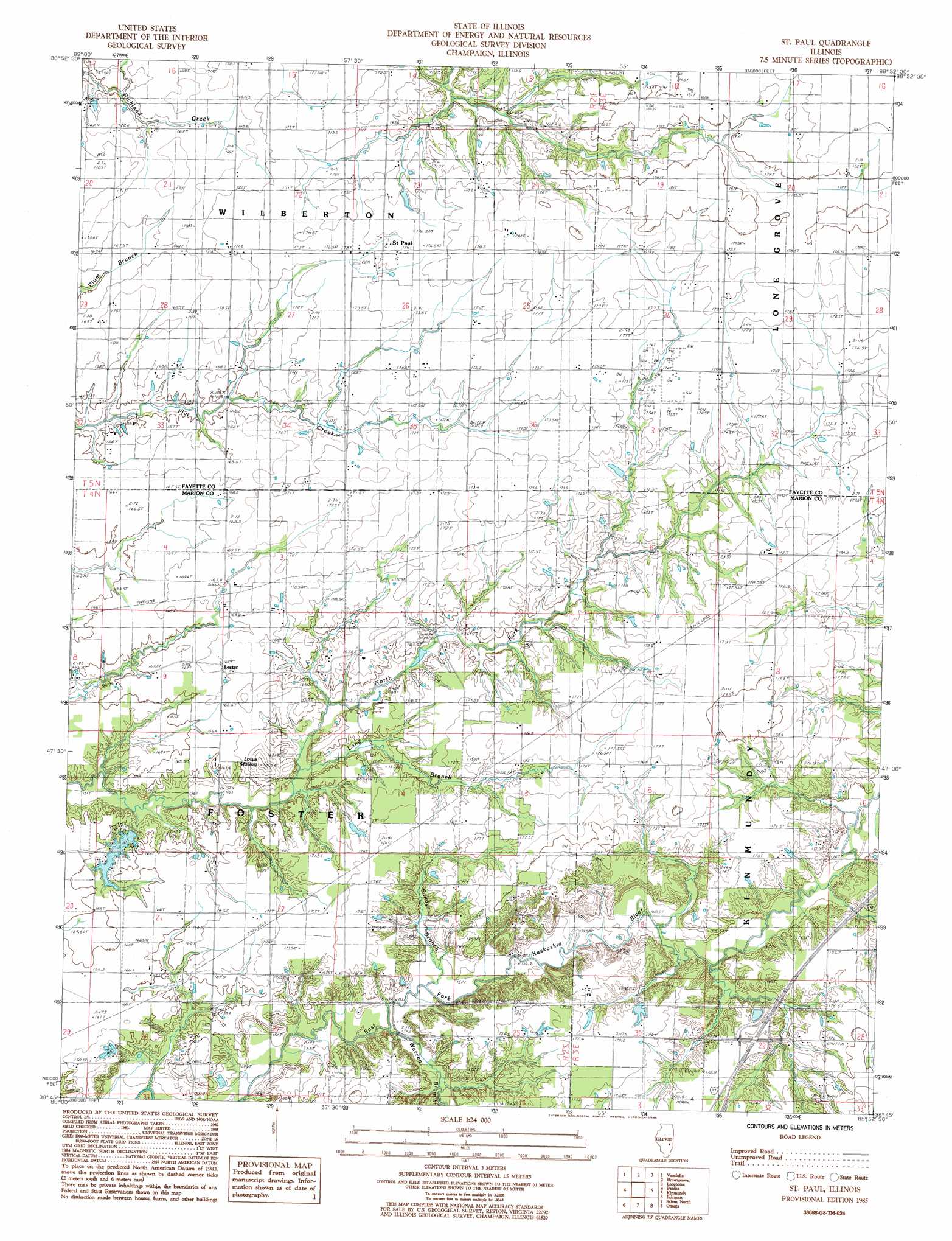
USGS Topo Quad 38088g8 - 1:24,000 scale
| Topo Map Name: | Saint Paul |
| USGS Topo Quad ID: | 38088g8 |
| Print Size: | ca. 21 1/4" wide x 27" high |
| Southeast Coordinates: | 38.75° N latitude / 88.875° W longitude |
| Map Center Coordinates: | 38.8125° N latitude / 88.9375° W longitude |
| U.S. State: | IL |
| Filename: | o38088g8.jpg |
| Download Map JPG Image: | Saint Paul topo map 1:24,000 scale |
| Map Type: | Topographic |
| Topo Series: | 7.5´ |
| Map Scale: | 1:24,000 |
| Source of Map Images: | United States Geological Survey (USGS) |
| Alternate Map Versions: |
St. Paul IL 1985, updated 1985 Download PDF Buy paper map Saint Paul IL 2012 Download PDF Buy paper map Saint Paul IL 2015 Download PDF Buy paper map |
1:24,000 Topo Quads surrounding Saint Paul
Bingham |
Vera |
Avena |
Altamont West |
Altamont East |
Hagarstown |
Vandalia |
Brownstown |
Loogootee |
Edgewood |
Wildcat Lake |
Patoka |
Saint Paul |
Kinmundy |
Oskaloosa |
Boulder |
Fairman |
Salem North |
Omega |
Xenia |
Centralia West |
Centralia East |
Salem South |
Iuka |
Orchardville |
> Back to 38088e1 at 1:100,000 scale
> Back to 38088a1 at 1:250,000 scale
> Back to U.S. Topo Maps home
Saint Paul topo map: Gazetteer
Saint Paul: Crossings
Interchange 127 elevation 173m 567′Saint Paul: Dams
Patoka Club Lake Dam elevation 166m 544′Saint Paul: Populated Places
Lester elevation 168m 551′Saint Paul elevation 174m 570′
Saint Paul: Reservoirs
Patoka Club Lake elevation 166m 544′Saint Paul: Streams
Long Branch elevation 157m 515′Sandy Branch elevation 156m 511′
Warren Branch elevation 158m 518′
Saint Paul: Summits
Lowe Mound elevation 178m 583′Saint Paul digital topo map on disk
Buy this Saint Paul topo map showing relief, roads, GPS coordinates and other geographical features, as a high-resolution digital map file on DVD: