Worden Topo Map Illinois
To zoom in, hover over the map of Worden
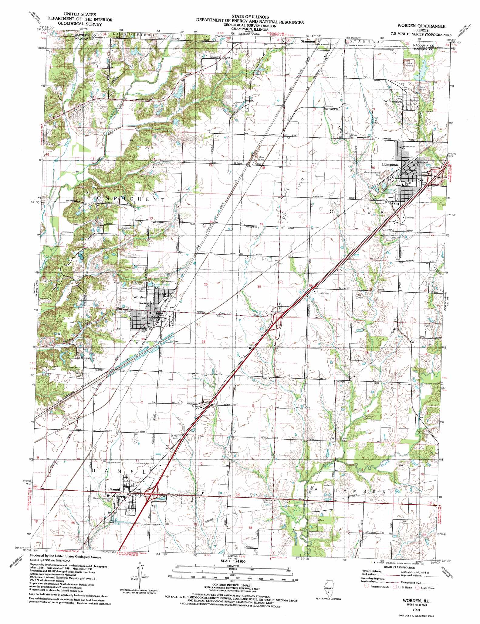
USGS Topo Quad 38089h7 - 1:24,000 scale
| Topo Map Name: | Worden |
| USGS Topo Quad ID: | 38089h7 |
| Print Size: | ca. 21 1/4" wide x 27" high |
| Southeast Coordinates: | 38.875° N latitude / 89.75° W longitude |
| Map Center Coordinates: | 38.9375° N latitude / 89.8125° W longitude |
| U.S. State: | IL |
| Filename: | o38089h7.jpg |
| Download Map JPG Image: | Worden topo map 1:24,000 scale |
| Map Type: | Topographic |
| Topo Series: | 7.5´ |
| Map Scale: | 1:24,000 |
| Source of Map Images: | United States Geological Survey (USGS) |
| Alternate Map Versions: |
Worden IL 1954, updated 1959 Download PDF Buy paper map Worden IL 1954, updated 1969 Download PDF Buy paper map Worden IL 1954, updated 1975 Download PDF Buy paper map Worden IL 1954, updated 1982 Download PDF Buy paper map Worden IL 1991, updated 1991 Download PDF Buy paper map Worden IL 2012 Download PDF Buy paper map Worden IL 2015 Download PDF Buy paper map |
1:24,000 Topo Quads surrounding Worden
Summerville |
Plainview |
Gillespie North |
Litchfield |
Butler |
Shipman |
Bunker Hill |
Gillespie South |
Mount Olive |
Sorento North |
Bethalto |
Prairietown |
Worden |
New Douglas |
Sorento South |
Wood River |
Edwardsville |
Marine |
Grantfork |
Pocahontas |
Monks Mound |
Collinsville |
Saint Jacob |
Highland |
Saint Rose |
> Back to 38089e1 at 1:100,000 scale
> Back to 38088a1 at 1:250,000 scale
> Back to U.S. Topo Maps home
Worden topo map: Gazetteer
Worden: Crossings
Interchange 30 elevation 167m 547′Interchange 33 elevation 171m 561′
Interchange 37 elevation 182m 597′
Worden: Dams
Vesper Lake Dam elevation 173m 567′Williamson Dam elevation 185m 606′
Worden: Parks
Hamel Community Park elevation 164m 538′John Slifka Memorial Park elevation 182m 597′
Miners Memorial Park elevation 182m 597′
Slifka Memorial Park elevation 182m 597′
Worden: Populated Places
Hamel elevation 167m 547′Livingston elevation 180m 590′
Williamson elevation 184m 603′
Worden elevation 173m 567′
Worden: Post Offices
Worden Post Office elevation 173m 567′Worden: Reservoirs
Mount Olive Staunton Coal Company Reservoir elevation 185m 606′Vesper Lake elevation 173m 567′
Worden: Streams
West Fork Cahokia Creek elevation 149m 488′Worden digital topo map on disk
Buy this Worden topo map showing relief, roads, GPS coordinates and other geographical features, as a high-resolution digital map file on DVD: