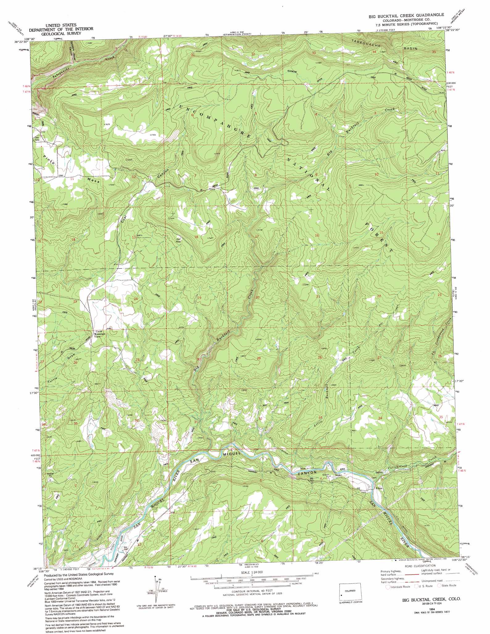
Big Bucktail Creek Topo Map Colorado
To zoom in, hover over the map of Big Bucktail Creek
USGS Topo Quad 38108c4 - 1:24,000 scale
| Topo Map Name: | Big Bucktail Creek |
| USGS Topo Quad ID: | 38108c4 |
| Print Size: | ca. 21 1/4" wide x 27" high |
| Southeast Coordinates: | 38.25° N latitude / 108.375° W longitude |
| Map Center Coordinates: | 38.3125° N latitude / 108.4375° W longitude |
| U.S. State: | CO |
| Filename: | o38108c4.jpg |
| Download Map JPG Image: | Big Bucktail Creek topo map 1:24,000 scale |
| Map Type: | Topographic |
| Topo Series: | 7.5´ |
| Map Scale: | 1:24,000 |
| Source of Map Images: | United States Geological Survey (USGS) |
| Alternate Map Versions: |
Big Bucktail Creek CO 1973, updated 1975 Download PDF Buy paper map Big Bucktail Creek CO 1973, updated 1975 Download PDF Buy paper map Big Bucktail Creek CO 1994, updated 1994 Download PDF Buy paper map Big Bucktail Creek CO 2011 Download PDF Buy paper map Big Bucktail Creek CO 2013 Download PDF Buy paper map Big Bucktail Creek CO 2016 Download PDF Buy paper map |
| FStopo: | US Forest Service topo Big Bucktail Creek is available: Download FStopo PDF Download FStopo TIF |
1:24,000 Topo Quads surrounding Big Bucktail Creek
Uncompahgre Butte |
Snipe Mountain |
Kelso Point |
Cottonwood Basin |
Camel Back |
Atkinson Creek |
Windy Point |
Starvation Point |
Moore Mesa |
Davis Point |
Uravan |
Nucla |
Big Bucktail Creek |
Ute |
Antone Spring |
Naturita Nw |
Naturita |
Redvale |
Norwood |
Sanborn Park |
Gypsum Gap |
Basin |
Barkelew Draw |
Oak Hill |
Gurley Canyon |
> Back to 38108a1 at 1:100,000 scale
> Back to 38108a1 at 1:250,000 scale
> Back to U.S. Topo Maps home
Big Bucktail Creek topo map: Gazetteer
Big Bucktail Creek: Mines
Goulding Mine elevation 1733m 5685′Hobbs Mine elevation 1733m 5685′
Big Bucktail Creek: Populated Places
Mountain View elevation 2017m 6617′Piñon elevation 1782m 5846′
Big Bucktail Creek: Streams
Big Bucktail Creek elevation 1737m 5698′Cottonwood Creek elevation 1778m 5833′
Little Bucktail Creek elevation 1759m 5770′
North Fork Cottonwood Creek elevation 1861m 6105′
Big Bucktail Creek: Summits
Pinto Mesa elevation 2237m 7339′Big Bucktail Creek: Trails
Ray Trail elevation 2279m 7477′Big Bucktail Creek: Valleys
Robbers Roost Canyon elevation 1901m 6236′San Miguel Canyon elevation 1720m 5643′
Big Bucktail Creek digital topo map on disk
Buy this Big Bucktail Creek topo map showing relief, roads, GPS coordinates and other geographical features, as a high-resolution digital map file on DVD: