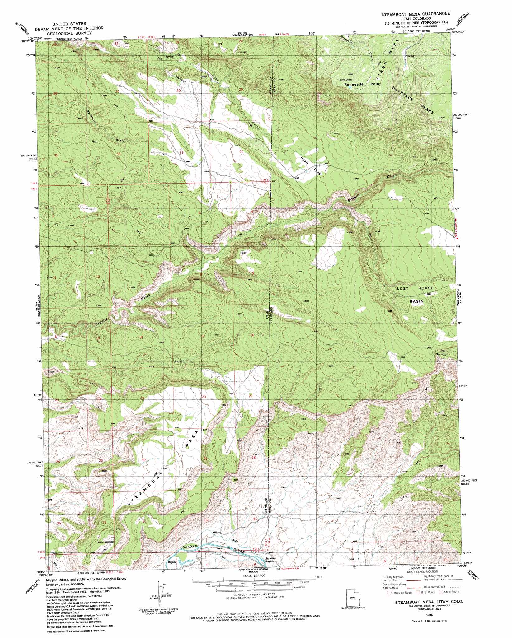
Steamboat Mesa Topo Map Utah
To zoom in, hover over the map of Steamboat Mesa
USGS Topo Quad 38109g1 - 1:24,000 scale
| Topo Map Name: | Steamboat Mesa |
| USGS Topo Quad ID: | 38109g1 |
| Print Size: | ca. 21 1/4" wide x 27" high |
| Southeast Coordinates: | 38.75° N latitude / 109° W longitude |
| Map Center Coordinates: | 38.8125° N latitude / 109.0625° W longitude |
| U.S. States: | UT, CO |
| Filename: | o38109g1.jpg |
| Download Map JPG Image: | Steamboat Mesa topo map 1:24,000 scale |
| Map Type: | Topographic |
| Topo Series: | 7.5´ |
| Map Scale: | 1:24,000 |
| Source of Map Images: | United States Geological Survey (USGS) |
| Alternate Map Versions: |
Mt. Waas 1 SE UT 1954, updated 1956 Download PDF Buy paper map Steamboat Mesa UT 1985, updated 1986 Download PDF Buy paper map Steamboat Mesa UT 2011 Download PDF Buy paper map Steamboat Mesa UT 2014 Download PDF Buy paper map |
1:24,000 Topo Quads surrounding Steamboat Mesa
Danish Flat |
Agate |
Westwater |
Sieber Canyon |
Battleship Rock |
Cisco |
Big Triangle |
Marble Canyon |
Bieser Creek |
Payne Wash |
Dewey |
Blue Chief Mesa |
Steamboat Mesa |
Two V Basin |
Fish Creek |
Fisher Towers |
Fisher Valley |
Dolores Point North |
Gateway |
Pine Mountain |
Warner Lake |
Mount Waas |
Dolores Point South |
Juanita Arch |
Calamity Mesa |
> Back to 38109e1 at 1:100,000 scale
> Back to 38108a1 at 1:250,000 scale
> Back to U.S. Topo Maps home
Steamboat Mesa topo map: Gazetteer
Steamboat Mesa: Cliffs
Renegade Point elevation 2539m 8330′Steamboat Mesa: Flats
Ryan Park elevation 2036m 6679′Steamboat Mesa: Rapids
Stateline Rapids elevation 1353m 4438′Steamboat Mesa: Summits
Haystack Peaks elevation 2529m 8297′Steamboat Mesa elevation 2038m 6686′
Steamboat Mesa digital topo map on disk
Buy this Steamboat Mesa topo map showing relief, roads, GPS coordinates and other geographical features, as a high-resolution digital map file on DVD: