Secret Basin Topo Map Nevada
To zoom in, hover over the map of Secret Basin
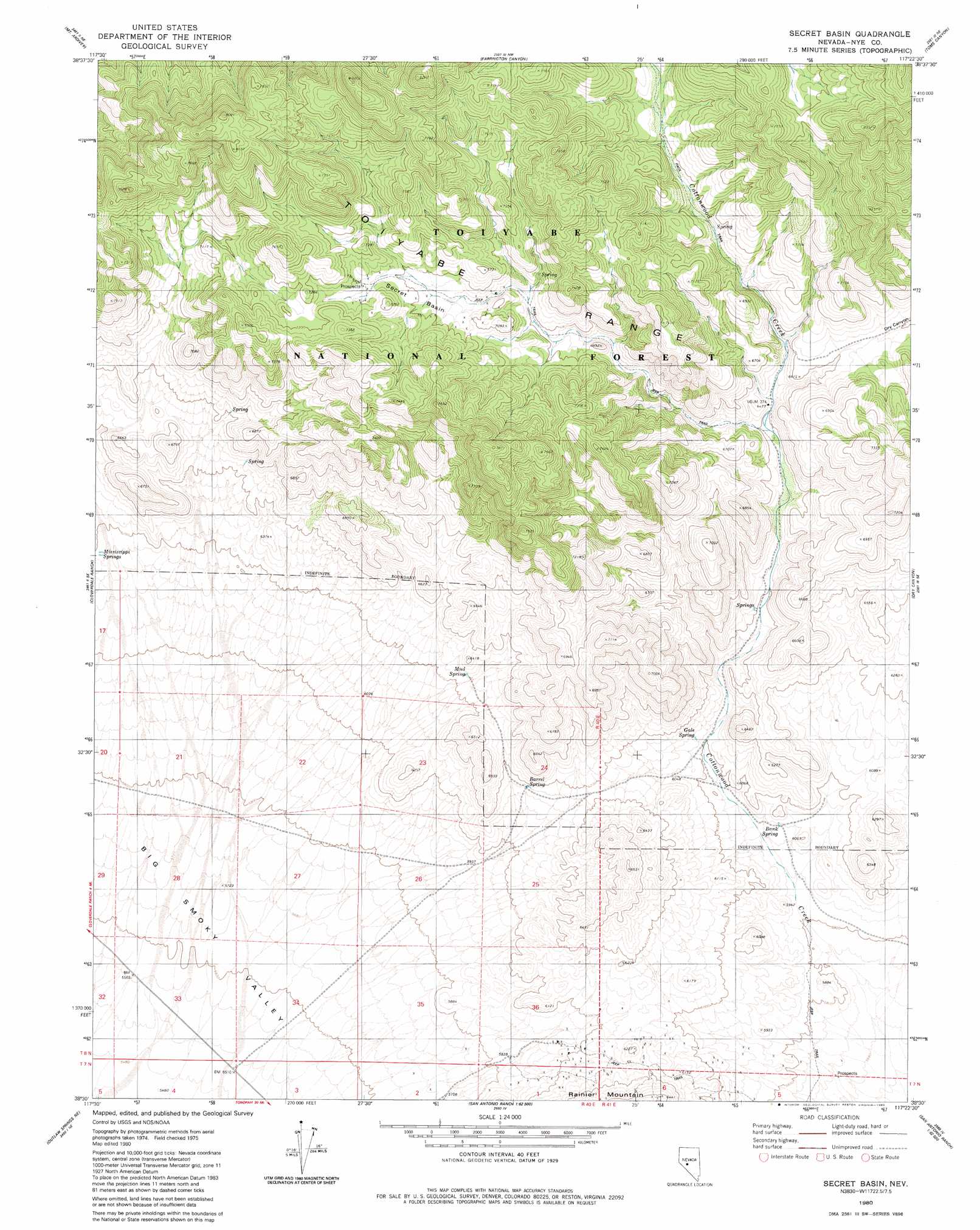
USGS Topo Quad 38117e4 - 1:24,000 scale
| Topo Map Name: | Secret Basin |
| USGS Topo Quad ID: | 38117e4 |
| Print Size: | ca. 21 1/4" wide x 27" high |
| Southeast Coordinates: | 38.5° N latitude / 117.375° W longitude |
| Map Center Coordinates: | 38.5625° N latitude / 117.4375° W longitude |
| U.S. State: | NV |
| Filename: | o38117e4.jpg |
| Download Map JPG Image: | Secret Basin topo map 1:24,000 scale |
| Map Type: | Topographic |
| Topo Series: | 7.5´ |
| Map Scale: | 1:24,000 |
| Source of Map Images: | United States Geological Survey (USGS) |
| Alternate Map Versions: |
Secret Basin NV 1980, updated 1980 Download PDF Buy paper map Secret Basin NV 2011 Download PDF Buy paper map Secret Basin NV 2014 Download PDF Buy paper map |
| FStopo: | US Forest Service topo Secret Basin is available: Download FStopo PDF Download FStopo TIF |
1:24,000 Topo Quads surrounding Secret Basin
Ione Sw |
Grantsville |
Bakeoven Creek |
Arc Dome |
Carvers |
Black Spring Nw |
Mount Ardivey |
Farrington Canyon |
Toms Canyon |
Pablo Canyon Ranch |
Black Spring |
Cloverdale Ranch |
Secret Basin |
Peavine Ranch |
Seyler Peak |
Cole Spring |
Outlaw Springs Ne |
Rainier Mountain |
San Antonio Ranch |
Baxter Spring Nw |
Outlaw Springs |
Outlaw Springs Se |
San Antonio Ranch Sw |
Liberty Springs |
San Antonio Well |
> Back to 38117e1 at 1:100,000 scale
> Back to 38116a1 at 1:250,000 scale
> Back to U.S. Topo Maps home
Secret Basin topo map: Gazetteer
Secret Basin: Basins
Secret Basin elevation 2135m 7004′Secret Basin: Springs
Bank Spring elevation 1811m 5941′Barrel Spring elevation 1877m 6158′
Gale Spring elevation 1852m 6076′
Mud Spring elevation 1913m 6276′
Secret Basin: Trails
Belmont and Sodaville Stage Route elevation 1766m 5793′Secret Basin digital topo map on disk
Buy this Secret Basin topo map showing relief, roads, GPS coordinates and other geographical features, as a high-resolution digital map file on DVD: