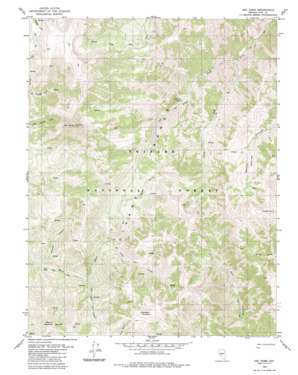
Arc Dome Topo Map Nevada
To zoom in, hover over the map of Arc Dome
USGS Topo Quad 38117g3 - 1:24,000 scale
| Topo Map Name: | Arc Dome |
| USGS Topo Quad ID: | 38117g3 |
| Print Size: | ca. 21 1/4" wide x 27" high |
| Southeast Coordinates: | 38.75° N latitude / 117.25° W longitude |
| Map Center Coordinates: | 38.8125° N latitude / 117.3125° W longitude |
| U.S. State: | NV |
| Filename: | o38117g3.jpg |
| Download Map JPG Image: | Arc Dome topo map 1:24,000 scale |
| Map Type: | Topographic |
| Topo Series: | 7.5´ |
| Map Scale: | 1:24,000 |
| Source of Map Images: | United States Geological Survey (USGS) |
| Alternate Map Versions: |
Arc Dome NV 1980, updated 1980 Download PDF Buy paper map Arc Dome NV 1980, updated 1985 Download PDF Buy paper map Arc Dome NV 2011 Download PDF Buy paper map Arc Dome NV 2014 Download PDF Buy paper map |
| FStopo: | US Forest Service topo Arc Dome is available: Download FStopo PDF Download FStopo TIF |
1:24,000 Topo Quads surrounding Arc Dome
> Back to 38117e1 at 1:100,000 scale
> Back to 38116a1 at 1:250,000 scale
> Back to U.S. Topo Maps home
Arc Dome topo map: Gazetteer
Arc Dome: Basins
Belcher Basin elevation 2829m 9281′Arc Dome: Flats
South Twin Pasture elevation 2460m 8070′Arc Dome: Streams
Little Jett Creek elevation 2575m 8448′South Fork South Twin River elevation 2242m 7355′
Trail Creek elevation 2526m 8287′
Arc Dome: Summits
Arc Dome elevation 3590m 11778′Mahogany Mountain elevation 3343m 10967′
Peavine Mountain elevation 3063m 10049′
Southeast Summit elevation 3112m 10209′
Toiyabe Dome elevation 3462m 11358′
Arc Dome: Valleys
Sheep Canyon elevation 2674m 8772′Wrango Canyon elevation 2463m 8080′
Arc Dome digital topo map on disk
Buy this Arc Dome topo map showing relief, roads, GPS coordinates and other geographical features, as a high-resolution digital map file on DVD:


