Birds Landing Topo Map California
To zoom in, hover over the map of Birds Landing
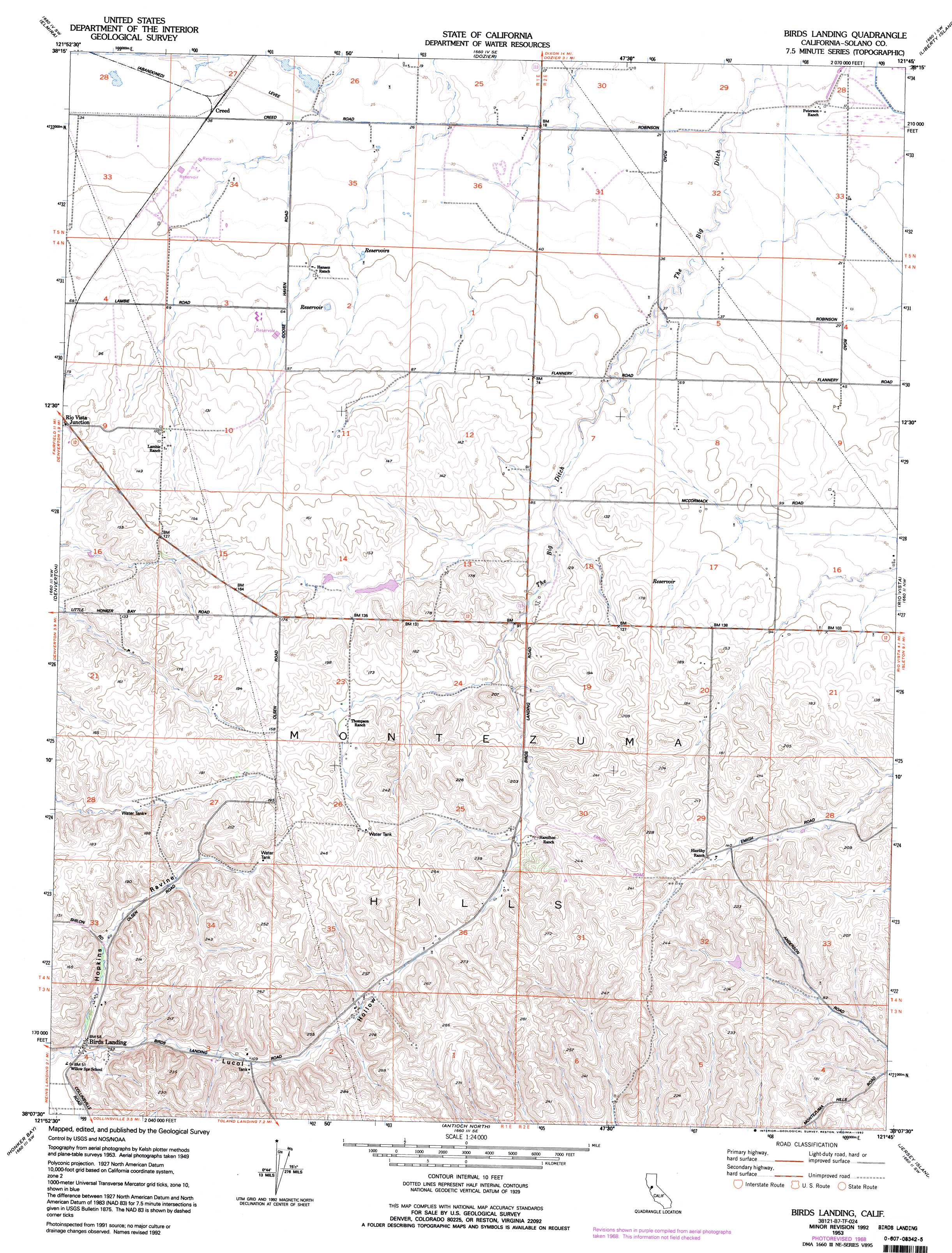
USGS Topo Quad 38121b7 - 1:24,000 scale
| Topo Map Name: | Birds Landing |
| USGS Topo Quad ID: | 38121b7 |
| Print Size: | ca. 21 1/4" wide x 27" high |
| Southeast Coordinates: | 38.125° N latitude / 121.75° W longitude |
| Map Center Coordinates: | 38.1875° N latitude / 121.8125° W longitude |
| U.S. State: | CA |
| Filename: | o38121b7.jpg |
| Download Map JPG Image: | Birds Landing topo map 1:24,000 scale |
| Map Type: | Topographic |
| Topo Series: | 7.5´ |
| Map Scale: | 1:24,000 |
| Source of Map Images: | United States Geological Survey (USGS) |
| Alternate Map Versions: |
Birds Landing CA 1953, updated 1954 Download PDF Buy paper map Birds Landing CA 1953, updated 1958 Download PDF Buy paper map Birds Landing CA 1953, updated 1969 Download PDF Buy paper map Birds Landing CA 1953, updated 1969 Download PDF Buy paper map Birds Landing CA 1953, updated 1986 Download PDF Buy paper map Birds Landing CA 1953, updated 1992 Download PDF Buy paper map Birds Landing CA 2012 Download PDF Buy paper map Birds Landing CA 2015 Download PDF Buy paper map |
1:24,000 Topo Quads surrounding Birds Landing
Mount Vaca |
Allendale |
Dixon |
Saxon |
Clarksburg |
Fairfield North |
Elmira |
Dozier |
Liberty Island |
Courtland |
Fairfield South |
Denverton |
Birds Landing |
Rio Vista |
Isleton |
Vine Hill |
Honker Bay |
Antioch North |
Jersey Island |
Bouldin Island |
Walnut Creek |
Clayton |
Antioch South |
Brentwood |
Woodward Island |
> Back to 38121a1 at 1:100,000 scale
> Back to 38120a1 at 1:250,000 scale
> Back to U.S. Topo Maps home
Birds Landing topo map: Gazetteer
Birds Landing: Populated Places
Birds Landing elevation 16m 52′Creed elevation 11m 36′
Solano City (historical) elevation 19m 62′
Birds Landing: Valleys
Hopkins Ravine elevation 9m 29′Lucol Hollow elevation 11m 36′
Birds Landing digital topo map on disk
Buy this Birds Landing topo map showing relief, roads, GPS coordinates and other geographical features, as a high-resolution digital map file on DVD: