Tallula Topo Map Illinois
To zoom in, hover over the map of Tallula
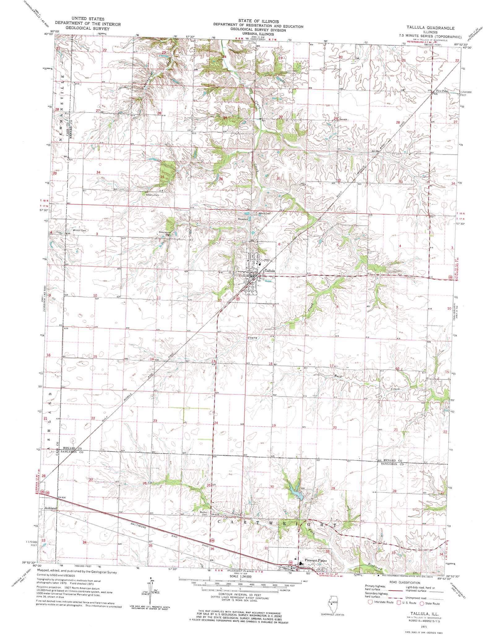
USGS Topo Quad 39089h8 - 1:24,000 scale
| Topo Map Name: | Tallula |
| USGS Topo Quad ID: | 39089h8 |
| Print Size: | ca. 21 1/4" wide x 27" high |
| Southeast Coordinates: | 39.875° N latitude / 89.875° W longitude |
| Map Center Coordinates: | 39.9375° N latitude / 89.9375° W longitude |
| U.S. State: | IL |
| Filename: | o39089h8.jpg |
| Download Map JPG Image: | Tallula topo map 1:24,000 scale |
| Map Type: | Topographic |
| Topo Series: | 7.5´ |
| Map Scale: | 1:24,000 |
| Source of Map Images: | United States Geological Survey (USGS) |
| Alternate Map Versions: |
Tallula IL 1971, updated 1973 Download PDF Buy paper map Tallula IL 2012 Download PDF Buy paper map Tallula IL 2015 Download PDF Buy paper map |
1:24,000 Topo Quads surrounding Tallula
Bath |
Kilbourne |
Biggs |
Easton |
Mason City |
Chandlerville |
Newmansville |
Oakford |
Petersburg |
Greenview |
Virginia |
Ashland |
Tallula |
Salisbury |
Athens |
Literberry |
Prentice |
Pleasant Plains |
Farmingdale |
Springfield West |
Jacksonville |
Alexander |
New Berlin |
Loami |
Chatham |
> Back to 39089e1 at 1:100,000 scale
> Back to 39088a1 at 1:250,000 scale
> Back to U.S. Topo Maps home
Tallula topo map: Gazetteer
Tallula: Airports
Brandt Heliport elevation 189m 620′Tallula: Dams
Braun Pond Dam elevation 179m 587′Tallula: Populated Places
Hill Top elevation 184m 603′Tallula elevation 190m 623′
Tallula: Reservoirs
Braun Pond elevation 179m 587′Tallula: Streams
North Fork Richland Creek elevation 172m 564′Tallula digital topo map on disk
Buy this Tallula topo map showing relief, roads, GPS coordinates and other geographical features, as a high-resolution digital map file on DVD:
Northern Illinois, Northern Indiana & Southwestern Michigan
Buy digital topo maps: Northern Illinois, Northern Indiana & Southwestern Michigan