Indian Garden Mountain Topo Map Nevada
To zoom in, hover over the map of Indian Garden Mountain
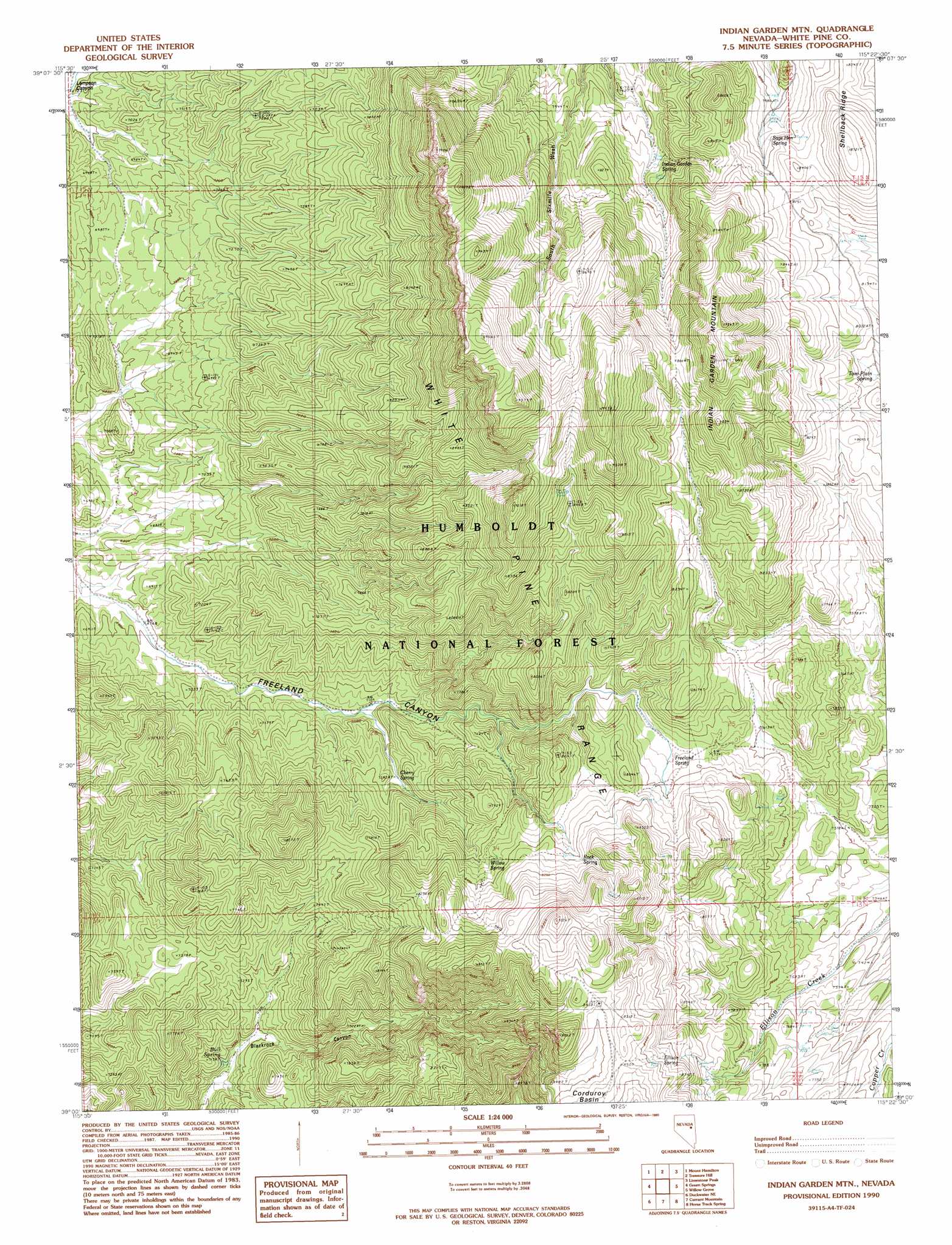
USGS Topo Quad 39115a4 - 1:24,000 scale
| Topo Map Name: | Indian Garden Mountain |
| USGS Topo Quad ID: | 39115a4 |
| Print Size: | ca. 21 1/4" wide x 27" high |
| Southeast Coordinates: | 39° N latitude / 115.375° W longitude |
| Map Center Coordinates: | 39.0625° N latitude / 115.4375° W longitude |
| U.S. State: | NV |
| Filename: | o39115a4.jpg |
| Download Map JPG Image: | Indian Garden Mountain topo map 1:24,000 scale |
| Map Type: | Topographic |
| Topo Series: | 7.5´ |
| Map Scale: | 1:24,000 |
| Source of Map Images: | United States Geological Survey (USGS) |
| Alternate Map Versions: |
Indian Garden Mtn NV 1990, updated 1990 Download PDF Buy paper map Indian Garden Mountain NV 2012 Download PDF Buy paper map Indian Garden Mountain NV 2014 Download PDF Buy paper map |
| FStopo: | US Forest Service topo Indian Garden Mountain is available: Download FStopo PDF Download FStopo TIF |
1:24,000 Topo Quads surrounding Indian Garden Mountain
Pancake Summit Sw |
Seligman Canyon |
Hamilton |
Illipah |
Waldy Pond |
Green Springs Nw |
Mount Hamilton |
Treasure Hill |
Limestone Peak |
Railroad Crossing Dam |
Green Springs Sw |
Green Springs |
Indian Garden Mountain |
Easter Springs |
Blackjack Springs |
Duckwater |
Duckwater Ne |
Currant Mountain |
Horse Track Spring |
Badger Hole Spring |
Bradshaw Spring |
Duckwater Se |
White Pine Peak |
Currant Summit |
Douglas |
> Back to 39115a1 at 1:100,000 scale
> Back to 39114a1 at 1:250,000 scale
> Back to U.S. Topo Maps home
Indian Garden Mountain topo map: Gazetteer
Indian Garden Mountain: Ridges
Shellback Ridge elevation 2535m 8316′Indian Garden Mountain: Springs
Bull Spring elevation 2106m 6909′Cherry Spring elevation 2224m 7296′
Ellison Spring elevation 2466m 8090′
Freeland Spring elevation 2351m 7713′
Indian Garden Spring elevation 2401m 7877′
Red Rock Spring elevation 2272m 7454′
Rock Spring elevation 2492m 8175′
Sage Hen Spring elevation 2448m 8031′
Tom Plain Spring elevation 2414m 7919′
Willow Spring elevation 2422m 7946′
Indian Garden Mountain: Summits
Indian Garden Mountain elevation 2846m 9337′Indian Garden Mountain digital topo map on disk
Buy this Indian Garden Mountain topo map showing relief, roads, GPS coordinates and other geographical features, as a high-resolution digital map file on DVD: