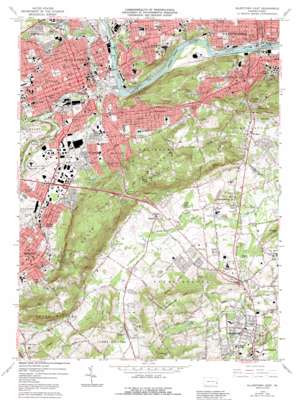
Allentown East Topo Map Pennsylvania
To zoom in, hover over the map of Allentown East
USGS Topo Quad 40075e4 - 1:24,000 scale
| Topo Map Name: | Allentown East |
| USGS Topo Quad ID: | 40075e4 |
| Print Size: | ca. 21 1/4" wide x 27" high |
| Southeast Coordinates: | 40.5° N latitude / 75.375° W longitude |
| Map Center Coordinates: | 40.5625° N latitude / 75.4375° W longitude |
| U.S. State: | PA |
| Filename: | o40075e4.jpg |
| Download Map JPG Image: | Allentown East topo map 1:24,000 scale |
| Map Type: | Topographic |
| Topo Series: | 7.5´ |
| Map Scale: | 1:24,000 |
| Source of Map Images: | United States Geological Survey (USGS) |
| Alternate Map Versions: |
Allentown East PA 1964, updated 1967 Download PDF Buy paper map Allentown East PA 1964, updated 1973 Download PDF Buy paper map Allentown East PA 1964, updated 1979 Download PDF Buy paper map Allentown East PA 1964, updated 1984 Download PDF Buy paper map Allentown East PA 1964, updated 1992 Download PDF Buy paper map Allentown East PA 1999, updated 2001 Download PDF Buy paper map Allentown East PA 2010 Download PDF Buy paper map Allentown East PA 2013 Download PDF Buy paper map Allentown East PA 2016 Download PDF Buy paper map |
1:24,000 Topo Quads surrounding Allentown East
> Back to 40075e1 at 1:100,000 scale
> Back to 40074a1 at 1:250,000 scale
> Back to U.S. Topo Maps home
Allentown East topo map: Gazetteer
Allentown East: Airports
Allentown Queen City Municipal Airport elevation 116m 380′Allentown-Bethlehem-Easton Airport elevation 186m 610′
Go Helistop elevation 102m 334′
Allentown East: Bridges
Bogerts Bridge elevation 80m 262′Hill to Hill Bridge elevation 66m 216′
Allentown East: Canals
Lehigh Coal and Navigation Canal elevation 68m 223′Allentown East: Cliffs
Jasper Cliffs elevation 274m 898′Allentown East: Dams
Little Lehigh Dam elevation 73m 239′Number Seven Dam elevation 69m 226′
Pa-7 Dam elevation 91m 298′
Allentown East: Gaps
Leiberts Gap elevation 162m 531′Allentown East: Islands
Adams Island elevation 78m 255′Calypso Island elevation 73m 239′
Eves Island elevation 77m 252′
Kline Island elevation 74m 242′
Allentown East: Lakes
Lake Thomas elevation 117m 383′Moyers Lake elevation 169m 554′
Allentown East: Parks
Bicentennial elevation 110m 360′Butz Baseball Field elevation 128m 419′
Devonshire Park elevation 104m 341′
Fasching Track elevation 134m 439′
Fountain Park elevation 76m 249′
Irving Park elevation 99m 324′
John Valeniz Park elevation 92m 301′
Jordan Park elevation 79m 259′
Keck Park elevation 103m 337′
Laubach Park elevation 160m 524′
Little Lehigh Park elevation 80m 262′
Mack Park elevation 99m 324′
Our Lady of Deliverance Status/Recreation Area elevation 142m 465′
Robert Rodale Reserve elevation 193m 633′
Rosegarden Park elevation 93m 305′
Ruhe Park elevation 123m 403′
South Mountain Park elevation 163m 534′
South Mountain Park elevation 173m 567′
South Mountain Preserve elevation 271m 889′
Tocik/Conmy Recreation Area elevation 135m 442′
Trout Creek Park elevation 82m 269′
West Park elevation 120m 393′
Allentown East: Pillars
Bauer Rock elevation 312m 1023′Allentown East: Populated Places
Allentown elevation 103m 337′Alton Park elevation 119m 390′
Center Valley elevation 134m 439′
Colesville elevation 142m 465′
Coopersburg elevation 143m 469′
East Allentown elevation 106m 347′
Emmaus elevation 136m 446′
Emmaus Junction elevation 122m 400′
Farmington elevation 164m 538′
Fountain Hill elevation 114m 374′
Friedensville elevation 128m 419′
Gauff Hill elevation 165m 541′
Hanover Acres elevation 100m 328′
Lanark elevation 131m 429′
Limeport elevation 158m 518′
Mountainville elevation 133m 436′
Overlook Springs elevation 219m 718′
Ritterville elevation 115m 377′
Saucon Valley elevation 119m 390′
Seidersville elevation 148m 485′
Star Village elevation 218m 715′
Summit Lawn elevation 147m 482′
University Heights elevation 191m 626′
Vera Cruz elevation 170m 557′
Vera Cruz Station elevation 176m 577′
Waldheim Park elevation 154m 505′
Wilbur elevation 139m 456′
Wydnor elevation 122m 400′
Allentown East: Reservoirs
South Mountain Reservoir elevation 156m 511′Allentown East: Springs
Crystal Spring elevation 77m 252′Fifteenth Street Spring elevation 75m 246′
Lehigh Park Spring elevation 78m 255′
Allentown East: Streams
Cedar Creek elevation 74m 242′Jordan Creek elevation 71m 232′
Little Lehigh Creek elevation 69m 226′
Rodale Run elevation 109m 357′
Trout Creek elevation 71m 232′
Tumble Brook elevation 133m 436′
Allentown East: Summits
Applebutter Hill elevation 258m 846′Chestnut Hill elevation 282m 925′
Dutch Hill elevation 161m 528′
Lehigh Mountain elevation 257m 843′
Limeport Hill elevation 238m 780′
Allentown East digital topo map on disk
Buy this Allentown East topo map showing relief, roads, GPS coordinates and other geographical features, as a high-resolution digital map file on DVD:
Atlantic Coast (NY, NJ, PA, DE, MD, VA, NC)
Buy digital topo maps: Atlantic Coast (NY, NJ, PA, DE, MD, VA, NC)


