New Galilee Topo Map Pennsylvania
To zoom in, hover over the map of New Galilee
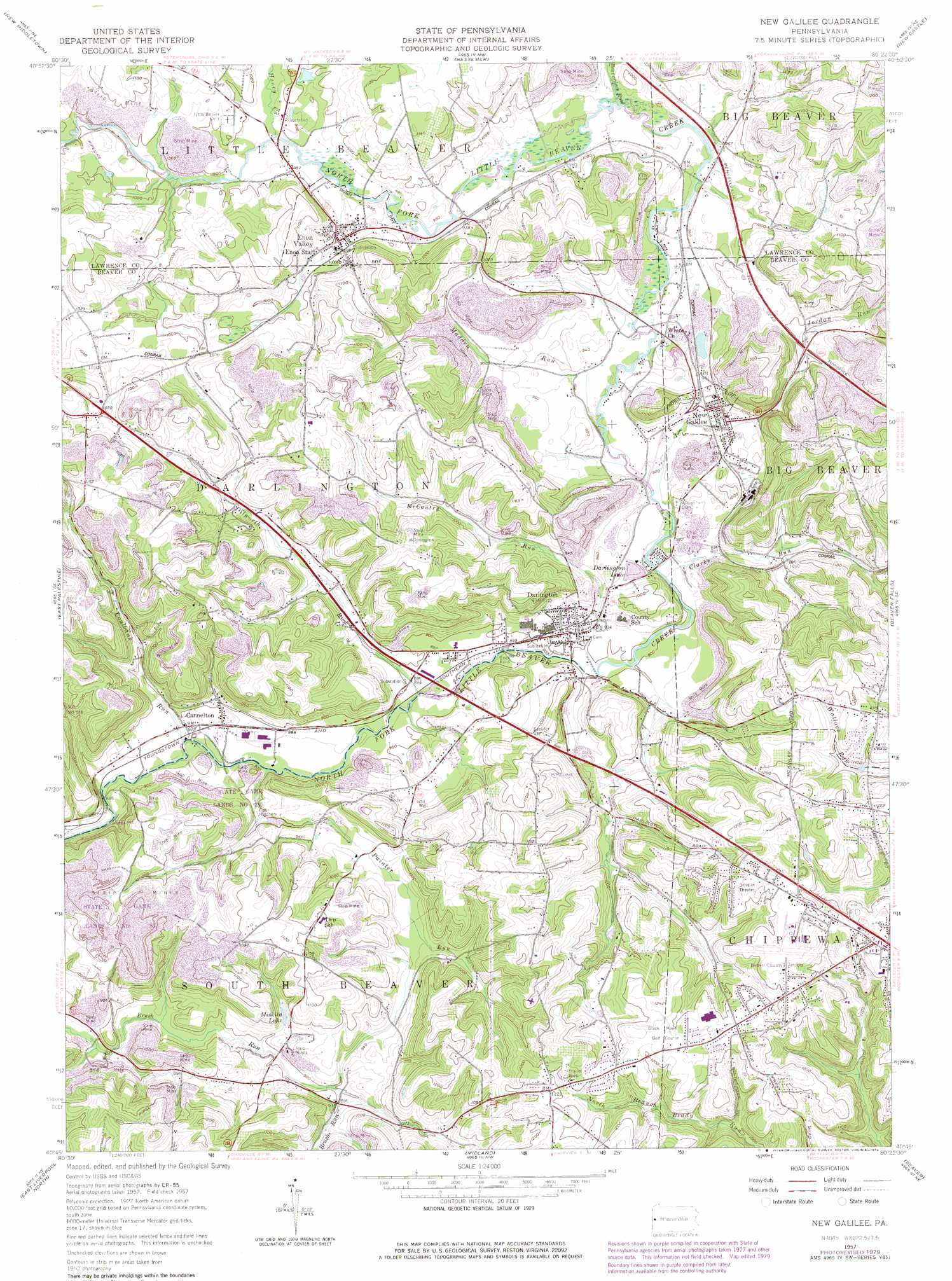
USGS Topo Quad 40080g4 - 1:24,000 scale
| Topo Map Name: | New Galilee |
| USGS Topo Quad ID: | 40080g4 |
| Print Size: | ca. 21 1/4" wide x 27" high |
| Southeast Coordinates: | 40.75° N latitude / 80.375° W longitude |
| Map Center Coordinates: | 40.8125° N latitude / 80.4375° W longitude |
| U.S. State: | PA |
| Filename: | o40080g4.jpg |
| Download Map JPG Image: | New Galilee topo map 1:24,000 scale |
| Map Type: | Topographic |
| Topo Series: | 7.5´ |
| Map Scale: | 1:24,000 |
| Source of Map Images: | United States Geological Survey (USGS) |
| Alternate Map Versions: |
New Galilee PA 1957, updated 1959 Download PDF Buy paper map New Galilee PA 1957, updated 1968 Download PDF Buy paper map New Galilee PA 1957, updated 1970 Download PDF Buy paper map New Galilee PA 1957, updated 1979 Download PDF Buy paper map New Galilee PA 1957, updated 1979 Download PDF Buy paper map New Galilee PA 2010 Download PDF Buy paper map New Galilee PA 2013 Download PDF Buy paper map New Galilee PA 2016 Download PDF Buy paper map |
1:24,000 Topo Quads surrounding New Galilee
Youngstown |
Campbell |
Edinburg |
New Castle North |
Harlansburg |
Columbiana |
New Middletown |
Bessemer |
New Castle South |
Portersville |
Elkton |
East Palestine |
New Galilee |
Beaver Falls |
Zelienople |
West Point |
East Liverpool North |
Midland |
Beaver |
Baden |
Wellsville |
East Liverpool South |
Hookstown |
Aliquippa |
Ambridge |
> Back to 40080e1 at 1:100,000 scale
> Back to 40080a1 at 1:250,000 scale
> Back to U.S. Topo Maps home
New Galilee topo map: Gazetteer
New Galilee: Airports
Beaver County Airport elevation 376m 1233′New Galilee: Lakes
Darlington Lake elevation 286m 938′Miskita Lake elevation 286m 938′
New Galilee: Populated Places
Cannelton elevation 267m 875′Darlington elevation 276m 905′
Enon Valley elevation 302m 990′
New Galilee elevation 298m 977′
Rowtown elevation 289m 948′
New Galilee: Post Offices
Rowe Post Office (historical) elevation 294m 964′New Galilee: Streams
Beaverdam Run elevation 286m 938′Coalbank Run elevation 262m 859′
Dilworth Run elevation 268m 879′
Honey Creek elevation 295m 967′
Jordan Run elevation 289m 948′
Madden Run elevation 280m 918′
McCautry Run elevation 273m 895′
Painter Run elevation 266m 872′
Small Run elevation 296m 971′
New Galilee digital topo map on disk
Buy this New Galilee topo map showing relief, roads, GPS coordinates and other geographical features, as a high-resolution digital map file on DVD:
 map DVD")