Forest City Topo Map Illinois
To zoom in, hover over the map of Forest City
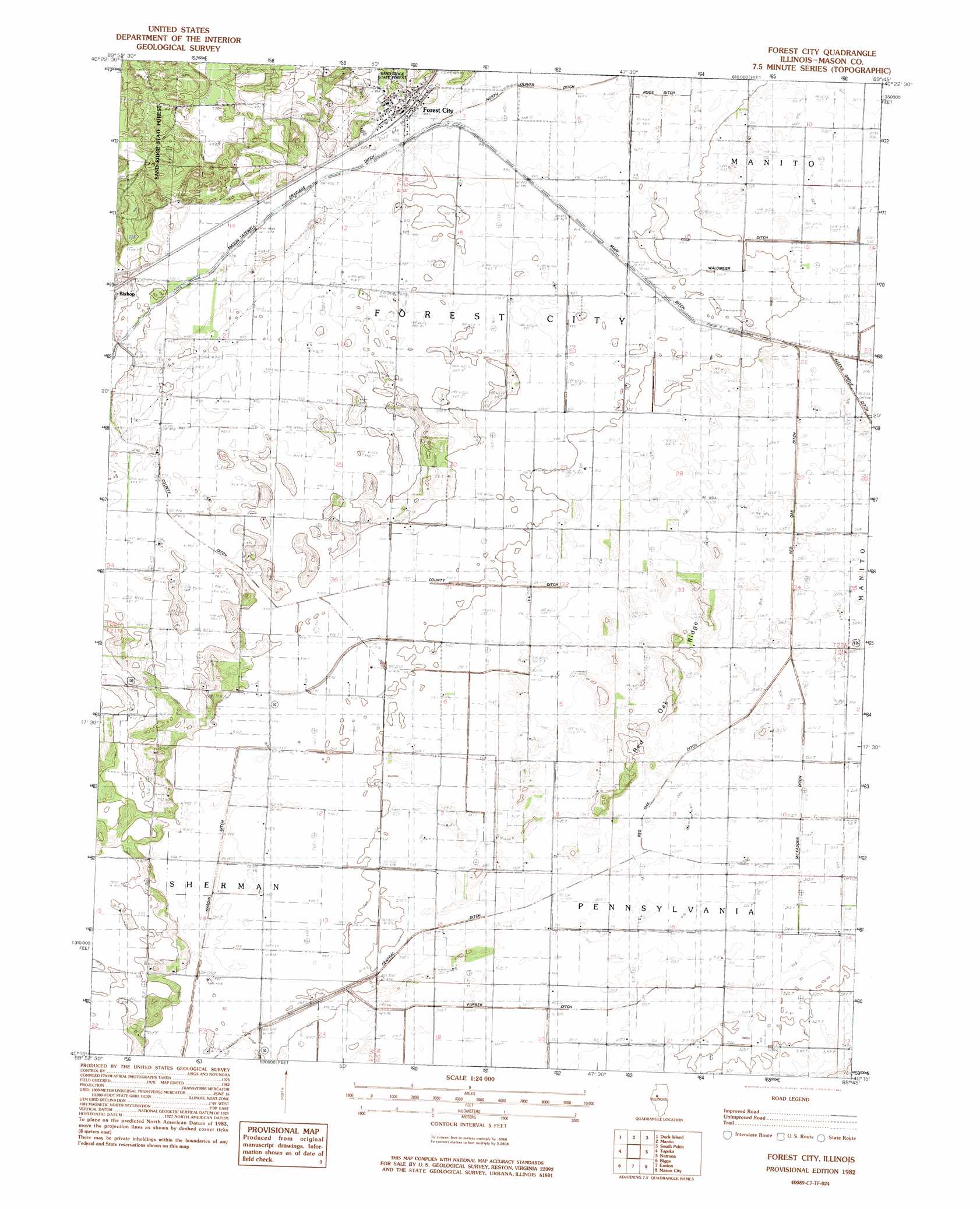
USGS Topo Quad 40089c7 - 1:24,000 scale
| Topo Map Name: | Forest City |
| USGS Topo Quad ID: | 40089c7 |
| Print Size: | ca. 21 1/4" wide x 27" high |
| Southeast Coordinates: | 40.25° N latitude / 89.75° W longitude |
| Map Center Coordinates: | 40.3125° N latitude / 89.8125° W longitude |
| U.S. State: | IL |
| Filename: | o40089c7.jpg |
| Download Map JPG Image: | Forest City topo map 1:24,000 scale |
| Map Type: | Topographic |
| Topo Series: | 7.5´ |
| Map Scale: | 1:24,000 |
| Source of Map Images: | United States Geological Survey (USGS) |
| Alternate Map Versions: |
Forest City IL 1982, updated 1982 Download PDF Buy paper map Forest City IL 2012 Download PDF Buy paper map Forest City IL 2015 Download PDF Buy paper map |
1:24,000 Topo Quads surrounding Forest City
Canton |
Banner |
Glasford |
Pekin |
Marquette Heights |
Saint David |
Duck Island |
Manito |
South Pekin |
Delavan North |
Havana |
Topeka |
Forest City |
Natrona |
Delavan South |
Kilbourne |
Biggs |
Easton |
Mason City |
New Holland |
Newmansville |
Oakford |
Petersburg |
Greenview |
Middleton |
> Back to 40089a1 at 1:100,000 scale
> Back to 40088a1 at 1:250,000 scale
> Back to U.S. Topo Maps home
Forest City topo map: Gazetteer
Forest City: Airports
Kreilings Airport elevation 153m 501′Forest City: Canals
Central Ditch elevation 154m 505′Furrer Ditch elevation 152m 498′
Hardin Ditch elevation 149m 488′
McFadden Ditch elevation 155m 508′
Red Oak Ditch elevation 152m 498′
Roos Ditch elevation 149m 488′
Waldmeier Ditch elevation 152m 498′
White and Brown Ditch elevation 154m 505′
White and Rowley Ditch elevation 151m 495′
Forest City: Populated Places
Bishop elevation 150m 492′Forest City elevation 150m 492′
Forest City: Ridges
Red Oak Ridge elevation 158m 518′Forest City digital topo map on disk
Buy this Forest City topo map showing relief, roads, GPS coordinates and other geographical features, as a high-resolution digital map file on DVD:
Northern Illinois, Northern Indiana & Southwestern Michigan
Buy digital topo maps: Northern Illinois, Northern Indiana & Southwestern Michigan