Blue Springs Topo Map Nebraska
To zoom in, hover over the map of Blue Springs
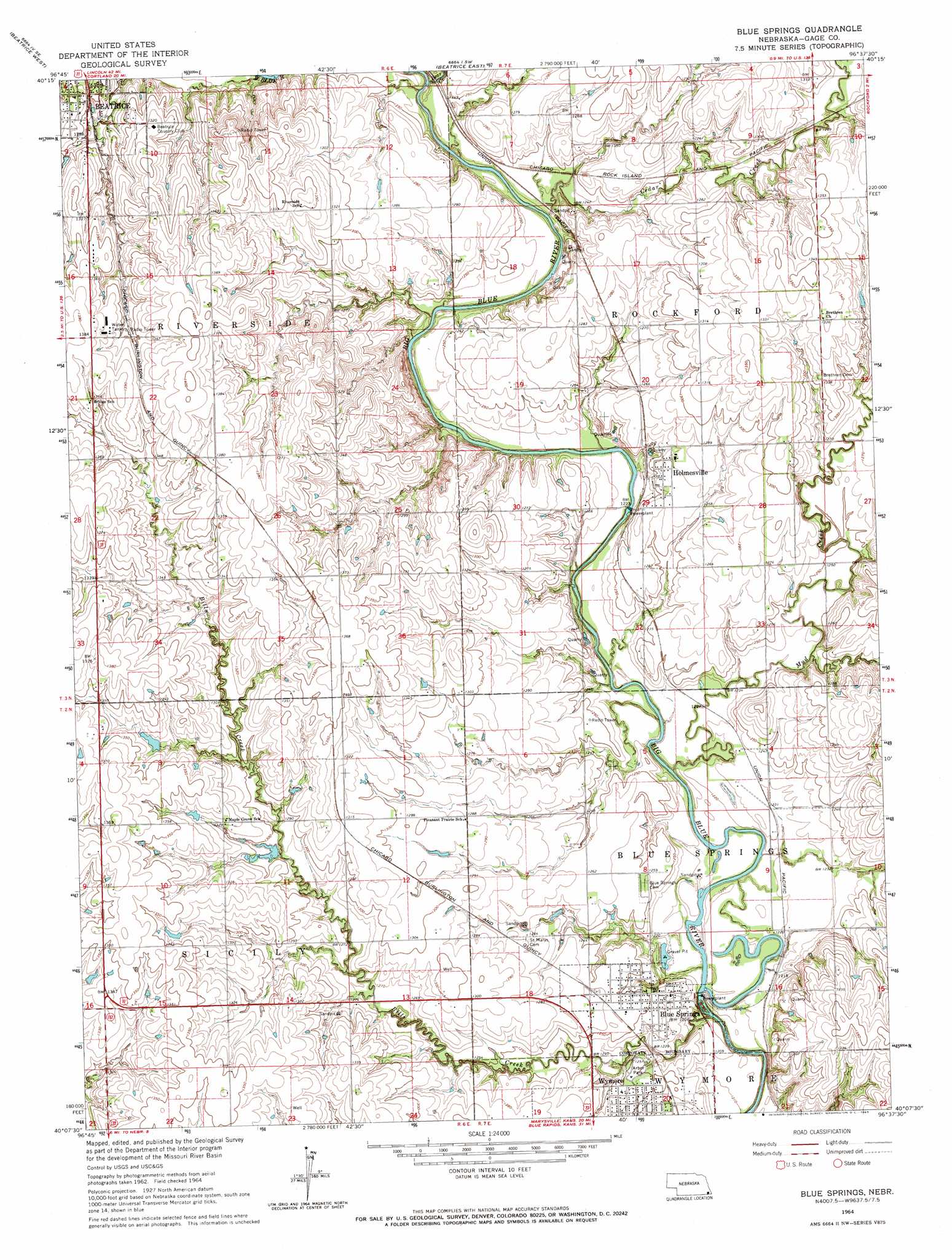
USGS Topo Quad 40096b6 - 1:24,000 scale
| Topo Map Name: | Blue Springs |
| USGS Topo Quad ID: | 40096b6 |
| Print Size: | ca. 21 1/4" wide x 27" high |
| Southeast Coordinates: | 40.125° N latitude / 96.625° W longitude |
| Map Center Coordinates: | 40.1875° N latitude / 96.6875° W longitude |
| U.S. State: | NE |
| Filename: | O40096b6.jpg |
| Download Map JPG Image: | Blue Springs topo map 1:24,000 scale |
| Map Type: | Topographic |
| Topo Series: | 7.5´ |
| Map Scale: | 1:24,000 |
| Source of Map Images: | United States Geological Survey (USGS) |
| Alternate Map Versions: |
Blue Springs NE 1964, updated 1965 Download PDF Buy paper map Blue Springs NE 2011 Download PDF Buy paper map Blue Springs NE 2014 Download PDF Buy paper map |
1:24,000 Topo Quads surrounding Blue Springs
Wilber |
Clatonia |
Pickrell |
Adams |
Sterling |
Plymouth |
Beatrice West |
Beatrice East |
Filley |
Crab Orchard |
Harbine |
Odell Ne |
Blue Springs |
Wymore Ne |
Lewiston |
Diller |
Odell |
Wymore |
Barneston |
Liberty |
Hanover West |
Hanover East |
Herkimer |
Oketo |
Axtell Nw |
> Back to 40096a1 at 1:100,000 scale
> Back to 40096a1 at 1:250,000 scale
> Back to U.S. Topo Maps home
Blue Springs topo map: Gazetteer
Blue Springs: Dams
Blue Springs Power Plant Dam elevation 374m 1227′Holmesville Power Plant Dam elevation 367m 1204′
Blue Springs: Parks
Arbor Park elevation 381m 1250′Feit Memorial Park elevation 371m 1217′
Blue Springs: Populated Places
Blue Springs elevation 378m 1240′Holmesville elevation 385m 1263′
Blue Springs: Post Offices
Blue Springs Post Office elevation 378m 1240′Holmesville Post Office elevation 385m 1263′
Putnam Post Office (historical) elevation 372m 1220′
Sicily Post Office (historical) elevation 401m 1315′
Blue Springs: Reservoirs
Blue Springs Power Plant Reservoir elevation 374m 1227′Holmesville Power Plant Reservoir elevation 367m 1204′
Blue Springs: Streams
Bear Creek elevation 369m 1210′Bills Creek elevation 362m 1187′
Bloody Run elevation 386m 1266′
Cedar Creek elevation 371m 1217′
Mud Creek elevation 367m 1204′
Blue Springs digital topo map on disk
Buy this Blue Springs topo map showing relief, roads, GPS coordinates and other geographical features, as a high-resolution digital map file on DVD: