York Sw Topo Map Nebraska
To zoom in, hover over the map of York Sw
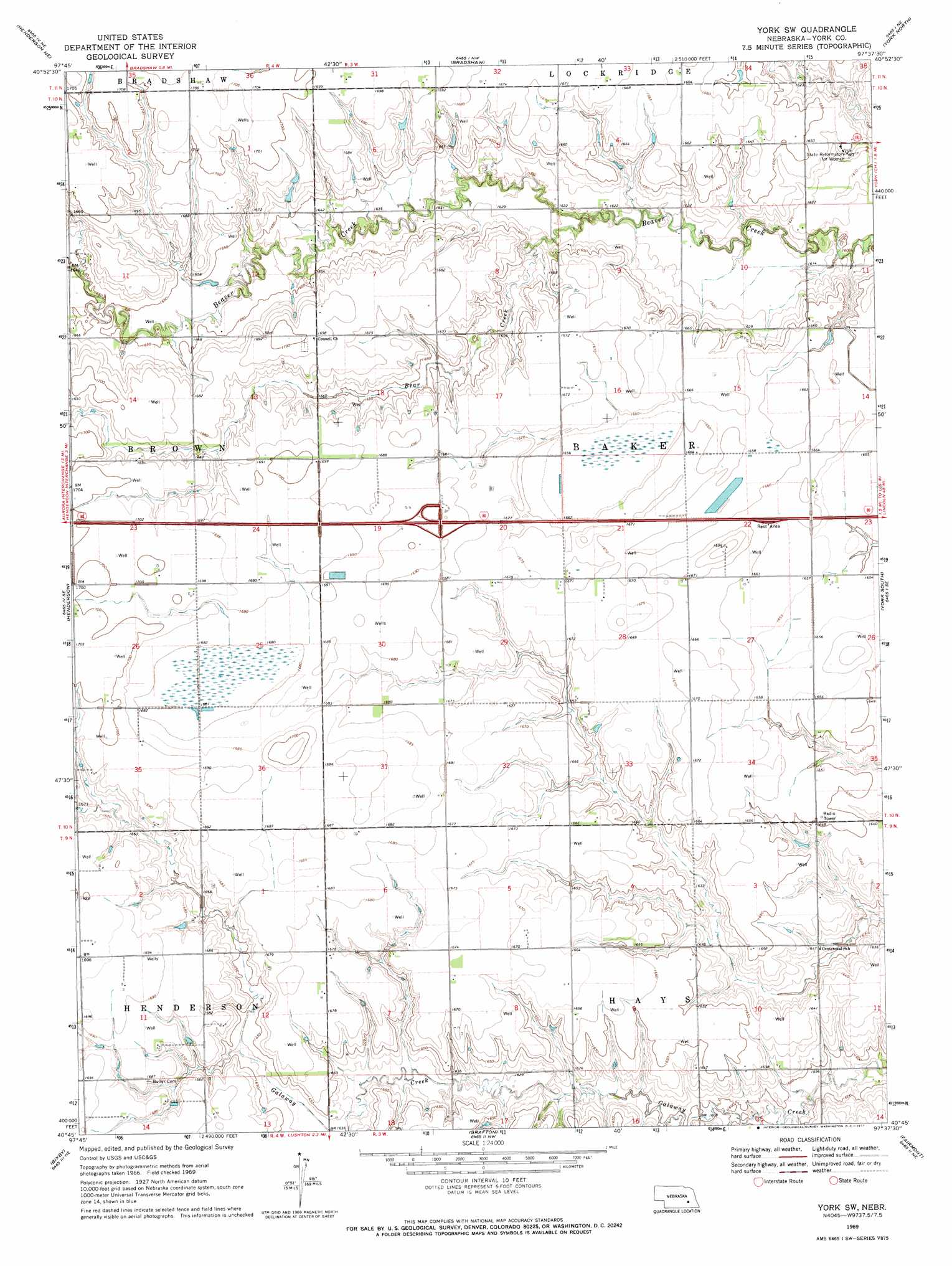
USGS Topo Quad 40097g6 - 1:24,000 scale
| Topo Map Name: | York Sw |
| USGS Topo Quad ID: | 40097g6 |
| Print Size: | ca. 21 1/4" wide x 27" high |
| Southeast Coordinates: | 40.75° N latitude / 97.625° W longitude |
| Map Center Coordinates: | 40.8125° N latitude / 97.6875° W longitude |
| U.S. State: | NE |
| Filename: | O40097g6.jpg |
| Download Map JPG Image: | York Sw topo map 1:24,000 scale |
| Map Type: | Topographic |
| Topo Series: | 7.5´ |
| Map Scale: | 1:24,000 |
| Source of Map Images: | United States Geological Survey (USGS) |
| Alternate Map Versions: |
York SW NE 1969, updated 1971 Download PDF Buy paper map York SW NE 2011 Download PDF Buy paper map York SW NE 2014 Download PDF Buy paper map |
1:24,000 Topo Quads surrounding York Sw
Central City East |
Polk |
Durant |
Stromsburg |
Gresham |
Hampton |
Henderson Ne |
Bradshaw |
York North |
Waco |
Aurora East |
Henderson |
York Sw |
York South |
Utica Sw |
Stockham |
Bixby |
Grafton |
Fairmont |
Exeter |
Saronville |
Sutton |
Geneva Sw |
Geneva |
Friend Sw |
> Back to 40097e1 at 1:100,000 scale
> Back to 40096a1 at 1:250,000 scale
> Back to U.S. Topo Maps home
York Sw topo map: Gazetteer
York Sw: Crossings
Interchange 348 elevation 516m 1692′York Sw: Parks
Kirkpatrick Basin North State Wildlife Management Area elevation 505m 1656′Kirkpatrick Basin South State Wildlife Management Area elevation 511m 1676′
Nebraska City-Fort Kearny Cut-off Historical Marker elevation 506m 1660′
York Sw: Populated Places
Charlestown (historical) elevation 515m 1689′York Sw: Post Offices
Charlestown Post Office (historical) elevation 515m 1689′York Sw: Streams
Bear Creek elevation 490m 1607′York Sw digital topo map on disk
Buy this York Sw topo map showing relief, roads, GPS coordinates and other geographical features, as a high-resolution digital map file on DVD: