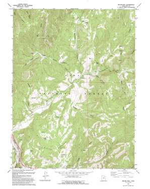
Billies Mountain Topo Map Utah
To zoom in, hover over the map of Billies Mountain
USGS Topo Quad 40111a4 - 1:24,000 scale
| Topo Map Name: | Billies Mountain |
| USGS Topo Quad ID: | 40111a4 |
| Print Size: | ca. 21 1/4" wide x 27" high |
| Southeast Coordinates: | 40° N latitude / 111.375° W longitude |
| Map Center Coordinates: | 40.0625° N latitude / 111.4375° W longitude |
| U.S. State: | UT |
| Filename: | o40111a4.jpg |
| Download Map JPG Image: | Billies Mountain topo map 1:24,000 scale |
| Map Type: | Topographic |
| Topo Series: | 7.5´ |
| Map Scale: | 1:24,000 |
| Source of Map Images: | United States Geological Survey (USGS) |
| Alternate Map Versions: |
Billies Mtn. UT 1967, updated 1969 Download PDF Buy paper map Billies Mtn. UT 1967, updated 1978 Download PDF Buy paper map Billies Mtn. UT 1967, updated 1987 Download PDF Buy paper map Billies Mtn. UT 1994, updated 1994 Download PDF Buy paper map Billies Mountain UT 1998, updated 2002 Download PDF Buy paper map Billies Mountain UT 2011 Download PDF Buy paper map Billies Mountain UT 2014 Download PDF Buy paper map |
| FStopo: | US Forest Service topo Billies Mountain is available: Download FStopo PDF Download FStopo TIF |
1:24,000 Topo Quads surrounding Billies Mountain
> Back to 40111a1 at 1:100,000 scale
> Back to 40110a1 at 1:250,000 scale
> Back to U.S. Topo Maps home
Billies Mountain topo map: Gazetteer
Billies Mountain: Arches
Diamond Fork Arch elevation 1647m 5403′Billies Mountain: Flats
Wignal Flat elevation 1726m 5662′Billies Mountain: Forests
Diamond Fork Youth Forest elevation 1646m 5400′Billies Mountain: Parks
Diamond Battle Historical Monument elevation 1732m 5682′Billies Mountain: Populated Places
Patrick Place elevation 1769m 5803′Billies Mountain: Springs
Wignal Spring elevation 1696m 5564′Billies Mountain: Streams
Little Diamond Creek elevation 1577m 5173′Mill Hollow elevation 1908m 6259′
Billies Mountain: Summits
Billies Mountain elevation 2025m 6643′Billies Mountain: Valleys
Brimhall Canyon elevation 1574m 5164′Monks Hollow elevation 1634m 5360′
Red Hollow elevation 1634m 5360′
Sams Canyon elevation 1606m 5269′
Wanrhodes Canyon elevation 1597m 5239′
Billies Mountain digital topo map on disk
Buy this Billies Mountain topo map showing relief, roads, GPS coordinates and other geographical features, as a high-resolution digital map file on DVD:


