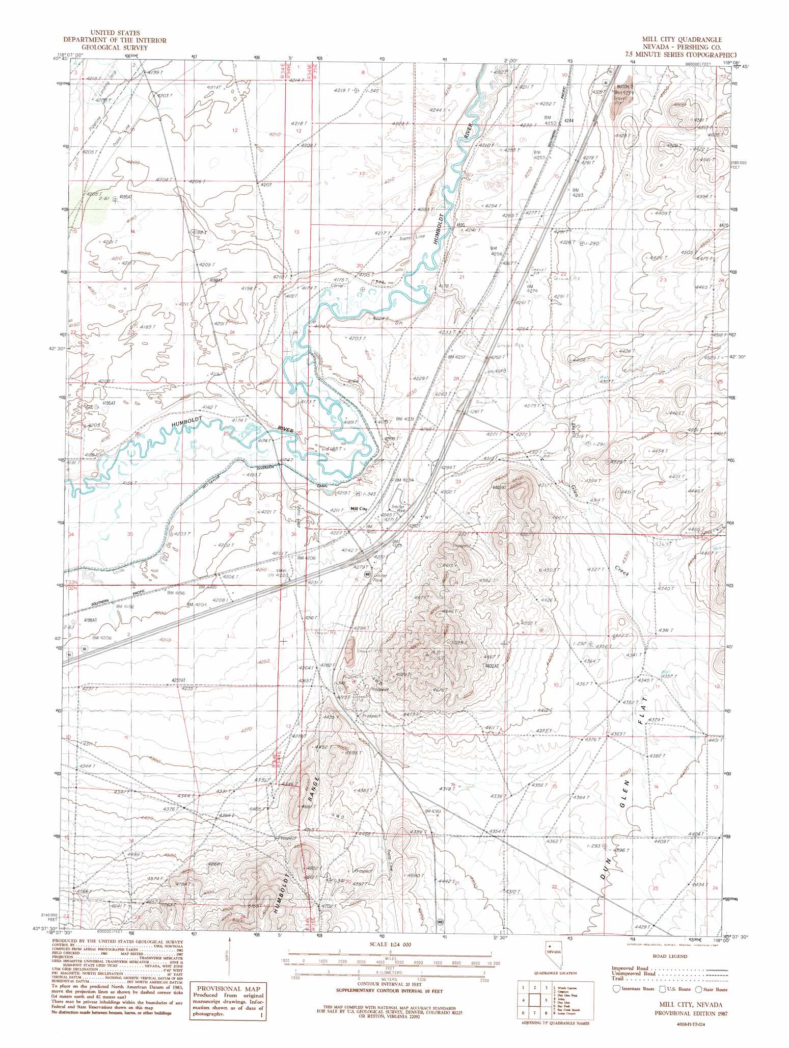
Mill City Topo Map Nevada
To zoom in, hover over the map of Mill City
USGS Topo Quad 40118f1 - 1:24,000 scale
| Topo Map Name: | Mill City |
| USGS Topo Quad ID: | 40118f1 |
| Print Size: | ca. 21 1/4" wide x 27" high |
| Southeast Coordinates: | 40.625° N latitude / 118° W longitude |
| Map Center Coordinates: | 40.6875° N latitude / 118.0625° W longitude |
| U.S. State: | NV |
| Filename: | o40118f1.jpg |
| Download Map JPG Image: | Mill City topo map 1:24,000 scale |
| Map Type: | Topographic |
| Topo Series: | 7.5´ |
| Map Scale: | 1:24,000 |
| Source of Map Images: | United States Geological Survey (USGS) |
| Alternate Map Versions: |
Mill City NV 1987, updated 1987 Download PDF Buy paper map Mill City NV 2011 Download PDF Buy paper map Mill City NV 2014 Download PDF Buy paper map |
1:24,000 Topo Quads surrounding Mill City
Jungo Ne |
Gaskell |
Pronto |
Rose Creek |
Winnemucca West |
Alpha Mountain |
Woody Canyon |
Cosgrave |
Dun Glen Peak |
Rose Creek Mountain |
Rye Patch Res North |
Imlay |
Mill City |
Dun Glen |
Natchez Pass |
Rye Patch Res South |
Star Peak |
Star Creek Ranch |
Inskip Canyon |
Lee Peak |
Rye Patch Dam |
Congress Canyon |
Unionville |
Kyle Hot Springs |
Bartomes Spring |
> Back to 40118e1 at 1:100,000 scale
> Back to 40118a1 at 1:250,000 scale
> Back to U.S. Topo Maps home
Mill City topo map: Gazetteer
Mill City: Flats
Dun Glen Flat elevation 1341m 4399′Mill City: Populated Places
Mill City elevation 1290m 4232′Neptune City (historical) elevation 1340m 4396′
Mill City: Post Offices
Mill City Post Office (historical) elevation 1290m 4232′Mill City: Streams
Dun Glen Creek elevation 1273m 4176′Mill City: Trails
Old Idaho Stage Road elevation 1282m 4206′Mill City: Tunnels
Lancaster Tunnel (historical) elevation 1283m 4209′Mill City digital topo map on disk
Buy this Mill City topo map showing relief, roads, GPS coordinates and other geographical features, as a high-resolution digital map file on DVD: