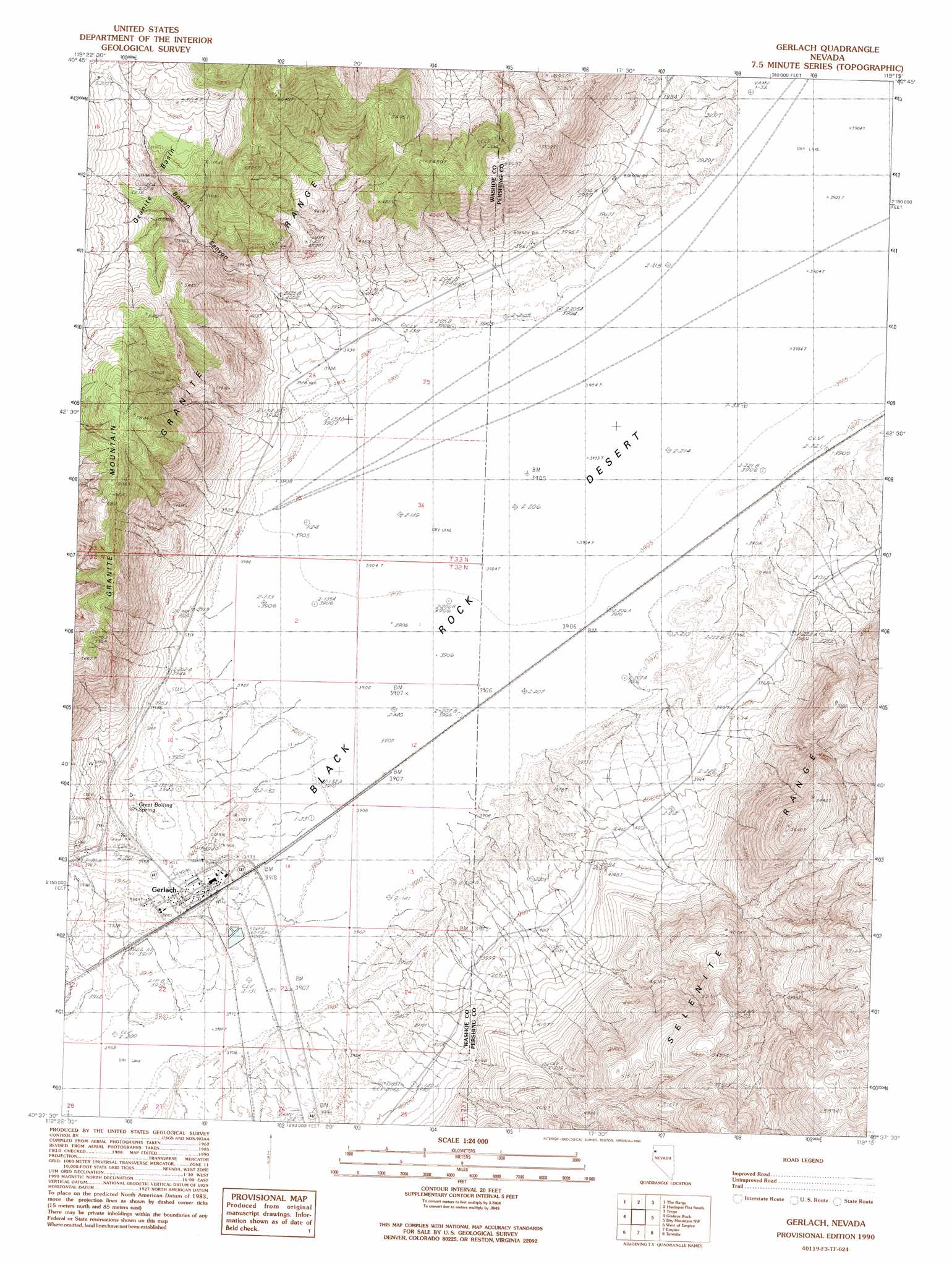
Gerlach Topo Map Nevada
To zoom in, hover over the map of Gerlach
USGS Topo Quad 40119f3 - 1:24,000 scale
| Topo Map Name: | Gerlach |
| USGS Topo Quad ID: | 40119f3 |
| Print Size: | ca. 21 1/4" wide x 27" high |
| Southeast Coordinates: | 40.625° N latitude / 119.25° W longitude |
| Map Center Coordinates: | 40.6875° N latitude / 119.3125° W longitude |
| U.S. State: | NV |
| Filename: | o40119f3.jpg |
| Download Map JPG Image: | Gerlach topo map 1:24,000 scale |
| Map Type: | Topographic |
| Topo Series: | 7.5´ |
| Map Scale: | 1:24,000 |
| Source of Map Images: | United States Geological Survey (USGS) |
| Alternate Map Versions: |
Gerlach NV 1990, updated 1990 Download PDF Buy paper map Gerlach NV 2011 Download PDF Buy paper map Gerlach NV 2014 Download PDF Buy paper map |
1:24,000 Topo Quads surrounding Gerlach
Crutcher Canyon |
Melody Mountain |
Hualapai Flat North |
Mormon Dan Peak |
Black Rock Point West |
Squaw Valley |
The Banjo |
Hualapai Flat South |
Trego |
Trego Hot Springs |
Wall Spring |
Godeys Rock |
Gerlach |
Dry Mountain Nw |
Dry Mountain |
Smith Canyon |
West Of Empire |
Empire |
Tenmile |
Eagle Rock Spring |
Pah-Rum Peak |
San Emidio Desert North |
Kumiva Peak |
Betty Creek |
Twin Buttes Well |
> Back to 40119e1 at 1:100,000 scale
> Back to 40118a1 at 1:250,000 scale
> Back to U.S. Topo Maps home
Gerlach topo map: Gazetteer
Gerlach: Airports
Gerlach Landing Strip elevation 1203m 3946′Gerlach: Basins
Granite Basin elevation 1490m 4888′Gerlach: Parks
Great Boiling Spring Park elevation 1208m 3963′Gerlach: Populated Places
Gerlach elevation 1202m 3943′Gerlach: Post Offices
Gerlach Post Office elevation 1202m 3943′Gerlach: Springs
Great Boiling Spring elevation 1208m 3963′Gerlach: Valleys
Bowen Canyon elevation 1200m 3937′Gerlach: Wells
Hughes Well elevation 1202m 3943′Gerlach digital topo map on disk
Buy this Gerlach topo map showing relief, roads, GPS coordinates and other geographical features, as a high-resolution digital map file on DVD: