Lawton Topo Map Pennsylvania
To zoom in, hover over the map of Lawton
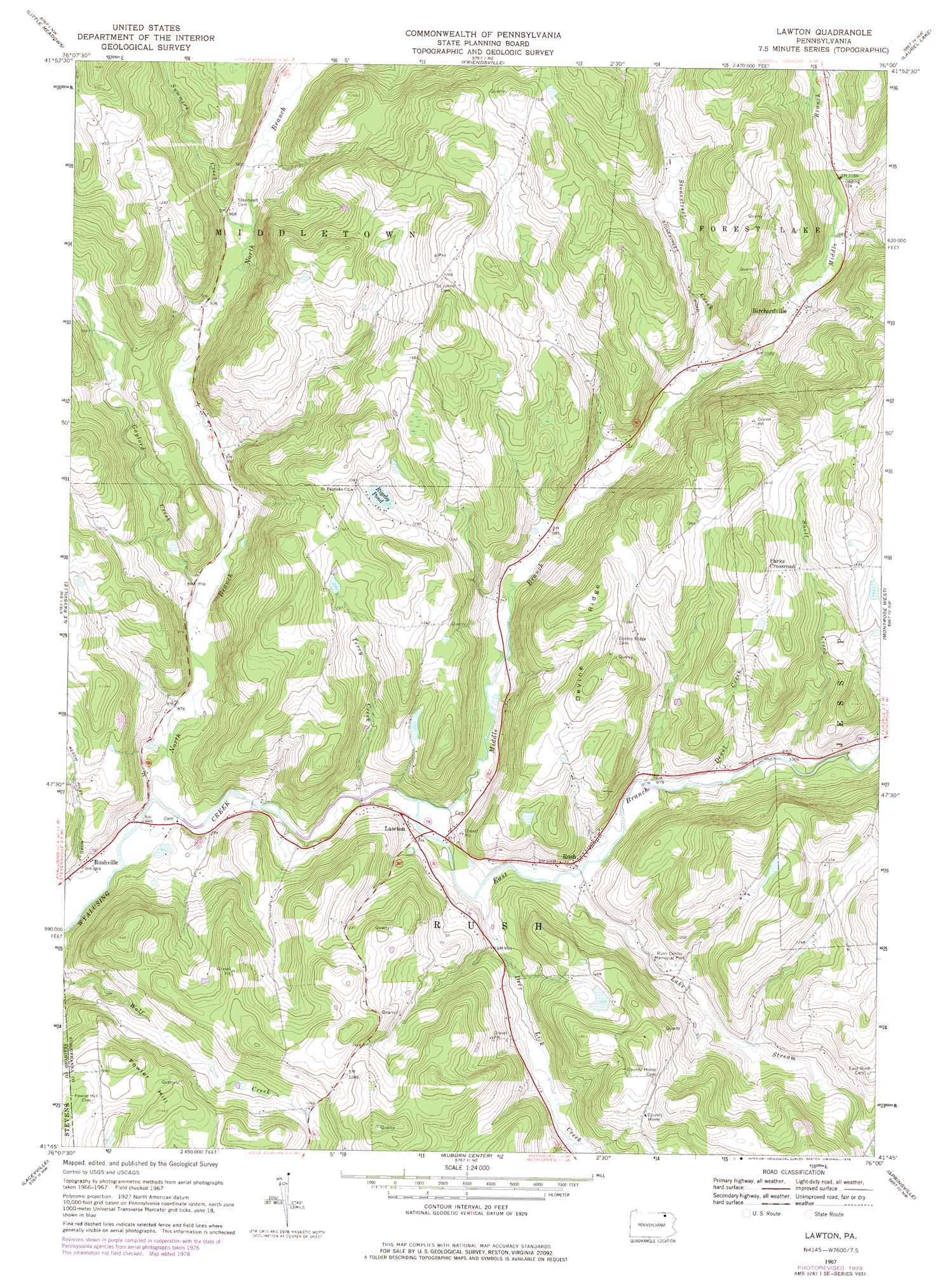
USGS Topo Quad 41076g1 - 1:24,000 scale
| Topo Map Name: | Lawton |
| USGS Topo Quad ID: | 41076g1 |
| Print Size: | ca. 21 1/4" wide x 27" high |
| Southeast Coordinates: | 41.75° N latitude / 76° W longitude |
| Map Center Coordinates: | 41.8125° N latitude / 76.0625° W longitude |
| U.S. State: | PA |
| Filename: | o41076g1.jpg |
| Download Map JPG Image: | Lawton topo map 1:24,000 scale |
| Map Type: | Topographic |
| Topo Series: | 7.5´ |
| Map Scale: | 1:24,000 |
| Source of Map Images: | United States Geological Survey (USGS) |
| Alternate Map Versions: |
Lawton PA 1967, updated 1971 Download PDF Buy paper map Lawton PA 1967, updated 1977 Download PDF Buy paper map Lawton PA 1967, updated 1978 Download PDF Buy paper map Lawton PA 2010 Download PDF Buy paper map Lawton PA 2013 Download PDF Buy paper map Lawton PA 2016 Download PDF Buy paper map |
1:24,000 Topo Quads surrounding Lawton
Owego |
Apalachin |
Endicott |
Binghamton West |
Binghamton East |
Windham |
Little Meadows |
Friendsville |
Laurel Lake |
Franklin Forks |
Rome |
Le Raysville |
Lawton |
Montrose West |
Montrose East |
Wyalusing |
Laceyville |
Auburn Center |
Springville |
Hop Bottom |
Colley |
Jenningsville |
Meshoppen |
Tunkhannock |
Factoryville |
> Back to 41076e1 at 1:100,000 scale
> Back to 41076a1 at 1:250,000 scale
> Back to U.S. Topo Maps home
Lawton topo map: Gazetteer
Lawton: Lakes
Rigsby Pond elevation 409m 1341′Lawton: Populated Places
Birchardville elevation 318m 1043′Lawton elevation 285m 935′
Parks Crossroad elevation 459m 1505′
Rush elevation 301m 987′
Rushville elevation 266m 872′
Lawton: Post Offices
Birchardsville Post Office (historical) elevation 320m 1049′Lawton: Ridges
Devine Ridge elevation 461m 1512′Lawton: Streams
Deer Lick Creek elevation 276m 905′Deuel Creek elevation 287m 941′
East Branch Wyalusing Creek elevation 269m 882′
Elk Lake Stream elevation 281m 921′
Gaylord Creek elevation 269m 882′
Middle Branch Wyalusing Creek elevation 269m 882′
North Branch Wyalusing Creek elevation 255m 836′
Snell Creek elevation 301m 987′
Stonestreet Creek elevation 305m 1000′
Summers Creek elevation 282m 925′
Terry Creek elevation 266m 872′
Lawton: Summits
Fowler Hill elevation 449m 1473′Lawton digital topo map on disk
Buy this Lawton topo map showing relief, roads, GPS coordinates and other geographical features, as a high-resolution digital map file on DVD:
New York, Vermont, Connecticut & Western Massachusetts
Buy digital topo maps: New York, Vermont, Connecticut & Western Massachusetts